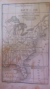
Map of United States & Mexico with Texas 1845
Similar Sale History
View More Items in Maps & Atlases
Related Maps & Atlases
More Items in Maps & Atlases
View MoreRecommended Transportation & Travel Collectibles
View More


Item Details
Description
Heading: (Texas)
Author: Woodbridge, William Channing
Title: Political Map of the United States, Mexico and the British Provinces adapted to Woodbridge’s Geography
Place Published: Hartford, CT
Publisher:Case, Tiffany & Co.
Date Published: 1845
Description:
Author: Woodbridge, William Channing
Title: Political Map of the United States, Mexico and the British Provinces adapted to Woodbridge’s Geography
Place Published: Hartford, CT
Publisher:Case, Tiffany & Co.
Date Published: 1845
Description:
Engraved map, hand-colored in outline. 27.7x45.8 cm (11x18").
The U.S. and Mexico with an independent Texas, which has an indistinct border with Mexico, but extends nearly to the Oregon border in the north. There are insets of the District of Columbia, the Railways and Canals of the Middle States, and the upper Midwest.
Condition
Minor soiling and faint staining, very good.
Buyer's Premium
- 25%
Map of United States & Mexico with Texas 1845
Estimate $200 - $300
8 bidders are watching this item.
Shipping & Pickup Options
Item located in Berkeley, CA, usOffers In-House Shipping
Local Pickup Available
Payment

Related Searches
TOP


![Map of U.S., 1846: *** START PRICE IS THE RESERVE *** [America] HAVEN & EMMERSON. Map of the United States and Mexico Including Oregon, Texas and the Californias. Engraved map with original hand color. New York, 1846. 1](https://p1.liveauctioneers.com/1968/163248/82424576_1_x.jpg?height=310&quality=70&version=1583340284)


![[MAP]. TODESCHI, Pietro. [Nova et Acurata Totius Americae Tabula auct. G.I. Blaeu] America quarta: [MAP]. TODESCHI, Pietro. [Nova et Acurata Totius Americae Tabula auct. G.I. Blaeu] America quarta pars orbis quam plerunq, nuvum orbem appellitant primo detecta est anno 1492 a Christophoro Columbo...](https://p1.liveauctioneers.com/197/329395/177650542_1_x.jpg?height=310&quality=70&version=1715364962)


![[MAPS]. HOMANN, Johann Baptist, HOMANN HEIRS, and Georg Matthäus SEUTTER. [Composite Atlas].: [MAPS]. HOMANN, Johann Baptist (1663-1724), HOMANN HEIRS, and Georg Matthäus SEUTTER (1678-1757). [Composite Atlas]. [Nuremberg, Augsburg, and others: Homann Heirs and others, maps dated between](https://p1.liveauctioneers.com/197/329395/177650530_1_x.jpg?height=310&quality=70&version=1715364962)


![[MAP]. ORTELIUS, Abraham. Turcici Imperii Descriptio.1592.: [MAP]. ORTELIUS, Abraham (1527-1598). Turcici Imperii Descriptio. Antwerp, 1592. Engraved map with hand-coloring. Matted, framed, and double glazed, sight 406 x 521 mm (unexamined out of frame). Decor](https://p1.liveauctioneers.com/197/329395/177650538_1_x.jpg?height=310&quality=70&version=1715364962)


