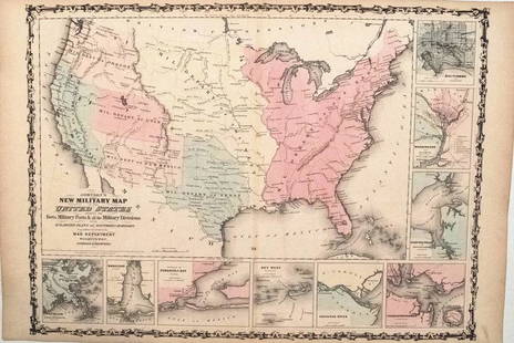
Map of U.S., 1846
Similar Sale History
View More Items in Maps & AtlasesRelated Maps & Atlases
More Items in American Maps & Atlases
View MoreRecommended Transportation & Travel Collectibles
View More


Item Details
Description
*** START PRICE IS THE RESERVE ***
[America] HAVEN & EMMERSON.
Map of the United States and Mexico Including Oregon, Texas and the Californias.
Engraved map with original hand color.
New York, 1846.
18 5/8" x 23 1/8" sheet.
Comparable: Bonhams, 2012 - $3,125.
The map set within four columns of text and bordered by thirty state seals. John Haven had a reputation for publishing maps which asserted contentious boundary lines during the era of rapid westward expansion, and this map is no exception. It depicts Oregon's boundary as above the 54th parallel (marked "Boundary claimed by United States") as well as one near the 48th parallel ("Boundary offered as Compromise by U.S."). The map also depicts disputed boundary lines between Texas and Mexico in the same year the Mexican-American War began.
Buyer's Premium
- 20%
Map of U.S., 1846
Estimate $2,000 - $4,000
6 bidders are watching this item.
Shipping & Pickup Options
Item located in New York, New York, usOffers In-House Shipping
Local Pickup Available
Payment

Related Searches
TOP


![Johnston Map of U.S. 1844: *** START PRICE IS THE RESERVE *** [America] JOHNSTON, Alexander Keith (1804-1871). United States and Texas. Lithograph with original color. London, 1844. 21 1/8" x 26 1/8" sheet. Comparable: Old Worl](https://p1.liveauctioneers.com/1968/163248/82424588_1_x.jpg?height=310&quality=70&version=1583340284)


![North-west Europe. Nordic Countries. British Isles Scandinavia. THOMSON 1830 map: TITLE/CONTENT OF MAP: [Europe after the Congress of Vienna - North-west sheet] DATE PRINTED: 1830 IMAGE SIZE: Approx 53.0 x 65.0cm, 20.75 x 25.5 inches (Large); Please note that this is a folding map.](https://p1.liveauctioneers.com/5584/328641/177014337_1_x.jpg?height=310&quality=70&version=1715113718)
![North-west Europe. Nordic Countries. British Isles Scandinavia. THOMSON 1817 map: CAPTION PRINTED BELOW PICTURE: [Europe after the Congress of Vienna - North-west sheet] DATE PRINTED: Published in 1817. Engraved in 1816; this date is marked on the map IMAGE SIZE: Approx 53.0 x 63.0](https://p1.liveauctioneers.com/5584/328641/177014463_1_x.jpg?height=310&quality=70&version=1715113718)


![Corso del Danubio da Belgrado fino al Mar Ner. Danube. ROSSI / CANTELLI 1684 map: TITLE/CONTENT OF MAP: Corso del Danubio da Belgrado fino al Mar Ner [The course of the Danube from Belgrade to the Black Sea] The course of the Danube through eastern Europe and the northern Balkans,](https://p1.liveauctioneers.com/5584/328641/177014347_1_x.jpg?height=310&quality=70&version=1715113718)

![La Scandinavia divisa nelli suoi Regni… Sweden Denmark Norway. DE ROSSI 1678 map: TITLE/CONTENT OF MAP: La Scandinavia Divisa nelli suoi Regni di Svezia, Danimarca, Norvegia, e Paese de Lapponi [Scandinavia divided into its Kingdoms of Sweden, Denmark, Norway, and Lapland] Includin](https://p1.liveauctioneers.com/5584/328641/177014261_1_x.jpg?height=310&quality=70&version=1715113718)

![Hyperboreorum/Septentrionalum regionum. Bertius/Langenes. Europe Arctic 1603 map: CAPTION PRINTED BELOW PICTURE: Descriptio Hyperboreorum / Septentrionalum regionu[m] descrip. [The northern latitudes] The map features the phantom island of Frisland off the coast of Greenland, south](https://p1.liveauctioneers.com/5584/328641/177014168_1_x.jpg?height=310&quality=70&version=1715113718)


