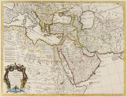
Maps of the Ottoman Empire, 17th-18th Century
Similar Sale History
View More Items in Maps & AtlasesRelated Maps & Atlases
More Items in Maps & Atlases
View MoreRecommended Transportation & Travel Collectibles
View More


Item Details
Description
Lot of two maps of the Ottoman Empire including Palestine: 1. "Accuratissima et Maxima Totius Turcici Imperii Tabula cum omnibus suis regionibus novissima delineatio". Hand-colored copperplate engraving by Justus Danckerts, Amsterdam: ca. 1680. Dimensions: 49X57 cm. Framed. Good condition (not examined out of frame).2. "Magni Turcarum Dominatoris Imperium per Europam, Asiam, et Africam". Hand-colored copperplate engraving by Tobias Conrad Lotter, Augsburg, ca. 1750. Dimensions: 49X57 cm. Framed. Good condition (not examined out of frame).
Buyer's Premium
- 29%
Maps of the Ottoman Empire, 17th-18th Century
Estimate $100 - $150
2 bidders are watching this item.
Shipping & Pickup Options
Item located in Tel Aviv, ilOffers In-House Shipping
Local Pickup Available
Payment

Related Searches
TOP


