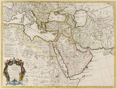
Colossal 1909 map of the Ottoman Empire composed during
Similar Sale History
View More Items in Maps & AtlasesRelated Maps & Atlases
More Items in Maps & Atlases
View MoreRecommended Transportation & Travel Collectibles
View More


Item Details
Description
Title:
Nouvelle Carte Générale des Provinces Asiatiques de l'Empire Ottoman (sans l'Arabie) dressée par Henri Kiepert, Berlin 1883. Chemins De Fer d'après l'état de 1909.
Map maker:
Heinrich Kiepert, Dietrich Reimer
Place and Year:
Berlin, 1909
Dimensions:
104 x 172 cm (41 x 67.5 in)
Technique:
Chromolithograph
Coloring:
Original coloring
Condition Rating:
VG
This impressive, large map depicts the heart of the Ottoman Empire, including Turkey, the Levant (modern Syria, Lebanon, Israel and Jordan) and Iraq; plus adjacent regions, including parts of Persia (Iran), Egypt and the Caucuses. One of the most detailed and accurate geographical overviews of the region ever made to date, it was complied in 1883 by the immensely knowledgeable and well connected German geographer Heinrich Kiepert, and updated to 1909 under the supervision of Kiepert’s son, Richard, also a professional geographer. The present edition of the Kiepert map is especially interesting and important, as it, perhaps better than any other map, showcases the ‘New Great Game’, the grand German-Ottoman designs in the region, conducted at the expense of the new Anglo-Russian alliance, in the immediate run-up to World War I.
Please note that this lot has a confidential reserve. When you leave a bid in advance of the auction, submit your maximum. The bidder who has submitted the highest bid wins the lot, provided the bid exceeds the reserve price.
Shipping:Domestic: Flat-rate of $25.00 to anywhere within the contiguous U.S. International: Foreign shipping rates are determined by destination. Location: This item ships from California
Your purchase is protected:
Photos, descriptions, and estimates were prepared with the utmost care by a fully certified expert and appraiser. All items in this sale are guaranteed authentic.
In the rare event that the item did not conform to the lot description in the sale, Jasper52 specialists are here to help. Buyers may return the item for a full refund provided you notify Jasper52 within 5 days of receiving the item.
Nouvelle Carte Générale des Provinces Asiatiques de l'Empire Ottoman (sans l'Arabie) dressée par Henri Kiepert, Berlin 1883. Chemins De Fer d'après l'état de 1909.
Map maker:
Heinrich Kiepert, Dietrich Reimer
Place and Year:
Berlin, 1909
Dimensions:
104 x 172 cm (41 x 67.5 in)
Technique:
Chromolithograph
Coloring:
Original coloring
Condition Rating:
VG
This impressive, large map depicts the heart of the Ottoman Empire, including Turkey, the Levant (modern Syria, Lebanon, Israel and Jordan) and Iraq; plus adjacent regions, including parts of Persia (Iran), Egypt and the Caucuses. One of the most detailed and accurate geographical overviews of the region ever made to date, it was complied in 1883 by the immensely knowledgeable and well connected German geographer Heinrich Kiepert, and updated to 1909 under the supervision of Kiepert’s son, Richard, also a professional geographer. The present edition of the Kiepert map is especially interesting and important, as it, perhaps better than any other map, showcases the ‘New Great Game’, the grand German-Ottoman designs in the region, conducted at the expense of the new Anglo-Russian alliance, in the immediate run-up to World War I.
Please note that this lot has a confidential reserve. When you leave a bid in advance of the auction, submit your maximum. The bidder who has submitted the highest bid wins the lot, provided the bid exceeds the reserve price.
Shipping:
Your purchase is protected:
Photos, descriptions, and estimates were prepared with the utmost care by a fully certified expert and appraiser. All items in this sale are guaranteed authentic.
In the rare event that the item did not conform to the lot description in the sale, Jasper52 specialists are here to help. Buyers may return the item for a full refund provided you notify Jasper52 within 5 days of receiving the item.
Condition
Good; some areas of light toning, separations in linen at some folds (since mended) with very minor chipping and loss to edges of few map sections; case heavily worn with loss to upper part of spine. Dissected into 65 sections and mounted upon original linen (104 x 172 cm / 41 x 67.5 inches), plus smaller chromolithographed political map, dissected into 10 sections and mounted upon original linen (33 x 55 cm / 13 x 21.5 inches), all folding into original card case, pastedown seller’s stamps of ‘Edward Stanford Ltd.’ and former pastedown owner’s stamp of the ‘Library of the Institute of Civil Engineers’ of Great Britain.
Buyer's Premium
- 15%
Colossal 1909 map of the Ottoman Empire composed during
Estimate $800 - $1,000
6 bidders are watching this item.
Get approved to bid.
Shipping & Pickup Options
Item located in California, US$25 shipping in the US
Payment
See More Items From This Jasper52 Seller

Auction Curated By

Maps Expert
Related Searches
TOP


![Turcicum Imperium by Bertius / Langenes. Ottoman Empire. Middle East 1603 map: CAPTION PRINTED BELOW PICTURE: Descriptio Imperii Turcici / Turcicum Imperium [The Ottoman or Turkish Empire] DATE PRINTED: 1603 IMAGE SIZE: Approx 10.5 x 17.0cm, 4.25 x 6.5 inches (Small) TYPE: Antiq](https://p1.liveauctioneers.com/5584/328641/177014373_1_x.jpg?height=310&quality=70&version=1715113718)


![Empire Romain sous Constantin et sous Trajan. Roman Empire. MALTE-BRUN c1871 map: TITLE/CONTENT OF MAP: Empire Romain sous Constantin et sous Trajan [Roman Empire under Constantine and under Trajan] DATE PRINTED: c1871 IMAGE SIZE: Approx 25.0 x 33.5cm, 10 x 13.25 inches (Large) TYP](https://p1.liveauctioneers.com/5584/328641/177014387_1_x.jpg?height=310&quality=70&version=1715113718)


![[Maps] Gio. Ant. Magnini, Italia, 1620: [Maps] Gio. Ant. Magnini, Italia, 1620, Giovanni Antonio Magnini. Italia, data in luce da Fabio suo figliuolo al Serenissimo Ferdinado Gonzaga Duca di Matoua edi Monserrato etc. Bologna, for Sebastian](https://p1.liveauctioneers.com/188/326797/176317457_1_x.jpg?height=310&quality=70&version=1713847031)
![[Maps] Martin Zeiler, Itinerarium Italiae, 1640: [Maps] Martin Zeiler, Itinerarium Italiae, 1640, Martini Zeilleri. Itinerarium Italiae Nov-Antiquae: oder, Raiss-Beschreibung durch Italien, Matthaus Merian, Frankfurt, 40 plates, most double-page, in](https://p1.liveauctioneers.com/188/326797/176317459_1_x.jpg?height=310&quality=70&version=1713847031)


