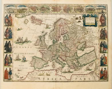
(1635) Blaeu Map: Mappa Aestivarvm Insularum,...
Similar Sale History
View More Items in Maps & Atlases
Related Maps & Atlases
More Items in Maps & Atlases
View MoreRecommended Transportation & Travel Collectibles
View More


Item Details
Description
Historic Maps
Hand-Colored "Mappa Aestivarvm Insularum, alias Barmvdas dictarum..." by Willem J. Blaeu, Amsterdam
(1635) Hand-Colored Historic Dutch Map titled: "Mappa Aestivarvm Insularum, alias Barmvdas dictarum..." by Willem J. Blaeu (1571-1638), Amsterdam, Fine.
This historic Dutch Map measures 21.25" x 16.25" (by sight), matted to 25.25" x 21" apparently laid down to heavy cardboard for display. The full title reads, "Mappa Aestivarvm Insularum, alias Barmvdas dictarum, ad Ostia Mexicani aestuarij jacentium in latitudine Graduum 32 Minutorum 25. Ab Anglia, Londino Scilicet versus Libonotum 3300 Miliaribus Anglicanis, et a Roanoack (qui locus est in Virginia) versus Eur", which translates to: "Map of the Northern Island, also known as Burmuda, East of the Gulf of Mexico at 32 degrees and 25 minutes. Lying 3300 miles from London England towards Libonotum, and 500 miles south east of Roanoke (which is located in Virginia). Accurately described". Combination nautical chart and property map of the Bermuda Islands. Map has rhumb lines showing navigation routes, but the distances between the islands and mainland's are extremely shortened. The main island of Bermuda is divided into "tribes" and these areas are further divided and labeled with numbers, which correspond to the table at the bottom of the map and identify land owners. Latin inscription at the bottom of the map relates the story of five men who were lost at sea for seven weeks, and eventually landed in Ireland, in 1616. Overall, clean with strong color, ready for reframing and display.
Combination of a nautical chart and property map of the Bermuda Islands. Map has rhumb lines showing navigation routes, but the distances between the islands and mainlands are extremely shortened. The main island of Bermuda is divided into "tribes" and these areas are further divided and labeled with numbers, which correspond to the table at the bottom of the map and identify land owners. Latin inscription at the bottom of the map relates the story of five men who were lost at sea for seven weeks, and eventually landed in Ireland, in 1616.
Buyer's Premium
- 25%
(1635) Blaeu Map: Mappa Aestivarvm Insularum,...
Estimate $1,000 - $1,500
2 bidders are watching this item.
Shipping & Pickup Options
Item located in Rancho Santa Fe, CA, usSee Policy for Shipping
Payment

Related Searches
TOP


![[MAP OF BERMUDA] BLAEU, WILLEM (c. 1630): Mappa Aestivarum Insularum, alias Barmudas..., engraved bi-fold map with hand-coloring, showing the coasts of Florida, Viginia, Cape Cod, and New England, based on Speed's map, with latin text on vers](https://p1.liveauctioneers.com/522/152734/77123885_1_x.jpg?height=310&quality=70&version=1571345617)


![Three editions of the famous Bermuda shareholder map: [MAPS-BERMUDA] Three editions of Mappa Aestivarum Insularum, Alias Barmudas Dictarum, ad Ostia Mexicani Aestuary. Three engraved maps with hand-coloring, in](https://p1.liveauctioneers.com/292/326828/175962852_1_x.jpg?height=310&quality=70&version=1713473479)


![A marked improvement on the Hondius map of 1606 (Burden): [MAP-NORTH AMERICA] [JANSSON, JAN]. Virginiae partis australis et Floridae partis orientalis, interjacentiumq, regionum Nova Descriptio. Amsterdam: Blaeu, circa 1640. Second state (left cherub with ta](https://p1.liveauctioneers.com/292/326828/175962857_1_x.jpg?height=310&quality=70&version=1713473479)


