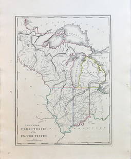
Early 19th Century Map of Louisiana
Similar Sale History
View More Items in Maps & AtlasesRelated Maps & Atlases
More Items in Maps & Atlases
View MoreRecommended Transportation & Travel Collectibles
View More


Item Details
Description
Early 19th Century Map of Louisiana
(Baltimore: F. Lucas, 1817), engraving with outline color, depicts adjacent areas in Mississippi, Alabama, Florida, Texas and Arkansas (being labeled "Missouri"). Presented in a plain wooden frame.
DOA 14.5 x 20 5/8 in.
From the Estate of Richard & Ida Simpson, Chapel Hill, NC
Additional high-resolution photos are available at LelandLittle.com
Condition
Foxing; overall age toning; not examined out of the frame.
Buyer's Premium
- 23%
Early 19th Century Map of Louisiana
Estimate $25 - $25,000
10 bidders are watching this item.
Shipping & Pickup Options
Item located in Hillsborough, NC, usSee Policy for Shipping
Payment

Related Searches
TOP


![Early Map of Tennessee, Daniel Smith, 1795: A MAP OF THE TENNASSEE [sic] GOVERNMENT FORMERLY PART OF NORTH CAROLINA TAKEN CHIEFLY FROM SURVEYS BY GENL. D. SMITH & OTHERS, drawn by Daniel Smith, engraved by Joseph T. Scott, for "General Atlas Fo](https://p1.liveauctioneers.com/525/272425/142901899_1_x.jpg?height=310&quality=70&version=1671337478)


![1888 Rand McNally Map of Louisiana -- [Louisiana]: Title: 1888 Rand McNally Map of Louisiana -- [Louisiana] Cartographer: Rand McNally Year / Place: 1888, Chicaho Map Dimension (in.): 12.7 X 19.1 in. This is an excellent, large map of Louisiana. Plent](https://p1.liveauctioneers.com/5584/328338/176911517_1_x.jpg?height=310&quality=70&version=1715113718)

![d'Anville (Jean Baptiste Bourguignon) [Untitled Composite Atlas with 102 map sheets], [probably: d'Anville (Jean Baptiste Bourguignon) [Untitled Composite Atlas with 102 map sheets], comprising 20 double-page maps, 9 two-sheet double-page maps, 3 two-sheet maps on folding double-pages [Asia, Afri](https://p1.liveauctioneers.com/5458/329231/177514974_1_x.jpg?height=310&quality=70&version=1715269091)


![[Maps] Gio. Ant. Magnini, Italia, 1620: [Maps] Gio. Ant. Magnini, Italia, 1620, Giovanni Antonio Magnini. Italia, data in luce da Fabio suo figliuolo al Serenissimo Ferdinado Gonzaga Duca di Matoua edi Monserrato etc. Bologna, for Sebastian](https://p1.liveauctioneers.com/188/326797/176317457_1_x.jpg?height=310&quality=70&version=1713847031)
![[Maps] Martin Zeiler, Itinerarium Italiae, 1640: [Maps] Martin Zeiler, Itinerarium Italiae, 1640, Martini Zeilleri. Itinerarium Italiae Nov-Antiquae: oder, Raiss-Beschreibung durch Italien, Matthaus Merian, Frankfurt, 40 plates, most double-page, in](https://p1.liveauctioneers.com/188/326797/176317459_1_x.jpg?height=310&quality=70&version=1713847031)


