HERMAN MOLL (ENGLISH, C. 1654 TO 1732) MAP OF VIRGINIA
Herman Moll Sale History
View Price Results for Herman MollRelated Maps & Atlases
More Items in Maps & Atlases
View MoreRecommended Transportation & Travel Collectibles
View More


Item Details
Description
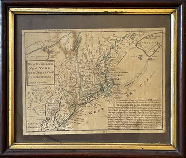
HERMAN MOLL (ENGLISH, C. 1654 TO 1732) MAP OF VIRGINIA AND MARYLAND, hand-colored, on laid paper, titled "VIRGINIA AND / MARYLAND / By H. Moll, Geographer" to box in upper left corner. Unframed. Second quarter 18th century. 14 3/4" x 9 3/8" OA.
Excellent condition overall, expected fold-line having some discoloration, expected minor toning, remnants of foam-board stuck to reverse at top corners. Margins likely trimmed.
Published: William C. Woolridge - Mapping Virginia: From the Age of Exploration to the Civil War, p. 90, pl. 86.
Provenance: Property deaccessioned by the Colonial Williamsburg, Foundation, VA. All proceeds to benefit the Collections Acquisition Fund.
Condition
Excellent condition overall, expected fold-line having some discoloration, expected minor toning, remnants of foam-board stuck to reverse at top corners. Margins likely trimmed.
Buyer's Premium
- 24.5%
HERMAN MOLL (ENGLISH, C. 1654 TO 1732) MAP OF VIRGINIA
Estimate $200 - $300
8 bidders are watching this item.
Shipping & Pickup Options
Item located in Mt. Crawford, VA, usSee Policy for Shipping
Payment

TOP


![Turky [Turkey] in Europe by Herman Moll. Balkans Greece Black Sea 1709 old map: CAPTION PRINTED BELOW PICTURE: 'Turky in Europe' DATE PRINTED: 1709 IMAGE SIZE: Approx 29.5 x 19.5cm, 11.5 x 7.75 inches (Medium) TYPE: Antique copperplate map CONDITION: Good; suitable for framing. P](https://p1.liveauctioneers.com/5584/328641/177014336_1_x.jpg?height=310&quality=70&version=1715113718)


![HAND COLORED MAP OF PERU & COUNTRY OF THE AMAZONS, 1747, BY EMANUEL BOWEN, FRAMED: A New And Accurate Map Of Peru And The Country Of The Amazones. Drawn From The Most Authentick French Maps &C. And Regulated By Astronomical Observations, London]: William Innys [et al.], 1747. A deta](https://p1.liveauctioneers.com/957/328836/177180798_1_x.jpg?height=310&quality=70&version=1715021458)


![[Maps] Gio. Ant. Magnini, Italia, 1620: [Maps] Gio. Ant. Magnini, Italia, 1620, Giovanni Antonio Magnini. Italia, data in luce da Fabio suo figliuolo al Serenissimo Ferdinado Gonzaga Duca di Matoua edi Monserrato etc. Bologna, for Sebastian](https://p1.liveauctioneers.com/188/326797/176317457_1_x.jpg?height=310&quality=70&version=1713847031)
![[Maps] Martin Zeiler, Itinerarium Italiae, 1640: [Maps] Martin Zeiler, Itinerarium Italiae, 1640, Martini Zeilleri. Itinerarium Italiae Nov-Antiquae: oder, Raiss-Beschreibung durch Italien, Matthaus Merian, Frankfurt, 40 plates, most double-page, in](https://p1.liveauctioneers.com/188/326797/176317459_1_x.jpg?height=310&quality=70&version=1713847031)


![[MAP]. TODESCHI, Pietro. [Nova et Acurata Totius Americae Tabula auct. G.I. Blaeu] America quarta: [MAP]. TODESCHI, Pietro. [Nova et Acurata Totius Americae Tabula auct. G.I. Blaeu] America quarta pars orbis quam plerunq, nuvum orbem appellitant primo detecta est anno 1492 a Christophoro Columbo...](https://p1.liveauctioneers.com/197/329395/177650542_1_x.jpg?height=310&quality=70&version=1715364962)


