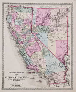
S.A. Mitchell: New Map of the State of California, 1854
Similar Sale History
View More Items in Maps & AtlasesRelated Maps & Atlases
More Items in American Maps & Atlases
View MoreRecommended Transportation & Travel Collectibles
View More


Item Details
Description
A clean and exceptional example of this important map, with three wide margins as issued. Bright paper with vivid period hand coloring. The first American Atlas map to focus on the post-California Gold Rush western United States. Based on Mitchell's seminal pocket map of 1846, the map extends from Vancouver Island to the Gulf of California and from the Pacific shore to Pikes Peak and the Yellowstone River. This vast territory includes present-day California, Washington, Oregon, Idaho, Montana, Colorado, Wyoming, Utah, Nevada, Arizona, and New Mexico, as well as adjacent parts of Canada and Mexico. Engraved and colored in Mitchell's distinctive style with green border work and vivid pastels. Political and topographical features are noted and color coded with elevation rendered by hachure. Issued just prior to the construction of the transcontinental railroads. Though California, following the Gold Rush population explosion, was admitted as a free state to the Union in 1850, the surrounding territories remained largely dominated by various American Indian nations, many of which are located on the map. Also noted are exploratory, emigrant, and military routes through the region, including the Spanish Trail from Los Angeles to Santa Fe., the Oregon Route, Lewis and Clark's Route, Lt. Col. Cooke's Wagon Road, and Kearney's Route along the Rio Gila. Though the Gadsden Purchase occurred the same year the map was published, it is not included here, so Tucson (Tueson) is set firmly within Mexican territory. However, several pre-Gadsden alternatives to the U.S. Mexico border, as proposed by Bartlett and Graham, are noted. One of a series of approximately 15 maps issued between 1846 and 1860 which shows the evolution of the Territories and States of the West from the earliest admission of Upper California as a Territory in 1846, through the creation of the Territories of Utah, New Mexico, & Washington, but pre-dating the creation of Colorado, Arizona and Nevada. Over the period, the cartographic detail of these maps evolves from a Pre-Fremont look at the west to a relatively established set of Territories and early county configurations. Early forts located, especially in Oregon Territory.
Please note that this lot has a reserve. When you leave a bid in advance of the auction, submit your maximum. Jasper52 will bid on your behalf as much as necessary to ensure that you meet the reserve price or that you remain in the lead, up to your maximum. The bidder who has submitted the highest bid wins the lot, provided the bid exceeds the reserve price.
Shipping:
Authenticity:
Photos, descriptions, and estimates were prepared with the utmost care by a fully certified expert and appraiser. All items in this sale are guaranteed authentic. Please contact us if there is a misrepresentation so that the item can be returned.
Your purchase is protected:
In the rare event that your purchase from this auction does not meet your expectations, Jasper52 specialists are here to help. If the item did not conform to the lot description in the sale, U.S. buyers may return the item for a full refund provided you notify Jasper52 within 5 days of receiving the item.
Condition
Fine
Buyer's Premium
- 10%
S.A. Mitchell: New Map of the State of California, 1854
Estimate $450 - $600
4 bidders are watching this item.
Shipping & Pickup Options
Item located in Ohio, USSee Policy for Shipping
Payment
Accepts seamless payments through LiveAuctioneers
See More Items From This Jasper52 Seller

TOP


![Mitchell Map of Western U.S.: *** START PRICE IS THE RESERVE *** [America] MITCHELL, Samuel Augustus (1792-1868). A New Map of Texas, Oregon and California with the Regions Adjoining. Engraving with original hand color, with origi](https://p1.liveauctioneers.com/1968/163248/82424595_1_x.jpg?height=310&quality=70&version=1583340284)


![[PICTORIAL MAPS – TRAVEL]. Three Pictorial Maps. 1940s/50s....: [PICTORIAL MAPS – TRAVEL]. Three Pictorial Maps. 1940s/50s. Three brochure sized foldout maps designed for travel including: Highroads to Happiness. Mexico City: Pemex Travel Club, ca. 1940s. &#](https://p1.liveauctioneers.com/928/325952/175495561_1_x.jpg?height=310&quality=70&version=1712935174)


![Three maps of the United States: [MAPS - AMERICA] A Group of three maps of the United States, including [SHAFFNER TALIAFERRO PRESTON, ] United States. [London,1862]. Hand-colored lithographed folding map from The War in Am](https://p1.liveauctioneers.com/292/326828/175962868_1_x.jpg?height=310&quality=70&version=1713473479)


![The rare first state of Speed's 1626 map of the Americas: [MAP - AMERICAS] SPEED, JOHN. America with those known parts in the unknowne world… [London:] G. Humble, 1626 [published 1627, state 1 per Burden]. Hand-colored engraved map on laid paper](https://p1.liveauctioneers.com/292/326828/175962854_1_x.jpg?height=310&quality=70&version=1713473479)


