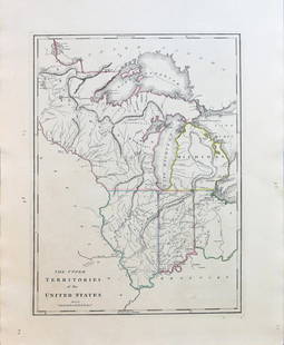
Mitchell: Map of the United States & Territories, 1860
Similar Sale History
View More Items in Maps & AtlasesRelated Maps & Atlases
More Items in American Maps & Atlases
View MoreRecommended Transportation & Travel Collectibles
View More


Item Details
Description
Very nice example of early edition of Mitchell's atlas map of the United States. This map illustrates the evolving territorial borders of the Trans-Mississippi West. New Mexico is shown above Arizona in a horizontal configuration which existed very briefly in what came to be known as the Baylor Line (Gadsden Purchase of 1854 is also noted). The Confederate Territory of Arizona appears in the southern third of New Mexico Territory. Between August 1861 and July 1862, Confederate officer John R. Baylor appointed himself the territorial governor and claimed all of New Mexico Territory south of the 34th Parallel for the Confederacy. Nebraska runs from the Rocky Mountains to Iowa and a massive Dacotah Territory includes all of Montana, Wyoming and part of Idaho. Washington Territory wraps around Oregon, incorporating much of modern day Idaho. Nevada is truncated at the bottom, putting Las Vegas in New Mexico. Its eastern border with Utah is also several degrees west of its final location, which would be moved out of concern for the Mormon influence in Utah. The newly delineated Colorado is shown in its first year as a Territory. Shows early explorers routes, forts, Indians, railroads, towns, rivers, mountains, etc., and is rich with topographical and historical information. Marvelous contrast from the 1860 edition, issued the prior year, with significant changes to the various western territorial borders and the first delineated appearances of Colorado, Nevada and Arizona, along with a significant change in Dacota Territory, Nebraska Territory and Kansas Territory. A great view of America in the midst of the Civil War.
Please note that this lot has a confidential reserve. When you leave a bid in advance of the auction, submit your maximum. Jasper52 will bid on your behalf as much as necessary to ensure that you meet the reserve price or that you remain in the lead, up to your maximum. The bidder who has submitted the highest bid wins the lot, provided the bid exceeds the reserve price.
Shipping:
Authenticity:
Photos, descriptions, and estimates were prepared with the utmost care by a fully certified expert and appraiser. All items in this sale are guaranteed authentic. Please contact us if there is a misrepresentation so that the item can be returned.
Your purchase is protected:
In the rare event that your purchase from this auction does not meet your expectations, Jasper52 specialists are here to help. If the item did not conform to the lot description in the sale, U.S. buyers may return the item for a full refund provided you notify Jasper52 within 5 days of receiving the item.
Buyer's Premium
- 10%
Mitchell: Map of the United States & Territories, 1860
Estimate $150 - $175
6 bidders are watching this item.
Shipping & Pickup Options
Item located in Ohio, USSee Policy for Shipping
Payment
Accepts seamless payments through LiveAuctioneers
See More Items From This Jasper52 Seller

TOP


![Memoir to accompany Missip.-Pacific Map: Heading: Author: Warren, Gouverneur K. Title: Memoir to Accompany the Map of the Territory of the United States from the Mississippi River to the Pacific Ocean Place Published: [Washington, D.C.] Pub](https://p1.liveauctioneers.com/642/326037/175553704_1_x.jpg?height=310&quality=70&version=1713477451)


