
 Discovery- InteriorsBonhamsSponsored.Your ad here?


Discovery- Interiors
Bonhams
Sponsored.Your ad here?


 Discovery- InteriorsBonhamsSponsored.Your ad here?


Discovery- Interiors
Bonhams
Sponsored.Your ad here?

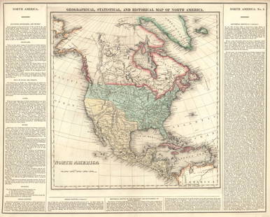
Geographical Statistical Historical Michigan Map, 1822
Similar Sale History
View More Items in Maps & AtlasesRelated Maps & Atlases
More Items in American Maps & Atlases
View MoreRecommended Transportation & Travel Collectibles
View More


Item Details
Description
This is the first map only focused on Michigan Territory. There is little evidence of human habitation, towns and forts, shown except in the southeast, near Detroit by Lake Erie and Lake St. Clair, and by Green Bay, in today’s Wisconsin. The Indian Line separates the territory roughly in half, with four counties named, but undesignated, in the southern section. Lake Michigan is somewhat misshaped. Subsequent to this map, the US Congress awarded Michigan the Upper Peninsula in exchange for moving the Ohio state line northward slightly to allow a proper port to form, called Toledo, on the Ohio side. Also the Western shores of Lake Michigan were awarded to Wisconsin. Two side panels in English flank the map providing plenty of details of the new territory and noting the total population at 8,896 in seven counties.
Please note that this lot has a reserve. When you leave a bid in advance of the auction, submit your maximum. Jasper52 will bid on your behalf as much as necessary to ensure that you meet the reserve price or that you remain in the lead, up to your maximum. The bidder who has submitted the highest bid wins the lot, provided the bid exceeds the reserve price.
Shipping:
Authenticity:
Photos, descriptions, and estimates were prepared with the utmost care by a fully certified expert and appraiser. All items in this sale are guaranteed authentic. Please contact us if there is a misrepresentation so that the item can be returned.
Your purchase is protected:
In the rare event that your purchase from this auction does not meet your expectations, Jasper52 specialists are here to help. If the item did not conform to the lot description in the sale, U.S. buyers may return the item for a full refund provided you notify Jasper52 within 5 days of receiving the item.
Condition
Very good. Nice outline color. Slight marginal separation in issued fold. Slight age toning and marginal finger soiling.
Buyer's Premium
- 10%
Geographical Statistical Historical Michigan Map, 1822
Estimate $400 - $700
10 bidders are watching this item.
Shipping & Pickup Options
Item located in Ohio, USSee Policy for Shipping
Payment
Accepts seamless payments through LiveAuctioneers
See More Items From This Jasper52 Seller

TOP


![Memoir to accompany Missip.-Pacific Map: Heading: Author: Warren, Gouverneur K. Title: Memoir to Accompany the Map of the Territory of the United States from the Mississippi River to the Pacific Ocean Place Published: [Washington, D.C.] Pub](https://p1.liveauctioneers.com/642/326037/175553704_1_x.jpg?height=310&quality=70&version=1713477451)
![Mercator's map of China 1606: Heading: (China, Korea & Japan) Author: Mercator, Gerard Title: China Place Published: [Antwerp] Publisher: Date Published: [1606 - printed later] Description: Copper-engraved map,](https://p1.liveauctioneers.com/642/326037/175553816_1_x.jpg?height=310&quality=70&version=1713477451)


