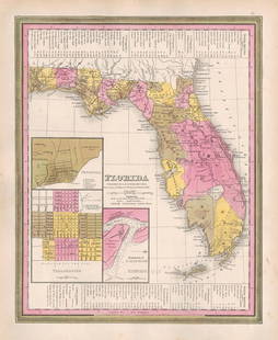
True 1st ed. 1846 Rivers/Mountains Chart from S. Mitchell
Similar Sale History
Recommended Items


Item Details
Description
Scarce and fascinating first edition cartographic chart, published in S. Augustus Mitchell’s true first edition of his New Universal Atlas in 1846. This beautiful chart shows the lengths of the world's principal rivers and the heights of its main mountains in a stunning display. It is both an informative and comparative guide, presenting geographic eloquence on a global scale. The rivers are depicted as straight lines, with lengths shown alongside, and the seas they flow into are shown at their end points. The mountains portion of the chart depicts the natural formations as small elevations with their peak altitudes denoted. 150 peaks are named, with information including their height and whether or not they are active volcanoes. The chart shows mountains from various continents, including the well-known Mont Blanc in Europe and lesser-known peaks in South America and the West Indies. By providing a visual comparative guide to the world's most significant natural geographical features, this “map” encapsulates a wealth of information in a relatively simple and accessible format. Its existence speaks to the mid-19th century interest in cataloguing and understanding the physical dimensions of the Earth, and it remains a fascinating resource for geographers and historians alike. This is an unusual example, as it carries the Carey & Hart decorative borders left over from the Tanner version, which Mitchell used only in the very first printing of his 1846 New Universal Atlas. Those decorative borders were switched out with new designs for all subsequent Mitchell atlases, making this true first edition Mitchell chart quite scarce. Some small spots and blemishes, mostly in the margin. Toning to edges. 12.75 x 15.75
Reserve: $165.00
Shipping:Domestic: Flat-rate of $6.00 to anywhere within the contiguous U.S. International: Foreign shipping rates are determined by destination. International shipping may be subject to VAT. Combined shipping: Please ask about combined shipping for multiple lots before bidding. Location: This item ships from Ohio
Your purchase is protected:
Photos, descriptions, and estimates were prepared with the utmost care by a fully certified expert and appraiser. All items in this sale are guaranteed authentic.
In the rare event that the item did not conform to the lot description in the sale, Jasper52 specialists are here to help. Buyers may return the item for a full refund provided you notify Jasper52 within 5 days of receiving the item.
Reserve: $165.00
Shipping:
Your purchase is protected:
Photos, descriptions, and estimates were prepared with the utmost care by a fully certified expert and appraiser. All items in this sale are guaranteed authentic.
In the rare event that the item did not conform to the lot description in the sale, Jasper52 specialists are here to help. Buyers may return the item for a full refund provided you notify Jasper52 within 5 days of receiving the item.
Condition
Good plus
Buyer's Premium
- 15%
True 1st ed. 1846 Rivers/Mountains Chart from S. Mitchell
Estimate $200 - $225
3 bidders are watching this item.
Shipping & Pickup Options
Item located in Ohio, US$6 shipping in the US
Payment
Accepts seamless payments through LiveAuctioneers
See More Items From This Jasper52 Seller

Related Searches
TOP


![[ART-BOOKS] JOAN MITCHELL 1ST ED 2008 AS NEW.: [ART-BOOKS] JOAN MITCHELL by Nils Ohlsen. Kehner, Germany, 2008. Hard-cover. 1st edition. Never opened, still shrink-wrapped.](https://p1.liveauctioneers.com/8321/253807/131946627_1_x.jpg?height=310&quality=70&version=1657141330)

![JOYCE WIELAND: TRUE PATRIOT LOVE. 1971, 1st. ED.: [CANADIAN ART BOOK MONOGRAPH] JOYCE WIELAND: TRUE PATRIOT LOVE. The National Gallery of Canada, Ottawa, 1971. 8to. Hardcover. Exhibition catalogue done up to look like (or superimposed on) Department](https://p1.liveauctioneers.com/8321/319996/172038346_1_x.jpg?height=310&quality=70&version=1708462457)
![True 1st ed. of Atwood, Handmaid's Tale: Heading: Author: Atwood, Margaret Title: The Handmaid's Tale Place Published: Toronto Publisher:McClelland and Stewart Date Published: [1985] Description: 324 pp. Duotone cloth in](https://p1.liveauctioneers.com/642/327728/176563468_1_x.jpg?height=310&quality=70&version=1714217008)

![In Cold Blood, 1st ed. w/ 1st issue dj: Heading: Author: Capote, Truman Title: In Cold Blood: A True Account of a Multiple Murder and Its Consequences Place Published: New York Publisher:Random House Date Published: [1965] D](https://p1.liveauctioneers.com/642/327728/176563480_1_x.jpg?height=310&quality=70&version=1714217008)


