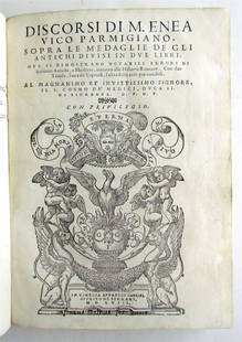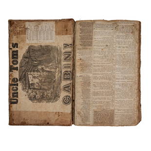
BALLINO. De' disegni delle piu illustri città, & fortezze del mondo
Similar Sale History
View More Items in Books


![1678 LIFE Of POLISH SAINT Stanislaus Kostka VELLUM BINDING antique SPANISH RARE: Aranda, Gabriel de (1633-1709) Vida y Milagros del B. Estanislao Kostka. Sevilla: Thome de Dios Mira[n]da, 1678. First edition Size 7 3/4 x 5 1/2 in. 398 pages Vellum binding with ties and manuscript](https://p1.liveauctioneers.com/5584/273386/143234986_1_x.jpg?height=310&quality=70&version=1672180773)
Related Books
More Items in Books
View MoreRecommended Books, Magazines & Papers
View More


Item Details
Description
BALLINO, Giulio. De' disegni delle piu illustri città, & fortezze del mondo parte 1.In Vinegia, appresso Bolognino Zaltieri, 1569In 4to oblungo, mm. 215x265; Legatura coeva in pergamena; cc. 2 nn. [Front. inciso con sonetti al verso, Dedica con carta geografica al verso], 102, con 51 carte topografiche, alcune con testo descrittivo al verso.Rarissima edizione originale. Questo è il primo atlas con piante di città prodotto in Italia e raccoglie vedute prospettiche da Venezia a Costantinopoli, da Napoli a Città del Messico, chiamata Timistitano. La qualità delle incisioni, molte firmate da Domenico Zenoi, è notevole e la maggior parte delle mappe sono corredate da una didascalia che ne attesta la credibilità, dichiarando che le piante sono fatte dal vero e documentano con precisione ciò che realmente si può vedere. Roma è raffigurata in quattro diversi modi, la città antica, quella moderna, Castel Sant’Angelo e una veduta a volo d’uccello del Borgo; altre città appaiono come campi di battaglia, con edifici di rilevante interesse strategico indicato nella leggenda. L’opera è molto importante anche per la storia delle fortificazioni. Hale: “the first topographical work aimed at an audience primarily interested in war. ” Per quanto sul titolo sia scritto ‘Parte I” non è stata mai pubblicata una seconda parte. Adams B138; Cremonini, 4.
Condition
4to oblong, mm. 215x265; Contemporary vellum binidng; leaves 2 nn. [Engraved Title page with sonets on verso, Dedication with map on verso], 102, with 51 maps, some with description on the verso.
Very rare first edition. This is the first atlas with city maps produced in Italy and collects perspective views from Venice to Constantinople, from Naples to Mexico City, called Timistitano. The quality of the engravings, many signed by Domenico Zenoi, is remarkable and most maps are accompanied by a caption that attests the credibility, stating that plants are made from real documenting precisely what actually you can see.Rome is depicted in four different ways, the ancient city, the modern, Castel Sant'Angelo and a view of the Borgo from above; other cities look like battlefields, with significant strategic interest buildings shown in the legend. The work is also very important for the history of the fortifications.
Very rare first edition. This is the first atlas with city maps produced in Italy and collects perspective views from Venice to Constantinople, from Naples to Mexico City, called Timistitano. The quality of the engravings, many signed by Domenico Zenoi, is remarkable and most maps are accompanied by a caption that attests the credibility, stating that plants are made from real documenting precisely what actually you can see.Rome is depicted in four different ways, the ancient city, the modern, Castel Sant'Angelo and a view of the Borgo from above; other cities look like battlefields, with significant strategic interest buildings shown in the legend. The work is also very important for the history of the fortifications.
Buyer's Premium
- 30%
BALLINO. De' disegni delle piu illustri città, & fortezze del mondo
Estimate €25,000 - €28,000
1 bidder is watching this item.
Get approved to bid.
Shipping & Pickup Options
Item located in Padova, ITALY, itOffers In-House Shipping
Payment

Related Searches
TOP


![[Mexican Imprint] of California Interest "Analisis: [Mexican Imprint] of California Interest "Analisis Estadistico De La Provinceia De La Michuacan En 1822 Por J J L", printed at Mexico by Nacional del Supremo Gobierno de los Estados Unidos en Palacio.](https://p1.liveauctioneers.com/5584/129930/66072188_1_x.jpg?height=310&quality=70&version=1540941162)

![1779 LIVES of SAINTS in SPANISH antique VELLUM BOUND: Vida Del Sen~or San Josef [with] Vida del Sen~or San Joaquin y de Sen~ora Santa Ana by Vallejo, Jose´ Ignacio and P. Estevan Binet En Cesena, En la Impenta de Gregorio Biasini en la Insignia de Pal](https://p1.liveauctioneers.com/5584/300835/160216261_1_x.jpg?height=310&quality=70&version=1693946337)


![1672 ROMAN FUNERALS ILLUSTRATED vellum bound antique DE FUNERIBUS ROMANORUM: DE FUNERIBUS ROMANORUM [...]. NITIDISSIMIS FIGURIS ILLUSTRATI. ACCESSIT ET FUNUS PARASITICUM NICOLAI RIGALTII. [FUNERALS OF THE ROMANS] by KIRCHMANN, Johann Lugduni Batavorum; 1672 3 parts in 1 volume](https://p1.liveauctioneers.com/5584/328415/176935285_1_x.jpg?height=310&quality=70&version=1715112425)


![19 issues of rare Gay Magazine METRA 1985-1986: [Queer interest], Metra: Midwest America's Leading Free Gay Magazine, 19 issues, published 1986-1987, a few duplicates, softcover, staplebound wraps, illustrated throughout in black and white, publish](https://p1.liveauctioneers.com/184/328649/177016396_1_x.jpg?height=310&quality=70&version=1714770323)


