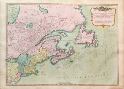
18th Century Florida Louisiana Coast Map - Jefferys
Thomas Jefferys Sale History
View Price Results for Thomas JefferysRelated Maps & Atlases
More Items in French Maps & Atlases
View MoreRecommended Transportation & Travel Collectibles
View More


Item Details
Description
Carte de la Floride occidentale et Louisiane. La peninsule et golfe de la Floride ou canal de Bahama avec les isles de Bahama. Contributors - Le Rouge, Georges-Louis, Jefferys, Thomas, -1777. Printed in Paris France. Full details at the Library of Congress. Measures at 20 7/8" x 49 3/8".
Condition
Some signs of wear consistent with age. Has some fold creases and tanning with loss to right edge.
Buyer's Premium
- 20%
18th Century Florida Louisiana Coast Map - Jefferys
Estimate $1,000 - $5,000
10 bidders are watching this item.
Shipping & Pickup Options
Item located in Chamblee, GA, usOffers In-House Shipping
Local Pickup Available
Payment
Accepts seamless payments through LiveAuctioneers

Related Searches
TOP


![Manuscript Map of Givet, France on the Belgian Border: [Givet, France]. "Charlemont les deux Givets et la Couronne d'Haurs Pour servir au Projet de mil Sept cent trente sept" Fine manuscript plan in ink and colours on paper (no visible watermark), scale a](https://p1.liveauctioneers.com/1968/273926/143704769_1_x.jpg?height=310&quality=70&version=1672435208)


![The top sheet of the famous Ratzer Map - with additions relating to an 1810 real estate dispute: RATZER, BERNARD. Plan of the City of New York, in North America surveyed in the Years 1766 & 1767. [London: Jefferys & Faden, 12 January 1776.] Engraved map with hand coloring and manuscript a](https://p1.liveauctioneers.com/292/326828/175962862_1_x.jpg?height=310&quality=70&version=1713473479)


