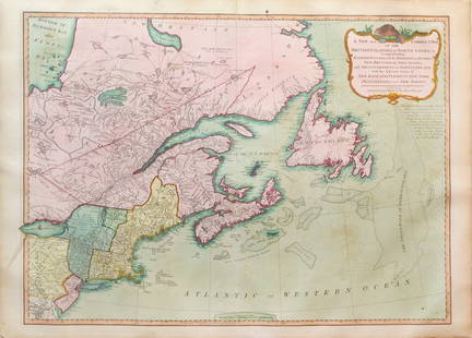
Fascinating 18th Century map of Florida, the Gulf Coast
Similar Sale History
View More Items in Maps & AtlasesRelated Maps & Atlases
More Items in French Maps & Atlases
View MoreRecommended Transportation & Travel Collectibles
View More


Item Details
Description
Carte Geo-Hydrographique du Golfe du Mexique des ses Isles. Giovanni Antonio Rizzi-Zannoni (1736-1814) . Engraved map with original hand color in outline. Paris, 1771. 13 x 18 3/4 inches visible, 22 1/2 x 27 1/2 inches framed. Fascinating map of Florida, the Gulf Coast & Caribbean, showing Barroto’s influence along the Gulf Coast.
Buyer's Premium
- 25%
Fascinating 18th Century map of Florida, the Gulf Coast
Estimate $300 - $500
4 bidders are watching this item.
Shipping & Pickup Options
Item located in New York, NY, usSee Policy for Shipping
Payment

Related Searches
TOP


![Manuscript Map of Givet, France on the Belgian Border: [Givet, France]. "Charlemont les deux Givets et la Couronne d'Haurs Pour servir au Projet de mil Sept cent trente sept" Fine manuscript plan in ink and colours on paper (no visible watermark), scale a](https://p1.liveauctioneers.com/1968/273926/143704769_1_x.jpg?height=310&quality=70&version=1672435208)


![Mortier / Jaillot Map of the Chesapeake Bay: [Map - East Coast, Colonial] MORTIER, Pierre (1661-1711), After JAILLOT, Alexis-Hubert (1632-1712). Carte Particuliere de Virginie, Maryland, Pennslyvanie, La Nouvelle Jarsey. . . Engraved map with or](https://p1.liveauctioneers.com/1968/225974/116712070_1_x.jpg?height=310&quality=70&version=1636655147)


![1898 Rand McNally Map of Texas [verso] Indian Territory and Oklahoma -- Texas [verso] Oklahoma and: Title: 1898 Rand McNally Map of Texas [verso] Indian Territory and Oklahoma -- Texas [verso] Oklahoma and Indian Territory Cartographer: Rand McNally Year / Place: 1898, Chicago Map Dimension (in.): 9](https://p1.liveauctioneers.com/5584/328338/176911581_1_x.jpg?height=310&quality=70&version=1715113718)


![Carte du Golphe de Bothnie'. Gulf of Bothnia. Sweden Finland. BELLIN 1759 map: CAPTION PRINTED BELOW PICTURE: Carte du Golphe de Bothnie [Map of the Gulf of Bothnia] DATE PRINTED: 1759 IMAGE SIZE: Approx 22.5 x 18.0cm, 8.75 x 7 inches (Medium) TYPE: Antique copperplate map CONDI](https://p1.liveauctioneers.com/5584/328641/177014466_1_x.jpg?height=310&quality=70&version=1715113718)
![Carte des Côtes de France & d’Espagne. France Spain coast BELLIN/SCHLEY 1747 map: CAPTION PRINTED BELOW PICTURE: Carte des Côtes de France & d’Espagne [Map of the coasts of France & Spain] France & Spain on the méridien de Ferro DATE PRINTED: 1747 IMAGE SIZE: Approx](https://p1.liveauctioneers.com/5584/328641/177014374_1_x.jpg?height=310&quality=70&version=1715113718)

![Carte des Costes de France & d’Espagne'. France & Spain coasts. BELLIN 1746 map: CAPTION PRINTED BELOW PICTURE: Carte des Costes de France et d’Espagne [Map of the coasts of France & Spain] DATE PRINTED: 1746 IMAGE SIZE: Approx 23.5 x 29.0cm, 9.25 x 11.5 inches (Large); Plea](https://p1.liveauctioneers.com/5584/328641/177014362_1_x.jpg?height=310&quality=70&version=1715113718)


![[MAPS]. A group of 3 engraved maps, most with hand-coloring.: [MAPS]. A group of 3 maps, comprising: HOMANN, Johann Baptist (1663-1724). Regni Mexicani seu Novae Hispaniae, Ludovicianae, N. Angliae, Carolinae, Virginiae et Pensylvaniae. Nuremberg: Homann, [ca 17](https://p1.liveauctioneers.com/197/328642/177014805_1_x.jpg?height=310&quality=70&version=1714760103)


