Sold2021Wilkes, John 1804 Map. England & WalesCopper Engraved Map Published 1796-1828 London for "Encyclopaedia Londinensis, or universal dictionary of arts, sciences and literature" by John Wilkes et al. Paper Size: 10.5 x 8.5 inch (27 x 22cm) GSee Sold Price
Sold2021Wilkes, John 1804 Map. Ancient EuropeCopper Engraved Map Published 1796-1828 London for "Encyclopaedia Londinensis, or universal dictionary of arts, sciences and literature" by John Wilkes et al. Paper Size: 10.5 x 8.5 inch (27 x 22cm) VSee Sold Price
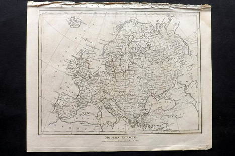
Sold2021Wilkes, John 1804 Map. Modern EuropeCopper Engraved Map Published 1796-1828 London for "Encyclopaedia Londinensis, or universal dictionary of arts, sciences and literature" by John Wilkes et al. Paper Size: 10.5 x 8.5 inch (27 x 22cm) VSee Sold Price
Sold2021Wilkes, John 1804 Map. BedfordshireCopper Engraved Map Published 1796-1828 London for "Encyclopaedia Londinensis, or universal dictionary of arts, sciences and literature" by John Wilkes et al. Paper Size: 10.5 x 8.5 inch (27 x 22cm) TSee Sold Price
Sold2021Wilkes, John 1804 Map. OxfordshireCopper Engraved Map Published 1796-1828 London for "Encyclopaedia Londinensis, or universal dictionary of arts, sciences and literature" by John Wilkes et al. Paper Size: 10.5 x 8.5 inch (27 x 22cm) VSee Sold Price
Sold2021Wilkes, John 1804 Map. France in 1805Copper Engraved Map Published 1796-1828 London for "Encyclopaedia Londinensis, or universal dictionary of arts, sciences and literature" by John Wilkes et al. Paper Size: 10.5 x 8.5 inch (27 x 22cm) VSee Sold Price
Sold2022Wilkes, John 1804 Antique Map of Essex, UKCopper Engraved Map Published 1796-1828 London for "Encyclopaedia Londinensis, or universal dictionary of arts, sciences and literature" by John Wilkes et al. Paper Size: 10.5 x 8.5 inch (27 x 22cm) GSee Sold Price
Sold2021Tallis, John (Pub) 1852 Map. England & WalesSteel Engraved Map with Original Outline Hand Color Published 1852-56 by John Tallis, London for "The Universal Pronouncing Dictionary" by Thomas Wright. Drawn & Engraved by John Rapkin. Centre fold aSee Sold Price
Sold2019Cary, John 1801 Map of England & WalesHand Colored Copper Engraved Map Published 1801, London for "The Field of Mars" Folds as issued. Paper Size: 10.5 x 8 inch (27 x 21cm) Some margin toning. A couple of tine margin splits on folds. OtheSee Sold Price
Sold2022Wilkes, John 1804 Pair of Maps. Ancient & Modern EuropeCopper Engraved Map Published 1796-1828 London for "Encyclopaedia Londinensis, or universal dictionary of arts, sciences and literature" by John Wilkes et al. Paper Size: 10.5 x 8.5 inch (27 x 22cm) VSee Sold Price
Sold2021Wilkes, John 1817 Map. Monmouthshire, WalesCopper Engraved Map Published 1796-1828 London for "Encyclopaedia Londinensis, or universal dictionary of arts, sciences and literature" by John Wilkes et al. Paper Size: 10.5 x 8.5 inch (27 x 22cm) GSee Sold Price
Sold2021Tallis, John (Pub) 1852 Map. England and WalesSteel Engraved Map with Original Outline Hand Color Published 1852-56 by John Tallis, London for "The Universal Pronouncing Dictionary" by Thomas Wright. Drawn & Engraved by John Rapkin. Centre fold aSee Sold Price
Sold2021Wilkes, John 1804 Print. Aborigines of England - TattooCopper Plate Published 1796-1828 London for "Encyclopaedia Londinensis, or universal dictionary of arts, sciences and literature" by John Wilkes et al. Paper Size: 10.5 x 8.5 inch (27 x 22cm) Good ConSee Sold Price
Sold2020Walker, John 1815 Antique Map of England & WalesCopper Plate Published 1815, London for "The Universal Gazetteer: Being a Concise Description" [Walker's Geography] by John Walker. Folds as issued. Paper Size: 10 x 8 inch (25 x 20cm) Minor toning/ofSee Sold Price
Sold2022England.- Ogilby (John) Ogilby's Road Maps of England and Wales from Ogilby's 'Britannia', 1675,NO RESERVE England.- Ogilby (John) Ogilby's Road Maps of England and Wales from Ogilby's 'Britannia', 1675, double- and whole-page maps, original cloth, Osprey, [1971]; and 16 others British TopographSee Sold Price
Sold2019Walker, John 1795 Pair Maps of Scotland, England, WalesCopper Engraved Maps Published 1795, London for "Elements of Geography, and of Natural and Civil History" by John Walker. Centre fold as published. Paper Size: 10 x 8.5 inch (26 x 22cm) Minor toning aSee Sold Price
Sold2019Cary, John 1812 Large Hand Col Map of England & Wales"A New Map of England and Wales. Adapted to Cary's New Itinerary" Hand Coloured Copper Engraved Map Published 1812, London for "Cary's Traveller's Companion" by John Cary. Paper Size: 19 x 15 inch (48See Sold Price
Sold2021Guthrie, William 1806 Map. England & WalesCopper Engraved Map Published 1806, London for "A New Geographical, Historical and Commercial Grammar..." by William Guthrie. The maps are by John Senex, Thomas Kitchin and others. Folds as issued. PaSee Sold Price
Sold2021Guthrie, William 1790 Antique Map. England & WalesCopper Engraved Map Published 1790, London for "A New Geographical, Historical and Commercial Grammar..." by William Guthrie. The maps are by John Senex, Thomas Kitchin and others. Folds as issued. EaSee Sold Price
Sold2022Guthrie & Kitchin 1782 Map. England & WalesCopper Engraved Map Published 1782, London for "A New Geographical, Historical and Commercial Grammar..." by William Guthrie. The maps are by John Senex, Thomas Kitchin and others. Folds as issued. PaSee Sold Price
Sold2018England & Wales (Section 6) [Cornwall And SouthwestTitle/Content of Map: England & Wales (Section 6) [Cornwall And Southwest England] Date Printed: 1890 Cartographer: BARTHOLOMEW, JOHN & CO. Size: 11.5X16.25 "By J. Bartholomew, F.R.G.S." 17 Two insetsSee Sold Price
Sold2021HISTORICAL MAP OF ENGLAND & WALESlithograph on paper mounted to cardboard; John Bartholomew and Son, Edinburgh, 1965; Provenance: The Freund Family Collection; Condition: unframed; toning throughout; 39 x 26 inchesSee Sold Price
Sold2023Bartholomew's "Half-Inch to Mile" Map of England & Wales. Dorset Sheet 34Publication Date: c1920 Title: Bartholomew's "Half-Inch to Mile" Map of England & Wales. Dorset Sheet 34 Cartographer: BARTHOLOMEW, JOHN Publisher: THE EDINBURGH GEOGRAPHICAL INSTITUTE, JOHN BARTHOLOMSee Sold Price
Sold2018Bartholomew: Antique Map of England & Wales, 1890Title/Content of Map: England & Wales Date Printed: 1890 Cartographer: BARTHOLOMEW, JOHN & CO. Size (inches): 11.25X11.6 "By J. Bartholomew, F.R.G.S." Polar projection. 11 Shows nautical routes. FromSee Sold Price
Jun 07Freeman's | HindmanMURCHISON, Roderick Impey, Sir. The Silurian System. 1839. COMPLETE WITH VERY RARE HAND-COLORED$1,500
5 days LeftUniversity ArchivesFeb. 1777 Issue of The Gentleman's Magazine with Superb Map of Philadelphia$140(1 bid)
5 days LeftUniversity ArchivesDeclaration of Independence, Very Early British Publ. in Gentleman's Magazine & Rare Map$1,000
Jun 07Freeman's | Hindman[HARDY, Thomas]. -- WINDLE, C.A. The Wessex of Thomas Hardy. Edmund H. New, illustrator. 1902.$200
Jun 02Schilb Antiquarian Rare Books1871 Alfred the Great King of England MAP Battle of Ashdown Vikings Thom Hughes$1(1 bid)
23 hrs LeftActivity AuctionsRare Find: The Dramatic Works of Shakespeare, Printed by W. Bulmer and Co. for John and Josiah$3,750
6 days LeftDuMouchellesGlobe of the World, Mahogany Frame, by Weber Costello Co., H 40" Dia. 23"$225(2 bids)


![Walker, John 1815 Antique Map of England & Wales: Copper Plate Published 1815, London for "The Universal Gazetteer: Being a Concise Description" [Walker's Geography] by John Walker. Folds as issued. Paper Size: 10 x 8 inch (25 x 20cm) Minor toning/of](https://p1.liveauctioneers.com/3952/178586/89905083_1_x.jpg?height=310&quality=70&version=1599488807)
![England.- Ogilby (John) Ogilby's Road Maps of England and Wales from Ogilby's 'Britannia', 1675,: NO RESERVE England.- Ogilby (John) Ogilby's Road Maps of England and Wales from Ogilby's 'Britannia', 1675, double- and whole-page maps, original cloth, Osprey, [1971]; and 16 others British Topograph](https://p1.liveauctioneers.com/5458/257239/133765092_1_x.jpg?height=310&quality=70&version=1659622051)


![England & Wales (Section 6) [Cornwall And Southwest: Title/Content of Map: England & Wales (Section 6) [Cornwall And Southwest England] Date Printed: 1890 Cartographer: BARTHOLOMEW, JOHN & CO. Size: 11.5X16.25 "By J. Bartholomew, F.R.G.S." 17 Two insets](https://p1.liveauctioneers.com/5584/121580/61869452_1_x.jpg?height=310&quality=70&version=1525825976)


![[PORTRAIT WAX PROFILES]. Pair of Matching Wax Portraits of ... (1 of 1)](https://p1.liveauctioneers.com/928/328184/176813470_1_x.jpg?height=282&quality=70&version=1714496988)
![[HARDY, Thomas]. -- WINDLE, C.A. The Wessex of Thomas Hardy. Edmund H. New, illustrator. 1902. (1 of 3)](https://p1.liveauctioneers.com/197/329395/177650387_1_x.jpg?height=282&quality=70&version=1715364962)


![[LINCOLN] 1863 Booth as Romeo Broadside (1 of 1)](https://p1.liveauctioneers.com/7226/322253/173251622_1_x.jpg?height=282&quality=70&version=1710004847)


