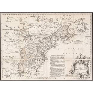
Map of French & Indian War theatre in 1756
Similar Sale History
View More Items in Maps & Atlases

Related Maps & Atlases
More Items in Maps & Atlases
View MoreRecommended Transportation & Travel Collectibles
View More


Item Details
Description
Heading: (North America - New England)
Author: Anonymous
Title: A Map of that Part of America which was the Principal Seat of War, in 1756
Place Published: London
Publisher:
Date Published: 1757
Description:
Author: Anonymous
Title: A Map of that Part of America which was the Principal Seat of War, in 1756
Place Published: London
Publisher:
Date Published: 1757
Description:
Copper-engraved map. 22x33 cm (8¾x13").
Map of the northeastern part of the present-day United States. It shows the areas of the primary action of the French & Indian War. A great deal of the conflict was focused around the upper Hudson and Lake Champlain, and the Mohawk River to Lake Ontario. Published in Gentlemen's Magazine.
Condition
Mild toning, folds, a few neat tape repairs on verso; very good.
Buyer's Premium
- 25%
Map of French & Indian War theatre in 1756
Estimate $200 - $300
1 bidder is watching this item.
Shipping & Pickup Options
Item located in San Francisco, CA, usSee Policy for Shipping
Payment

Related Searches
TOP


![[MAP]. SARTINE, Antoine Plan de la Barre et du Havre de Charles-Town...1778. RARE REVOLUTIONARY WAR: [MAP]. SARTINE, Antoine (1729-1801). Plan de la Barre et du Havre de Charles-Town d'apres un plan Anglois leve en 1776... Paris: Depot de la Marine for M. de Sartine, 1778. Copperplate engraving, matt](https://p1.liveauctioneers.com/197/329395/177650540_1_x.jpg?height=310&quality=70&version=1715364962)


![1858 Mitchell Map of Southern Europe and France [verso] Asia -- No. 24 Map of France, Spain,: Title: 1858 Mitchell Map of Southern Europe and France [verso] Asia -- No. 24 Map of France, Spain, Portugal & Italy [verso] No. 26 Map of Asia Cartographer: S Mitchell Year / Place: 1858, Philadelphi](https://p1.liveauctioneers.com/5584/328338/176911601_1_x.jpg?height=310&quality=70&version=1715113718)


![[Maps] Gio. Ant. Magnini, Italia, 1620: [Maps] Gio. Ant. Magnini, Italia, 1620, Giovanni Antonio Magnini. Italia, data in luce da Fabio suo figliuolo al Serenissimo Ferdinado Gonzaga Duca di Matoua edi Monserrato etc. Bologna, for Sebastian](https://p1.liveauctioneers.com/188/326797/176317457_1_x.jpg?height=310&quality=70&version=1713847031)
![[Maps] Martin Zeiler, Itinerarium Italiae, 1640: [Maps] Martin Zeiler, Itinerarium Italiae, 1640, Martini Zeilleri. Itinerarium Italiae Nov-Antiquae: oder, Raiss-Beschreibung durch Italien, Matthaus Merian, Frankfurt, 40 plates, most double-page, in](https://p1.liveauctioneers.com/188/326797/176317459_1_x.jpg?height=310&quality=70&version=1713847031)


![[MAP]. TODESCHI, Pietro. [Nova et Acurata Totius Americae Tabula auct. G.I. Blaeu] America quarta: [MAP]. TODESCHI, Pietro. [Nova et Acurata Totius Americae Tabula auct. G.I. Blaeu] America quarta pars orbis quam plerunq, nuvum orbem appellitant primo detecta est anno 1492 a Christophoro Columbo...](https://p1.liveauctioneers.com/197/329395/177650542_1_x.jpg?height=310&quality=70&version=1715364962)


