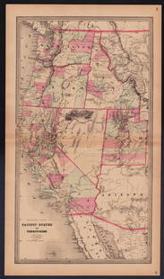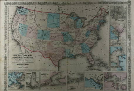
Bowles: Map of the Territories & Pacific States, 1865
Similar Sale History

Recommended Items


Item Details
Description
Map showing area west of MS river to Pacific Coast with inset of Central CA (near San Francisco) covering up Texas. Shows very large Dakota Territory
Joseph Hutchins Colton (1800 - 1893), known professionally as J.H. Colton, founded an American mapmaking company which was an international leader in the map publishing industry between 1831 and 1890. J.H. Colton Company maps were printed using engraved steel plates, which produced higher quality prints than maps made with less costly wax engravings. They were often individually hand watercolored and were recognized for their decorative borders.
Please note that this lot has a reserve. When you leave a bid in advance of the auction, submit your maximum. Jasper52 will bid on your behalf as much as necessary to ensure that you meet the reserve price or that you remain in the lead, up to your maximum. The bidder who has submitted the highest bid wins the lot, provided the bid exceeds the reserve price.
Shipping:
Authenticity:
Photos, descriptions, and estimates were prepared with the utmost care by a fully certified expert and appraiser. All items in this sale are guaranteed authentic. Please contact us if there is a misrepresentation so that the item can be returned.
Your purchase is protected:
In the rare event that your purchase from this auction does not meet your expectations, Jasper52 specialists are here to help. If the item did not conform to the lot description in the sale, U.S. buyers may return the item for a full refund provided you notify Jasper52 within 5 days of receiving the item.
Condition
Very good.
Buyer's Premium
- 10%
Bowles: Map of the Territories & Pacific States, 1865
Estimate $300 - $400
3 bidders are watching this item.
Get approved to bid.
Shipping & Pickup Options
Item located in Tennessee, USSee Policy for Shipping
Payment
Accepts seamless payments through LiveAuctioneers
See More Items From This Jasper52 Seller

Related Searches
TOP


![United States of North America, Pacific States by Joseph Wilson Lowry 1860 map: CAPTION PRINTED BELOW PICTURE: The United States of North America, Pacific States [including California, Oregon, Washington, Utah, and part of New Mexico, ] The map shows Washington, Oregon, Utah & Ne](https://p1.liveauctioneers.com/5584/332390/179262935_1_x.jpg?height=310&quality=70&version=1717528223)


![Maps of Asia & India, c1800's (2) [180164]: (2) Maps of Asia, from atlas, c. 1800's. The First is a map of the continent of Asia, highlighting the Russian Empire and the Chinese empire. Map legend includes "Geographical miles", "British Miles",](https://p1.liveauctioneers.com/2699/331495/178785787_1_x.jpg?height=310&quality=70&version=1717094933)


![Jacob Monk 1853 Map of North America [173506]: Large wall map, typical nvarnish finish, mounted to board for viewing. "New map of that portion of North America exhibiting the United States and Territories, the Canadas, New Brunswick, Nova Scotia,](https://p1.liveauctioneers.com/2699/331495/178785775_1_x.jpg?height=310&quality=70&version=1717094933)
