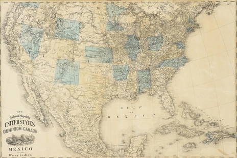
1848 MAP OF THE UNITED STATES AND MEXICO
Similar Sale History
View More Items in Prints & Multiples

Related Prints & Multiples
More Items in Prints & Multiples
View MoreRecommended Art
View More


Item Details
Description
Portraits of Washington, Gen. Taylor and Gen Scott", 'Panoramic View from New York to the Pacific Ocean by the Contemplated Oregon Railroad. Brief entries for the States and Territories of the United States." "Great Temple Dedicated to the Sun Destroyed by Cortez in 1521'; "'The Halls of the Montezumas.' An American Exhibiting to the Sovereigns of Europe the Progress of His Country.' All surrounded by decorative border."Colored lithograph. 30 x 22 inches. Published by Ensign and Thayer, New York. framed.
Condition
Good
Buyer's Premium
- 20%
1848 MAP OF THE UNITED STATES AND MEXICO
Estimate $500 - $1,000
4 bidders are watching this item.
Shipping & Pickup Options
Item located in Amesbury, MA, usSee Policy for Shipping
Payment

Related Searches
TOP


![[SEX] LOT OF 9 PHOTOGRAPHS SOLD TOGETHER: [SEX] A lot of 9 photographs sold together. Some postcards. One mounted with plastic corners in archival mat. Prints: 4.5" x 3" - 6" x 4". Generally good condition, various imperfections. *Additional](https://p1.liveauctioneers.com/8124/329546/177689790_1_x.jpg?height=310&quality=70&version=1715469494)


