1876 Colton Folding Map of the Western United States --
Similar Sale History
View More Items in Maps & AtlasesRelated Maps & Atlases
More Items in Maps & Atlases
View MoreRecommended Transportation & Travel Collectibles
View More


Item Details
Description
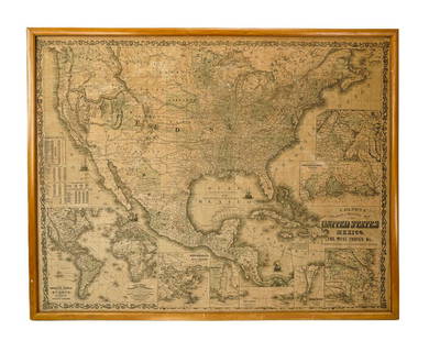
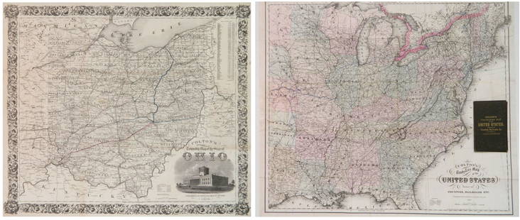
This very attractive and sought-after pocket folding map covers the USA from Chicago and New Orleans west to the Pacific Ocean. Expectedly, great deal of topographical detail is given as well as towns, cities, the proposed and existing railroads (the Pacific Railroad being complete from Iowa to San Francisco), wagon roads, the Pony Express route, Fremont's exploration routes and dates, etc. Yellowstone National Park does not yet appear in the newly organized Wyoming Territory. Decorated by an elaborate border which is customary for Colton.
Please note that this lot has a confidential reserve. When you leave a bid in advance of the auction, submit your maximum. The bidder who has submitted the highest bid wins the lot, provided the bid exceeds the reserve price.
Shipping:
Your purchase is protected:
Photos, descriptions, and estimates were prepared with the utmost care by a fully certified expert and appraiser. All items in this sale are guaranteed authentic.
In the rare event that the item did not conform to the lot description in the sale, Jasper52 specialists are here to help. Buyers may return the item for a full refund provided you notify Jasper52 within 5 days of receiving the item.
Condition
Very Good. Nice crisp original color and print on banknote paper. A number of issued fold splits, with no loss (except very small loss at one meet of two folds), and several verso repaired tears partially in the map. Attached to original near mint condition case.
Buyer's Premium
- 15%
1876 Colton Folding Map of the Western United States --
Estimate $1,500 - $2,000
3 bidders are watching this item.
Shipping & Pickup Options
Item located in Ohio, US$12 shipping in the US
Payment
See More Items From This Jasper52 Seller

Auction Curated By

Maps Expert
Related Searches
TOP


![Travels In N. America In1827-28, hand colored map, 1830: Title: Travels In North America, In The Years 1827 And 1828 Provenance: IN THREE VOLUMES, 1830, with large hand colored folding map of United States and Canada showing Capt. Hall's route. [HOWES H 47]](https://p1.liveauctioneers.com/5584/144949/73283335_1_x.jpg?height=310&quality=70&version=1561753751)


![Five Antique Maps of the Western United States: [Five Antique Maps of the Western United States], incl. "Map of the United States Territory of Oregon...", by Hood, 1838; "Johnson's California, with Utah...", Johnson and Ward, 1864; "Map Showing the](https://p1.liveauctioneers.com/268/141383/71622474_1_x.jpg?height=310&quality=70&version=1556895875)

![[MAPS & ATLASES]. COLTON, Joseph Hutchins. Colton's Map of the United States of America, the: [MAPS & ATLASES]. COLTON, Joseph Hutchins (1800-1893). Colton's Map of the United States of America, the British Provinces, Mexico and the West Indies. Showing the Country from the Atlantic to the](https://p1.liveauctioneers.com/197/305583/163286506_1_x.jpg?height=310&quality=70&version=1697143109)

![[WALL MAP]. Colton's map of the U.S.A . NY: 1853: J.H. COLTON (publisher) [WALL MAP]. Colton's map of the United States of America, the British provinces, Mexico and the West Indies. [WALL MAP]. Colton's map of the United States of America, the Briti](https://p1.liveauctioneers.com/7142/218924/116475153_1_x.jpg?height=310&quality=70&version=1636469267)
![1852 CROTONS MAP OF THE UNITED STATES & CANADAS: COLTON, J[oseph] H[utchins]. Colton’s Map of the United States & Canadas. Routes are by Railroads, Stage-Roads, and Canals. Lithograph map with original color. Original red cover with gold gilt lett](https://p1.liveauctioneers.com/4597/97465/50069280_1_x.jpg?height=310&quality=70&version=1482846039)


![[Maps] Martin Zeiler, Itinerarium Italiae, 1640: [Maps] Martin Zeiler, Itinerarium Italiae, 1640, Martini Zeilleri. Itinerarium Italiae Nov-Antiquae: oder, Raiss-Beschreibung durch Italien, Matthaus Merian, Frankfurt, 40 plates, most double-page, in](https://p1.liveauctioneers.com/188/326797/176317459_1_x.jpg?height=310&quality=70&version=1713847031)


![[Maps] Gio. Ant. Magnini, Italia, 1620: [Maps] Gio. Ant. Magnini, Italia, 1620, Giovanni Antonio Magnini. Italia, data in luce da Fabio suo figliuolo al Serenissimo Ferdinado Gonzaga Duca di Matoua edi Monserrato etc. Bologna, for Sebastian](https://p1.liveauctioneers.com/188/326797/176317457_1_x.jpg?height=310&quality=70&version=1713847031)


