
 Discovery- InteriorsBonhamsSponsored.Your ad here?


Discovery- Interiors
Bonhams
Sponsored.Your ad here?


 Discovery- InteriorsBonhamsSponsored.Your ad here?


Discovery- Interiors
Bonhams
Sponsored.Your ad here?

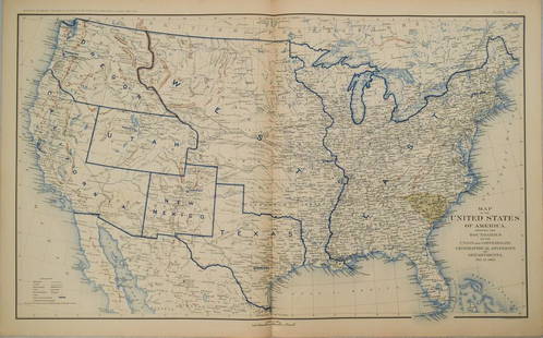
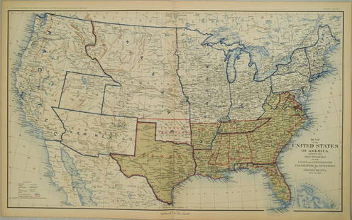
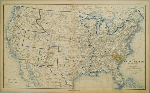
Official Civil War Geographical Boundary map, Julius Bien 1891
Similar Sale History
View More Items in Maps & Atlases
Related Maps & Atlases
More Items in Confederate Maps & Atlases
View MoreRecommended Transportation & Travel Collectibles
View More


Item Details
Description
Scarce definitive map of the geographical boundaries between the Union and Confederate armies. Opens a window into the state of the U. S. during the height of the Civil War. “Map of the United States of America showing the Boundaries of the Union and Confederate Geographical Divisions and Departments, June 30, 1863.” Large, single sheet double-page map is Plate 167 in the “Atlas to Accompany the Official Records of the Union and Confederate Armies, 1861-1865,” published 1891-95 by Julius Bien & Co. Large format map shows America prior to the formation of Wyoming and Montana Territories. Identifies gold, silver and other mines. Numerous forts located throughout the West. Traces various western routes including the U. S. Mail Route (one in the SW and one coming out of St. Joseph, Missouri), three different Fremont Routes (1843, 1844 and 1845), Route of Capt. Marcy in Texas (1849), Route to Ft. Smith, also in Texas, Kearney’s Route (1847), Santa Fe Route, Oregon Route and Pony Express Route. This is not a common map--when found it’s often not in great condition because of the type of paper used to print it. This example is in excellent clean and sound condition. 16.5 x 27.75
Reserve: $140.00
Shipping:Domestic: Flat-rate of $7.00 to anywhere within the contiguous U.S. International: Foreign shipping rates are determined by destination. International shipping may be subject to VAT. Combined shipping: Please ask about combined shipping for multiple lots before bidding. Location: This item ships from Ohio
Your purchase is protected:
Photos, descriptions, and estimates were prepared with the utmost care by a fully certified expert and appraiser. All items in this sale are guaranteed authentic.
In the rare event that the item did not conform to the lot description in the sale, Jasper52 specialists are here to help. Buyers may return the item for a full refund provided you notify Jasper52 within 5 days of receiving the item.
Reserve: $140.00
Shipping:
Your purchase is protected:
Photos, descriptions, and estimates were prepared with the utmost care by a fully certified expert and appraiser. All items in this sale are guaranteed authentic.
In the rare event that the item did not conform to the lot description in the sale, Jasper52 specialists are here to help. Buyers may return the item for a full refund provided you notify Jasper52 within 5 days of receiving the item.
Condition
Near fine
Buyer's Premium
- 15%
Official Civil War Geographical Boundary map, Julius Bien 1891
Estimate $185 - $200
3 bidders are watching this item.
Shipping & Pickup Options
Item located in Ohio, US$7 shipping in the US
Payment
Accepts seamless payments through LiveAuctioneers
See More Items From This Jasper52 Seller

TOP


