


1853 U.S. Coast Survey Map of New Orleans
Similar Sale History
View More Items in New Orleans Cultural District Product


Related New Orleans Cultural District Product


More Items in New Orleans Cultural District Product
View More


Recommended Art
View More


Item Details
Description
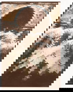
1853 U.S. Coast Survey Map of New Orleans, Lake Pontchartrain and the Mississippi Delta
hand-colored lithograph, inscribed "U.S. Coast Survey, A. D. Bache Superintendent, Sketch H, Showing the progress of the Survey in Section No. 8, 1846-1853", inscribed "No. 31" at upper left margin, printed by P. S. Duval & Co., Philadelphia.
Matted, glazed and framed.
sight 15" x 26-3/4", framed 22-1/2" x 33-7/8"
Provenance: Private collection, New Orleans, Louisiana.
Condition
Descriptions provided in both the print and online catalogues do not include condition reports. The absence of a condition report does not guarantee that a lot is in perfect condition or free from damage and/or wear. We strongly suggest that you request a condition report prior to bidding on any lot. All transactions are governed by New Orleans Auction Galleries' Conditions of Sale.
Buyer's Premium
- 28%
1853 U.S. Coast Survey Map of New Orleans
Estimate $1,200 - $1,800
13 bidders are watching this item.
Shipping & Pickup Options
Item located in New Orleans, LA, usSee Policy for Shipping
Local Pickup Available
Payment
Accepts seamless payments through LiveAuctioneers

TOP