1780 Revolutionary War Map, Massachusetts Bay
Similar Sale History
View More Items in Maps & AtlasesRelated Maps & Atlases
More Items in American Revolutionary Period Maps & Atlases
View MoreRecommended Transportation & Travel Collectibles
View More


Item Details
Description
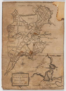
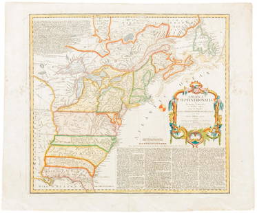
Revolutionary War Period Map of Massachusetts Bay, Published in Universal Magazine 1780. Map titled, "A New and accurate Map of the COLONY of MASSACHUSETTS BAY". Map depicts detailed image of coastal Massachusetts, Rhode Island and Connecticut. Good condition, set in wooden frame under glass, measures: 18" H X 20" W X1.25" D, Image: 10.5" H X 12.75" W.
Buyer's Premium
- 25%
1780 Revolutionary War Map, Massachusetts Bay
Estimate $200 - $400
32 bidders are watching this item.
Shipping & Pickup Options
Item located in Plymouth, MA, usSee Policy for Shipping
Local Pickup Available
Payment

TOP


![[MAP]. SARTINE, Antoine Plan de la Barre et du Havre de Charles-Town...1778. RARE REVOLUTIONARY WAR: [MAP]. SARTINE, Antoine (1729-1801). Plan de la Barre et du Havre de Charles-Town d'apres un plan Anglois leve en 1776... Paris: Depot de la Marine for M. de Sartine, 1778. Copperplate engraving, matt](https://p1.liveauctioneers.com/197/329395/177650540_1_x.jpg?height=310&quality=70&version=1715364962)


![Nicholson Map of the State of Virginia 1864: NICHOLSON, W. L. (19th Century). Map of the State of Virginia. Color-printed lithograph by Charles G. Krebs. [Washington, D.C.]: U.S. Coastal Survey under A.D. Bache, 1864. 24" x 37 1/2" sheet. Compar](https://p1.liveauctioneers.com/1968/330639/178336662_1_x.jpg?height=310&quality=70&version=1716827770)


![[MAPS]. HOMANN, Johann Baptist, HOMANN HEIRS, and Georg Matthäus SEUTTER. [Composite Atlas].: [MAPS]. HOMANN, Johann Baptist (1663-1724), HOMANN HEIRS, and Georg Matthäus SEUTTER (1678-1757). [Composite Atlas]. [Nuremberg, Augsburg, and others: Homann Heirs and others, maps dated between](https://p1.liveauctioneers.com/197/329395/177650530_1_x.jpg?height=310&quality=70&version=1715364962)


