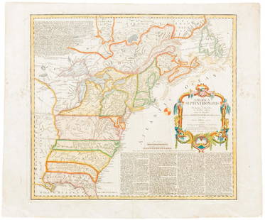
Revolutionary War era chart of Delaware Bay and River
Similar Sale History
View More Items in Maps & Atlases
Related Maps & Atlases
More Items in American Revolutionary Period Maps & Atlases
View MoreRecommended Transportation & Travel Collectibles
View More


Item Details
Description
Small antique chart of Delaware Bay and River. Derived from the larger chart of Delaware Bay and River up to Philadelphia, Pennsylvania by Joshua Fisher (1707-1783) in 1776. Shows the location of a Pilot's Town near Cape Henlopen. Identifies the ship channels from Cape May and Cape James up the Delaware River past Salem Mass., Wilmington, Newcastle, and Chester to the small town of Philadephia, Pennsylvania. Key features include Mud Island, the Schuylkill River, Stony Point, Egg Island Flats, Fortescues Island, Cold Spring Inlet, Turtle Gut Inlet, and Rehoboth Bay. The mouths of numerous creeks are named including Clark's Ditch, Motherkiln Creek, and Nantuxet Creek. Published in the "Gentleman's Magazine", July 1779, volume 49, page 369. Joshua Fisher's early chart of Delaware Bay from the Sea-Coast to Reedy-Island was published during the French & Indian War, and was immediately suppressed by the Assembly, fearing that its falling into enemy hands would make Philadelphia a target of the French navy. Fisher's chart showed the lower part of the bay and was intended to be used as a navigational aid for ships sailing toward Philadelphia. In 1775, Fisher produced an expanded chart that showed the bay and the Delaware River to just beyond Philadelphia. This was the most important map of the bay and river in the 18th century.
Please note that this lot has a confidential reserve. When you leave a bid in advance of the auction, submit your maximum. The bidder who has submitted the highest bid wins the lot, provided the bid exceeds the reserve price.
Shipping:
Your purchase is protected:
Photos, descriptions, and estimates were prepared with the utmost care by a fully certified expert and appraiser. All items in this sale are guaranteed authentic.
In the rare event that the item did not conform to the lot description in the sale, Jasper52 specialists are here to help. Buyers may return the item for a full refund provided you notify Jasper52 within 5 days of receiving the item.
Condition
Good. A bit browned but otherwise good condition. Bottom margin is narrow.
Buyer's Premium
- 10%
Revolutionary War era chart of Delaware Bay and River
Estimate $95 - $105
3 bidders are watching this item.
Shipping & Pickup Options
Item located in South Carolina, USSee Policy for Shipping
Payment
See More Items From This Jasper52 Seller

Auction Curated By

Maps Expert
TOP


![Vancouver: Antique Chart of Northwest Coast of America: Title/Content of Map: A Chart Shewing Part of the Coast of N.W. America, with the Tracks of His Majesty's Sloop Discovery and Armed Tender Chatham . . . [Columbia River to Northern California] Date Pr](https://p1.liveauctioneers.com/5584/114563/58815189_1_x.jpg?height=310&quality=70&version=1514941693)


![[MAP]. SARTINE, Antoine Plan de la Barre et du Havre de Charles-Town...1778. RARE REVOLUTIONARY WAR: [MAP]. SARTINE, Antoine (1729-1801). Plan de la Barre et du Havre de Charles-Town d'apres un plan Anglois leve en 1776... Paris: Depot de la Marine for M. de Sartine, 1778. Copperplate engraving, matt](https://p1.liveauctioneers.com/197/329395/177650540_1_x.jpg?height=310&quality=70&version=1715364962)


![1892 Cowles Civil War Map of Battles in Gettysburg, Virginia, W Virginia and Maryland -- Sketch of: Title: 1892 Cowles Civil War Map of Battles in Gettysburg, Virginia, W Virginia and Maryland -- Sketch of the battle of McDowell, VA. [and] Route Map of Gettysburg Campaign Lt-Gen T.J. Jackson [and] S](https://p1.liveauctioneers.com/5584/329422/177662185_1_x.jpg?height=310&quality=70&version=1715717898)


![Chinese Japanese Korean Ports sea chart. lighthouses mail routes. LARGE 1927 map: TITLE/CONTENT OF MAP: Chinese and Japanese Ports [inset Port Arthur & Dalny; Approaches to Shanghai; Wei-hai-wei; Kiao-chow; Kobe; Tokyo Bay; Yokohama] DATE PRINTED: 1927 IMAGE SIZE: Approx 50.5 x 70.](https://p1.liveauctioneers.com/5584/329387/177649259_1_x.jpg?height=310&quality=70&version=1715717898)


![1878 Mitchell Map of Virginia and West Virginia [verso] New Jersey, Maryland and Delaware -- County: Title: 1878 Mitchell Map of Virginia and West Virginia [verso] New Jersey, Maryland and Delaware -- County Map ofVirginia and West Virginia [Verso} County Map of Maryland and Delaware [with] County Ma](https://p1.liveauctioneers.com/5584/329422/177662152_1_x.jpg?height=310&quality=70&version=1715717898)


