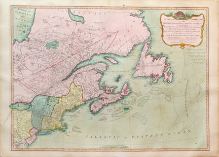
De Fer Map Showing California as an Island
Similar Sale History
View More Items in Maps & AtlasesRelated Maps & Atlases
More Items in French Maps & Atlases
View MoreRecommended Transportation & Travel Collectibles
View More


Item Details
Description
DE FER, Nicholas (1646-1720).
La Californie ou Nouvelle Caroline...
Engraved map with original color in outline.
Paris, 1720.
20 3/4" x 29 1/4" sheet.
An impressive map depicting California as an island on one of the largest scales ever produced. The text in the panel below the title at right is decorated by several vignettes of native peoples and describes a time-line of European history in California from Cortez in 1533 to the latest discoveries in 1695.
Buyer's Premium
- 25%
De Fer Map Showing California as an Island
Estimate $8,000 - $12,000
5 bidders are watching this item.
Shipping & Pickup Options
Item located in New York, NY, usOffers In-House Shipping
Local Pickup Available
Payment

Related Searches
TOP


![Manuscript Map of Givet, France on the Belgian Border: [Givet, France]. "Charlemont les deux Givets et la Couronne d'Haurs Pour servir au Projet de mil Sept cent trente sept" Fine manuscript plan in ink and colours on paper (no visible watermark), scale a](https://p1.liveauctioneers.com/1968/273926/143704769_1_x.jpg?height=310&quality=70&version=1672435208)


![Sanson World Atlas, 1659: SANSON D'ABBEVILLE, Nicholas (1600-1667). Cartes Generales de Toutes les Parties du Monde. Paris: The Author and Pierre Mariette, 1658 [but 1659]. Comparables: Arader Galleries, 2015 - $97,600; Christ](https://p1.liveauctioneers.com/1968/250616/130196469_1_x.jpg?height=310&quality=70&version=1654190895)


![French version of San Diego Bay map by Bache: Heading: (California - San Diego Bay) Author: Bache, A.D. Title: Baie de San Diego Californie. Copie de plan levé en 1859 sous la direction de A.D. Bache Place Published: [Paris] Publisher:Dépot](https://p1.liveauctioneers.com/642/236542/122557341_1_x.jpg?height=310&quality=70&version=1644354597)
![De Fer: Antique Map of Villefranche-sur-Mer, 1705: Title/Content of Map: 'Veue du port et des environs de Ville Franche [Villefranche-sur-Mer - Mont Boron - Saint-Jean-Cap-Ferrat]' Alpes-Maritimes Date Printed: 1705 Image Size: Approx 16.0 x 24.5cm, 6](https://p1.liveauctioneers.com/5584/106754/54692119_1_x.jpg?height=310&quality=70&version=1500663236)
![De Fer World Wall Map 1730: DE FER, Nicolas (1646-1720). Mappe-Monde ou Carte Generale de la Terre. Engraved map with original hand color. Paris: 1712 [1730]. 40" x 58 3/4" sheet, 46 1/2" x 65 1/2" framed. This separately publis](https://p1.liveauctioneers.com/1968/282833/149849107_1_x.jpg?height=310&quality=70&version=1680275215)


![Isles de Corse et de Sardaigne. Corsica and Sardinia. BONNE 1787 old map: TITLE/CONTENT OF MAP: Isles de Corse et de Sardaigne [The islands of Corsica and Sardinia] DATE PRINTED: 1787 IMAGE SIZE: Approx 36.0 x 24.5cm, 14 x 9.75 inches (Large); Please note that this is a fol](https://p1.liveauctioneers.com/5584/328641/177014474_1_x.jpg?height=310&quality=70&version=1715113718)


