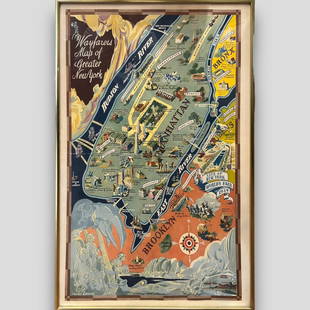
18TH C. (1755) MAP OF N.Y. , PENSYLVANIA & NEW ENGLAND
Similar Sale History
View More Items in Maps & Atlases
Related Maps & Atlases
More Items in Maps & Atlases
View MoreRecommended Transportation & Travel Collectibles
View More


Item Details
Description
FRAMED 18TH C. (DATED 1755) 2 PART MAP "A MAP OF THE PROVINCE OF NEW YORK, WITH PART OF PENSILVANIA AND NEW ENGLAND / FROM AN ACTUAL SURVEY BY CAPTAIN MONTRESOR, ENGINEER 1755" - FRAME 59 1/4" X 39", SITE 57 3/4" X 37 1/2"
Buyer's Premium
- 23%
18TH C. (1755) MAP OF N.Y. , PENSYLVANIA & NEW ENGLAND
Estimate $500 - $5,000
11 bidders are watching this item.
Shipping & Pickup Options
Item located in Bennington, VT, usOffers In-House Shipping
Local Pickup Available
Payment
Accepts seamless payments through LiveAuctioneers

TOP


![[MAP OF BERMUDA] BLAEU, WILLEM (c. 1630): Mappa Aestivarum Insularum, alias Barmudas..., engraved bi-fold map with hand-coloring, showing the coasts of Florida, Viginia, Cape Cod, and New England, based on Speed's map, with latin text on vers](https://p1.liveauctioneers.com/522/152734/77123885_1_x.jpg?height=310&quality=70&version=1571345617)


![1890s Cram Map of Vermont [verso] New Hampshire -- Vermont [verso] New Hampshire: Title: 1890s Cram Map of Vermont [verso] New Hampshire -- Vermont [verso] New Hampshire Cartographer: G Cram Year / Place: 1890 c., Chicago Map Dimension (in.): 12.9 X 9.8 in. This is a very nice map](https://p1.liveauctioneers.com/5584/328338/176911596_1_x.jpg?height=310&quality=70&version=1715113718)


![HAND COLORED MAP OF PERU & COUNTRY OF THE AMAZONS, 1747, BY EMANUEL BOWEN, FRAMED: A New And Accurate Map Of Peru And The Country Of The Amazones. Drawn From The Most Authentick French Maps &C. And Regulated By Astronomical Observations, London]: William Innys [et al.], 1747. A deta](https://p1.liveauctioneers.com/957/328836/177180798_1_x.jpg?height=310&quality=70&version=1715021458)


![[Maps] Gio. Ant. Magnini, Italia, 1620: [Maps] Gio. Ant. Magnini, Italia, 1620, Giovanni Antonio Magnini. Italia, data in luce da Fabio suo figliuolo al Serenissimo Ferdinado Gonzaga Duca di Matoua edi Monserrato etc. Bologna, for Sebastian](https://p1.liveauctioneers.com/188/326797/176317457_1_x.jpg?height=310&quality=70&version=1713847031)
![[Maps] Martin Zeiler, Itinerarium Italiae, 1640: [Maps] Martin Zeiler, Itinerarium Italiae, 1640, Martini Zeilleri. Itinerarium Italiae Nov-Antiquae: oder, Raiss-Beschreibung durch Italien, Matthaus Merian, Frankfurt, 40 plates, most double-page, in](https://p1.liveauctioneers.com/188/326797/176317459_1_x.jpg?height=310&quality=70&version=1713847031)


