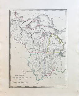
CAREY, MATHEW. The Upper Territories of the United
Similar Sale History
View More Items in Maps & AtlasesRelated Maps & Atlases
More Items in Maps & Atlases
View MoreRecommended Transportation & Travel Collectibles
View More


Item Details
Description
CAREY, MATHEW. The Upper Territories of the United States. Double-page engraved map of the American Midwest. 21¾x17½ inches sheet size, wide margins; original hand-color in outline; minor offset and soft creases, upper left sheet edge slightly chipped and discolored by foredge exposure. - Philadelphia, 1814
Buyer's Premium
- 30%
CAREY, MATHEW. The Upper Territories of the United
Estimate $600 - $900
6 bidders are watching this item.
Shipping & Pickup Options
Item located in New York, NY, usOffers In-House Shipping
Local Pickup Available
Payment

Auction Curated By

Specialist, Maps & Atlases
Related Searches
TOP


![Jacob Monk 1853 Map of North America [173506]: Large wall map, typical nvarnish finish, mounted to board for viewing. "New map of that portion of North America exhibiting the United States and Territories, the Canadas, New Brunswick, Nova Scotia,](https://p1.liveauctioneers.com/2699/331495/178785775_1_x.jpg?height=310&quality=70&version=1717094933)


![United States of North America, Pacific States by Joseph Wilson Lowry 1860 map: CAPTION PRINTED BELOW PICTURE: The United States of North America, Pacific States [including California, Oregon, Washington, Utah, and part of New Mexico, ] The map shows Washington, Oregon, Utah & Ne](https://p1.liveauctioneers.com/5584/332390/179262935_1_x.jpg?height=310&quality=70&version=1717528223)


![Indian Territory Map by Donaldson, 1883 [181628]: 1883 Indian Territory map by Thomas Donaldson. Scale is 12 miles=1". 12.5x17". In 2 pieces, 4" upper and lower right tears. Needs repair. Please inspect, sold as is. Indian Territory](https://p1.liveauctioneers.com/2699/331495/178785757_1_x.jpg?height=310&quality=70&version=1717094933)


![[MAPS]. HOMANN, Johann Baptist, HOMANN HEIRS, and Georg Matthäus SEUTTER. [Composite Atlas].: [MAPS]. HOMANN, Johann Baptist (1663-1724), HOMANN HEIRS, and Georg Matthäus SEUTTER (1678-1757). [Composite Atlas]. [Nuremberg, Augsburg, and others: Homann Heirs and others, maps dated between](https://p1.liveauctioneers.com/197/329395/177650530_1_x.jpg?height=310&quality=70&version=1715364962)
![[MAP]. TODESCHI, Pietro. [Nova et Acurata Totius Americae Tabula auct. G.I. Blaeu] America quarta: [MAP]. TODESCHI, Pietro. [Nova et Acurata Totius Americae Tabula auct. G.I. Blaeu] America quarta pars orbis quam plerunq, nuvum orbem appellitant primo detecta est anno 1492 a Christophoro Columbo...](https://p1.liveauctioneers.com/197/329395/177650542_1_x.jpg?height=310&quality=70&version=1715364962)
![[MAP]. ORTELIUS, Abraham. Americae Sive Novi Orbis, Nova Descriptio. 1573.: [MAP]. ORTELIUS, Abraham (1527-1598). Americae Sive Novi Orbis, Nova Descriptio. Antwerp, 1573. Engraved map with hand-coloring. Framed and double glazed, visible area 375 x 521 mm (unexamined out of](https://p1.liveauctioneers.com/197/329395/177650534_1_x.jpg?height=310&quality=70&version=1715364962)


![[MAP]. ORTELIUS, Abraham. Turcici Imperii Descriptio.1592.: [MAP]. ORTELIUS, Abraham (1527-1598). Turcici Imperii Descriptio. Antwerp, 1592. Engraved map with hand-coloring. Matted, framed, and double glazed, sight 406 x 521 mm (unexamined out of frame). Decor](https://p1.liveauctioneers.com/197/329395/177650538_1_x.jpg?height=310&quality=70&version=1715364962)
![Set of Twelve Satirical Anthropomorphic Maps of Europe: [SATIRICAL MAPS] A set of twelve satirical anthropomorphic maps of Europe. London: circa 1868. A set of 12 (believed complete) lithographed maps by Vincent Brooks, Day & Son, London, each offering](https://p1.liveauctioneers.com/292/330597/178279264_1_x.jpg?height=310&quality=70&version=1716409282)


![[MAP]. ORTELIUS, Abraham. Romani Imperii Imago. 1592.: [MAP]. ORTELIUS, Abraham (1527-1598). Romani Imperii Imago. Antwerp, 1592. Engraved map with hand-coloring. Matted, framed, and double glazed, visible area 381 x 521 mm (unexamined out of frame). 6 de](https://p1.liveauctioneers.com/197/329395/177650537_1_x.jpg?height=310&quality=70&version=1715364962)
![[MAP]. SPEED, John. A New Mappe of the Romane Empire. 1676.: [MAP]. SPEED, John (ca 1551-1629). A New Mappe of the Romane Empire. London: Basset & Chiswell, 1676. Engraved map with hand-coloring. Framed and double glazed, sight 419 x 559 mm. Decorative cartouch](https://p1.liveauctioneers.com/197/329395/177650541_1_x.jpg?height=310&quality=70&version=1715364962)


