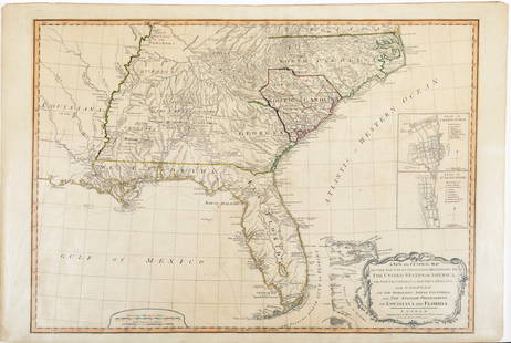
Map of Bahrain from 1825
Similar Sale History
View More Items in Maps & AtlasesRelated Maps & Atlases
More Items in Modern Maps & Atlases
View MoreRecommended Transportation & Travel Collectibles
View More


Item Details
Description
A reprint of the map of Bahrain and the western coast of the Qatari peninsula, drawn by British navigator George Brooks. This map was one of the first drawn by English navigators to determine the depth of the both the eastern and western coasts of the Arabian gulf. Important landmarks of Bahrain were placed on the map by G.B. Brucks. This map was also one of the most important of its time considering its high accuracy, as previously maps were redrawn with very little accuracy. خريطة البحرين عام ١٨٢٥مإعادة طبع لخريطة البحرين والساحل الغربي لشبه جزيرة قطر، رسمت من قبل الملاح البريطاني جورج بروكس ١٨٢٥م تعتبر هذه الخريطة من أول الخرائط التي قام برسمها الملاحون الإنجليز لمعرفة أعماق الساحل الغربي والشرقي للخليج العربي، ووضع بروكس أشهر المواقع المتواجدة في البحرين وتعتبر هذه الخريطة من الخرائط المهمة التي رسمت بشكل دقيق للمنطقة من الطبيعة، بعد ما كانت الخرائط ترسم عن طريق النقل من الخرائطالسابقة المفتقرة إلى الدقة
Buyer's Premium
- 25%
Map of Bahrain from 1825
Estimate BHD 300 - BHD 1,000
2 bidders are watching this item.
Get approved to bid.
Shipping & Pickup Options
Item located in Umm Al Hassam, bhOffers In-House Shipping
Payment
Related Searches
TOP


![Mitchell Map of the British and French Dominions of North America, 1755 - VERY RARE FIRST EDITION,: MITCHELL, John (1711-1768). A Map of the British and French Dominions of North America. Engraved map in 8 sheets. Published [London:] Publish'd by the Author Feb.ry 13th. 1755, and Sold by And: Miller](https://p1.liveauctioneers.com/1968/282833/149849101_1_x.jpg?height=310&quality=70&version=1680275215)

![Bernard / Miller Manuscript Map of the Great Eastern: [Map - Colonial New England] [BERNARD, Sir Francis, Governor of Colonial Massachusetts (1712-1779) & Francis MILLER, Surveyor (1733-1800). Untitled Manuscript Road Map of "The Great Eastern Road." [Ro](https://p1.liveauctioneers.com/1968/225974/116712071_1_x.jpg?height=310&quality=70&version=1636655147)


![Des Barres Map of Canada, St. Lawrence River & Gulf: DES BARRES, Joseph Frederick Wallet (1729 -1824). [Canada, St. Lawrence River & Gulf]. Engraved map with original hand color in outline. London, 1781. 30" x 63" sheet. Nice example of Des Barres' char](https://p1.liveauctioneers.com/1968/322135/173185704_1_x.jpg?height=310&quality=70&version=1709997984)


![Turkey in Europe. Balkans Bosphorus Rumania Rumelia. 50x60cm. JOHNSTON 1879 map: TITLE/CONTENT OF MAP: Turkey in Europe [inset: The Bosporus & Constantinople. Crete or Candia - Turkish Kirid - Modern Greek Kriti - Ancient Creta] DATE PRINTED: 1879 IMAGE SIZE: Approx 47.5 x 60.0cm,](https://p1.liveauctioneers.com/5584/328641/177014461_1_x.jpg?height=310&quality=70&version=1715113718)


![[FLAGS]. 31-star American parade flag. Ca 1850-1859.: [FLAGS]. 31-star American parade flag. Ca 1850-1859. 22 x 36 1/2 in. cotton flag with 31 printed stars, configured in a double medallion surrounding a much larger central star, that is haloed in both](https://p1.liveauctioneers.com/197/329785/177758218_1_x.jpg?height=310&quality=70&version=1715625218)


