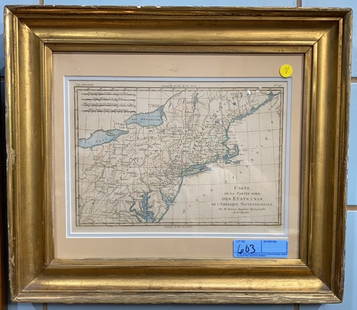
GROUPING OF FRAMED NEW ENGLAND 19TH MAPS
Similar Sale History
View More Items in Maps & AtlasesRelated Maps & Atlases
More Items in Maps & Atlases
View MoreRecommended Transportation & Travel Collectibles
View More


Item Details
Description
Grouping of three maps. 1) Framed 1862 hand color map of Massachusetts, Connecticut and Rhode Island. Map published by Mitchell. Map15 inches x 13 inches. Overall 21 inches x 19 inches. Somestains on edge. 2) 1882 Bradley & Co. Map of Vermont and New Hampshire. Map 15 inches x 23 inches. Hand-colored. Loss on corners. 3) 1882 Bradley & Company map of Maine. Map 15 inches x 23 inches. Overall with frame 20 inches x 28 inches. Loss on edges and bottom. Various condition.
Buyer's Premium
- 25%
GROUPING OF FRAMED NEW ENGLAND 19TH MAPS
Estimate $150 - $250
3 bidders are watching this item.
Shipping & Pickup Options
Item located in Middleboro, MA, usOffers In-House Shipping
Local Pickup Available
Payment

Related Searches
TOP


![19th C. Map of New York: Map of New York dated 1890, showing political divisions and subdivisions November 1870, gilt framed under glass. [Art: 17" H x 38" W; Frame: 25 1/2" H x 47" W]. In good condition.](https://p1.liveauctioneers.com/1221/251963/131695197_1_x.jpg?height=310&quality=70&version=1656475639)


![1890s Cram Map of Vermont [verso] New Hampshire -- Vermont [verso] New Hampshire: Title: 1890s Cram Map of Vermont [verso] New Hampshire -- Vermont [verso] New Hampshire Cartographer: G Cram Year / Place: 1890 c., Chicago Map Dimension (in.): 12.9 X 9.8 in. This is a very nice map](https://p1.liveauctioneers.com/5584/328338/176911596_1_x.jpg?height=310&quality=70&version=1715113718)


![HAND COLORED MAP OF PERU & COUNTRY OF THE AMAZONS, 1747, BY EMANUEL BOWEN, FRAMED: A New And Accurate Map Of Peru And The Country Of The Amazones. Drawn From The Most Authentick French Maps &C. And Regulated By Astronomical Observations, London]: William Innys [et al.], 1747. A deta](https://p1.liveauctioneers.com/957/328836/177180798_1_x.jpg?height=310&quality=70&version=1715021458)
![Antique Map of Scotland: [Antique Map of Scotland] "A New and Correct Map of Scotland or North Britain. with all the Post and Military roads, divisions & ca. Drawn from the most approved surveys, Illustrated with many additio](https://p1.liveauctioneers.com/268/328386/176967773_1_x.jpg?height=310&quality=70&version=1714748870)


![[MAP]. SPEED, John. A New Mappe of the Romane Empire. 1676.: [MAP]. SPEED, John (ca 1551-1629). A New Mappe of the Romane Empire. London: Basset & Chiswell, 1676. Engraved map with hand-coloring. Framed and double glazed, sight 419 x 559 mm. Decorative cartouch](https://p1.liveauctioneers.com/197/329395/177650541_1_x.jpg?height=310&quality=70&version=1715364962)


![[Maps] Gio. Ant. Magnini, Italia, 1620: [Maps] Gio. Ant. Magnini, Italia, 1620, Giovanni Antonio Magnini. Italia, data in luce da Fabio suo figliuolo al Serenissimo Ferdinado Gonzaga Duca di Matoua edi Monserrato etc. Bologna, for Sebastian](https://p1.liveauctioneers.com/188/326797/176317457_1_x.jpg?height=310&quality=70&version=1713847031)
![[Maps] Martin Zeiler, Itinerarium Italiae, 1640: [Maps] Martin Zeiler, Itinerarium Italiae, 1640, Martini Zeilleri. Itinerarium Italiae Nov-Antiquae: oder, Raiss-Beschreibung durch Italien, Matthaus Merian, Frankfurt, 40 plates, most double-page, in](https://p1.liveauctioneers.com/188/326797/176317459_1_x.jpg?height=310&quality=70&version=1713847031)


![[MAP]. TODESCHI, Pietro. [Nova et Acurata Totius Americae Tabula auct. G.I. Blaeu] America quarta: [MAP]. TODESCHI, Pietro. [Nova et Acurata Totius Americae Tabula auct. G.I. Blaeu] America quarta pars orbis quam plerunq, nuvum orbem appellitant primo detecta est anno 1492 a Christophoro Columbo...](https://p1.liveauctioneers.com/197/329395/177650542_1_x.jpg?height=310&quality=70&version=1715364962)


