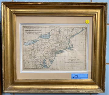
A framed 1844 Mitchell map of New England
Similar Sale History
View More Items in Maps & AtlasesRelated Maps & Atlases
More Items in Maps & Atlases
View MoreRecommended Transportation & Travel Collectibles
View More


Item Details
Description
A hand colored copy of S. Augustus Mitchell's Map of the New England or Eastern States, published in 1844, showing also parts of New York, New Brunswick and "Canada East", as Lower Canada was known from 1841 to 1849. (It is modern-day southern Quebec.) Inset maps of Boston & Providence, and New Haven & Hartford appear at lower right. Charmingly, tiny images of steamships and packets and even the Pilgrim ship Mayflower appear in the ocean. Beautifully framed and in good condition.
Condition
Absence of a condition report does not deem material without flaw. Please request a current condition report from the office at 610-558-1800 or info@williambunchauctions.com
Buyer's Premium
- 30%
A framed 1844 Mitchell map of New England
Estimate $100 - $200
6 bidders are watching this item.
Shipping & Pickup Options
Item located in Chadds Ford, PA, usSee Policy for Shipping
Local Pickup Available
Payment
Accepts seamless payments through LiveAuctioneers

Related Searches
TOP


![A highly detailed map of New England after the Jansson-Visscher series: [MAP-NORTH AMERICA] [MONTANUS, ARNOLDUS]. Novi Belgii Quod nune Novi Jorck vocatur, Novae Angliae & Partis](https://p1.liveauctioneers.com/292/326828/175962858_1_x.jpg?height=310&quality=70&version=1713473479)
![Jansson's important early map of New England: [MAP-NORTH AMERICA] JANSSON, JAN. Nova Belgica et Anglia Nova. Amsterdam: circa 1646. Latin text on verso. Neat lines 15 1/4 x 19 3/4 inches (38.7 x 50.5 cm). Marginal tears r](https://p1.liveauctioneers.com/292/326828/175962856_1_x.jpg?height=310&quality=70&version=1713473479)

![Three maps of the United States: [MAPS - AMERICA] A Group of three maps of the United States, including [SHAFFNER TALIAFERRO PRESTON, ] United States. [London,1862]. Hand-colored lithographed folding map from The War in Am](https://p1.liveauctioneers.com/292/326828/175962868_1_x.jpg?height=310&quality=70&version=1713473479)


![Untitled. [New England, Acadia, Quebec, St. Lawrence River, Etc.]: Publication Date: c1748 Title: Untitled. [New England, Acadia, Quebec, St. Lawrence River, Etc.] Cartographer: ANVILLE, J. B. B. D' Publisher: Height: 18.75 Width: 22.5 Eastern Canada & New England pr](https://p1.liveauctioneers.com/5584/326512/175785691_1_x.jpg?height=310&quality=70&version=1713903186)


![Coronelli's elegant two-sheet hemispheric world map: [MAP - WORLD] CORONELLI, VINCENZO MARIA. Planisfero Del Mondo Vecchio; [and] Planisfero Del Mondo Nuovo. [Venice: circa 1691]. Two hand-colored engraved hemispheric world maps printed on separate shee](https://p1.liveauctioneers.com/292/326828/175962847_1_x.jpg?height=310&quality=70&version=1713473479)
![Homann's expansive map of North America: [MAP-NORTH AMERICA] HOMANN, JOHANN BAPTISTA.Regni Mexicani seu Novae Hispaniae Ludov](https://p1.liveauctioneers.com/292/326828/175962859_1_x.jpg?height=310&quality=70&version=1713473479)
![The first map of China printed in England: [MAP - CHINA] [PURCHAS, SAMUEL]. The Map of China. [Huang Ming yitong fang uy bei lan - Comprehensive view map fo the Imperial Ming.] London: circa 1625. First and only edition, from Purchas his Pilgr](https://p1.liveauctioneers.com/292/326828/175962849_1_x.jpg?height=310&quality=70&version=1713473479)
![[MAP - TOURS]: [MAP - TOURS]MUNSTER, SEBASTIAN. Die abcontrafactur der schonen und Edlen Statt Tours. [Circa 1598]. Woodcut map, hand colored, text printed on verso, framed. Visible area measures 12 1/2 x 15 1/2 inc](https://p1.liveauctioneers.com/292/326828/175962850_1_x.jpg?height=310&quality=70&version=1713473479)
![After De L'Ise's map of North America: [MAP-NORTH AMERICA] DE L'ISLE, GUILLAUME, after. L'Amerique Septentrionale Dressee sur les Observations de Mrs de l'Academie Royale des Sciences. Amsterdam: R.& J. Ottens, circa 1730 or later. Han](https://p1.liveauctioneers.com/292/326828/175962860_1_x.jpg?height=310&quality=70&version=1713473479)
![A group of American prints, maps and graphics many in Perry Hopf frames: [CANADA-NATIVE AMERICANS] A group of miscellaneous prints, maps and graphics of mostly Canadian and Native American interest. A large group of about 19 items (all but one framed, most in fine Perry Ho](https://p1.liveauctioneers.com/292/326828/175962871_1_x.jpg?height=310&quality=70&version=1713473479)


