


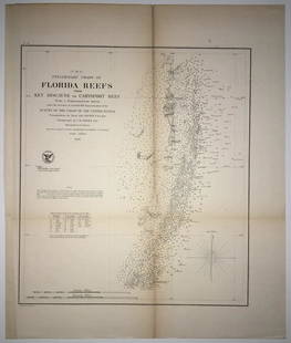
Preliminary Chart of St. Augustine Harbor Florida
Similar Sale History
View More Items in Maps & Atlases


Related Maps & Atlases
![[MAP]. SARTINE, Antoine Plan de la Barre et du Havre de Charles-Town...1778. RARE REVOLUTIONARY WAR: [MAP]. SARTINE, Antoine (1729-1801). Plan de la Barre et du Havre de Charles-Town d'apres un plan Anglois leve en 1776... Paris: Depot de la Marine for M. de Sartine, 1778. Copperplate engraving, matt](https://p1.liveauctioneers.com/197/329395/177650540_1_x.jpg?height=310&quality=70&version=1715364962)


![Bellin Map of St. Salvador, Brazil -- Plan de la ville de St. Salvador [with] Vue de la Ville de St.: Title: Bellin Map of St. Salvador, Brazil -- Plan de la ville de St. Salvador [with] Vue de la Ville de St. Salvador du Cote de la Baye Cartographer: J Bellin Year / Place: 1757, Paris Map Dimension (](https://p1.liveauctioneers.com/5584/328338/176911634_1_x.jpg?height=310&quality=70&version=1715113718)


More Items in Maps & Atlases
View More

![[Maps] Gio. Ant. Magnini, Italia, 1620: [Maps] Gio. Ant. Magnini, Italia, 1620, Giovanni Antonio Magnini. Italia, data in luce da Fabio suo figliuolo al Serenissimo Ferdinado Gonzaga Duca di Matoua edi Monserrato etc. Bologna, for Sebastian](https://p1.liveauctioneers.com/188/326797/176317457_1_x.jpg?height=310&quality=70&version=1713847031)
![[Maps] Martin Zeiler, Itinerarium Italiae, 1640: [Maps] Martin Zeiler, Itinerarium Italiae, 1640, Martini Zeilleri. Itinerarium Italiae Nov-Antiquae: oder, Raiss-Beschreibung durch Italien, Matthaus Merian, Frankfurt, 40 plates, most double-page, in](https://p1.liveauctioneers.com/188/326797/176317459_1_x.jpg?height=310&quality=70&version=1713847031)


![[MAP]. TODESCHI, Pietro. [Nova et Acurata Totius Americae Tabula auct. G.I. Blaeu] America quarta: [MAP]. TODESCHI, Pietro. [Nova et Acurata Totius Americae Tabula auct. G.I. Blaeu] America quarta pars orbis quam plerunq, nuvum orbem appellitant primo detecta est anno 1492 a Christophoro Columbo...](https://p1.liveauctioneers.com/197/329395/177650542_1_x.jpg?height=310&quality=70&version=1715364962)


Recommended Transportation & Travel Collectibles
View More


Item Details
Description
Railroad ends at west bank of San Sebastian River just west of city. "Anchorage" area depicted near mouth of Tolomato or North River. "Wreck" located near Breakers on Anastasia Island east shore. Since this is a (scarce) updated version, in upper right neatline it states: "Electrotype Copy No. 1 by G. Mathiot USCS". Attractive detailed chart with soundings and sailing directions. Shows town of St. Augustine with Fort Marion and every other structure, including streets, and fields with crop rows. Old Tower and Light (house) on Anastasia Island. "Channel 1879" shown just offshore from the light (updating). Encapsulated with hangers. Fold browning.
Reserve: $165.00
Shipping:
Your purchase is protected:
Photos, descriptions, and estimates were prepared with the utmost care by a fully certified expert and appraiser. All items in this sale are guaranteed authentic.
In the rare event that the item did not conform to the lot description in the sale, Jasper52 specialists are here to help. Buyers may return the item for a full refund provided you notify Jasper52 within 5 days of receiving the item.
Condition
Good
Buyer's Premium
- 15%
Preliminary Chart of St. Augustine Harbor Florida
Estimate $200 - $250
3 bidders are watching this item.
Shipping & Pickup Options
Item located in Tennessee, US$25 shipping in the US
Payment
See More Items From This Jasper52 Seller

Auction Curated By

Maps Expert
Related Searches
TOP