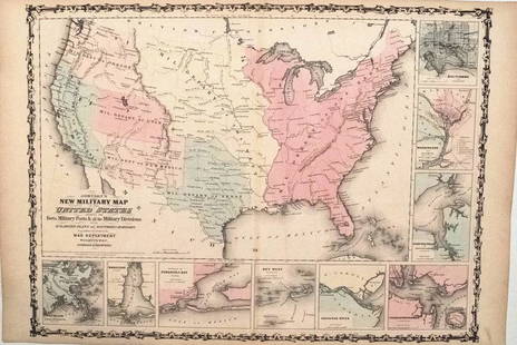
Johnston Map of U.S. 1875
Similar Sale History
View More Items in Maps & AtlasesRelated Maps & Atlases
More Items in American Maps & Atlases
View MoreRecommended Transportation & Travel Collectibles
View More


Item Details
Description
*** START PRICE IS THE RESERVE ***
[America] JOHNSTON, Keith (1804-1871)
United States of North America (Western States)
Lithograph.
Edinburgh, 1875.
19 1/4" x 24 1/4" sheet.
Comparable: Old World Auctions, 2006 - $308.
A terrific map of the western states and territories west of the Mississippi River. Shows a pivotal and fascinating period in America's westward expansion and state development. The entire northwest is occupied by Washington and Oregon as they extend to the Rocky Mountains at the Continental Divide where they are bordered by Nebraska. The large territory of New Mexico includes all of Arizona, and part of Nevada and Colorado, all not yet formed. A huge Utah Territory is bounded in the east by Nebraska and Kansas, and to California in the west. A huge territory of Nebraska extends from its present border with Kansas to the northern border of the United States, the Continental Divide in the west and the Missouri River in the east. Kansas has an extended panhandle that reaches into part of today's Colorado. Minnesota shows its early boundaries as it extends west to the Missouri River and Nebraska Territory. Okalahoma is Indian Territory.
Buyer's Premium
- 20%
Johnston Map of U.S. 1875
Estimate $800 - $1,200
1 bidder is watching this item.
Shipping & Pickup Options
Item located in New York, New York, usOffers In-House Shipping
Local Pickup Available
Payment

Related Searches
TOP


![Johnston Map of U.S. 1844: *** START PRICE IS THE RESERVE *** [America] JOHNSTON, Alexander Keith (1804-1871). United States and Texas. Lithograph with original color. London, 1844. 21 1/8" x 26 1/8" sheet. Comparable: Old Worl](https://p1.liveauctioneers.com/1968/163248/82424588_1_x.jpg?height=310&quality=70&version=1583340284)


![Map of U.S., 1846: *** START PRICE IS THE RESERVE *** [America] HAVEN & EMMERSON. Map of the United States and Mexico Including Oregon, Texas and the Californias. Engraved map with original hand color. New York, 1846. 1](https://p1.liveauctioneers.com/1968/163248/82424576_1_x.jpg?height=310&quality=70&version=1583340284)


![1894 Johnston Map of Oceania [verso] Island in the Indian Ocean and Near Africa -- Oceania [verso]: Title: 1894 Johnston Map of Oceania [verso] Island in the Indian Ocean and Near Africa -- Oceania [verso] Madagascar; Mauritius; Seychelles; Cape Town; St. Helena and Ascension Islands; Socotra; Aden](https://p1.liveauctioneers.com/5584/328338/176911535_1_x.jpg?height=310&quality=70&version=1715113718)


![Turkey in Europe. Balkans Bosphorus Rumania Rumelia. 50x60cm. JOHNSTON 1879 map: TITLE/CONTENT OF MAP: Turkey in Europe [inset: The Bosporus & Constantinople. Crete or Candia - Turkish Kirid - Modern Greek Kriti - Ancient Creta] DATE PRINTED: 1879 IMAGE SIZE: Approx 47.5 x 60.0cm,](https://p1.liveauctioneers.com/5584/328641/177014461_1_x.jpg?height=310&quality=70&version=1715113718)


![Austro-Hungarian Monarchy (West) Vienna Austria. 50x60cm. JOHNSTON 1879 map: TITLE/CONTENT OF MAP: Austro-Hungarian Monarchy (Western Sheet) [inset: Vienna (Wien) and its environs] DATE PRINTED: 1879 IMAGE SIZE: Approx 60.5 x 48.0cm, 23.75 x 18.75 inches (Large); Please note t](https://p1.liveauctioneers.com/5584/328641/177014162_1_x.jpg?height=310&quality=70&version=1715113718)


