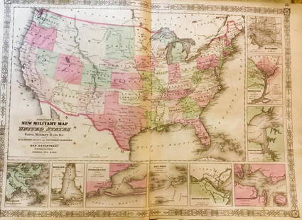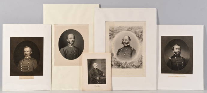
Johnson's New Illustrated Atlas 1864
Similar Sale History
View More Items in Militaria & War MemorabiliaRelated Militaria & War Memorabilia
More Items in Militaria & War Memorabilia
View MoreRecommended Collectibles
View More


Item Details
Description
Author: Johnson, A. J. and J. H. Colton
Title: Johnson's New Illustrated (Steel Plate) Family Atlas, with Physical Geography, and with Descriptions, Geographical, Statistical, and Historical, Including the Latest Federal Census, a Geographical Index, and a Chronological History of the Civil War in America.
Place Published: New York
Publisher:Johnson and Ward
Date Published: 1864
Description:
With a pictorial engraved additional title page (titled "American Atlas"), chart of the rivers & mountains, color lithographed plate of flags, time chart, coat of arms (not colored), and numerous hand-colored lithograph maps by Johnson and Colton, plates numbered to 97 (with many maps double page, taking two numbers, and there are many inset maps, not numbered separately). (Folio), rebacked with half black calf, original blindstamped green boards with gilt seal of the U.S. on front cover, marbled edges.
The final map listed on the contents page, (numbered 98, 99) "Ancient Greece and Rome (same sheet)," is not present. Johnson's 1864 atlas, which includes the large-scale double-page map of the Vicinity of Richmond and the Peninsular Campaign in Virginia...," showing the country between Richmond and Hampton Roads; also, a double-page maps of Texas; New York; and other states, including the entire southwest region with Arizona and New Mexico in the proper positions side-by-side. Also, a full-page map of Nebraska, Dakota, Colorado, Idaho & Kansas with Idaho encompassing most of present-day Montana and Wyoming. Phillips Atlases 843.
Condition
Buyer's Premium
- 25%
Johnson's New Illustrated Atlas 1864
Shipping & Pickup Options
Item located in San Francisco, CA, usPayment


![[CIVIL WAR] – [POLITICS]. A group of 18 CDVs of Union and Confederate personalities, incl.: [CIVIL WAR] – [POLITICS]. A group of 18 CDVs of Union and Confederate personalities, incl. Jefferson Davis, Alexander Stephens, Andrew Johnson, & Superintendent of Army Nurses Dorothea Dix. A gr](https://p1.liveauctioneers.com/197/329785/177758239_1_x.jpg?height=310&quality=70&version=1715625218)


![[CIVIL WAR]. [BELL, William H., photographer]. CDV of a wounded soldier identified as Private George: [CIVIL WAR]. [BELL, William H., photographer]. CDV of a wounded soldier identified as Private George Ruoss, 7th New York Veteran Infantry, featured naked below the waist. CDV on cardstock mount (light](https://p1.liveauctioneers.com/197/329785/177758300_1_x.jpg?height=310&quality=70&version=1715625218)


![[CIVIL WAR]. Confederate First National flag. Ca 1880s-early 1900s.: [CIVIL WAR]. Confederate First National flag. Ca 1880s-early 1900s. 5 1/4 x 10 in. printed silk flag. Blue canton includes circle comprised of 7 stars (toning, areas of staining, occasional spotting,](https://p1.liveauctioneers.com/197/329785/177758378_1_x.jpg?height=310&quality=70&version=1715625218)


