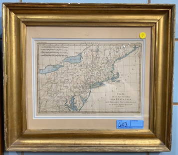
19TH CENTURY MAPS OF ENGLAND, PRUSSIAN, AND AUSTRIAN
Similar Sale History
View More Items in Maps & AtlasesRelated Maps & Atlases
More Items in Maps & Atlases
View MoreRecommended Transportation & Travel Collectibles
View More


Item Details
Description
19TH CENTURY MAPS INCLUDING ENGLAND BY GALLS AND IGLIS, PRUSSIAN DOMINIONS, AND AUSTRIAN EMPIRES ALONG WITH A COLLECTION OF SLAVIC CURRENCY INCLUDING CZECH KORUNA AND HUNGARIAN FORINTS OF DIFFERENT DOMINATIONS; LARGEST 32.5"W X 27.5"H
Buyer's Premium
- 25%
19TH CENTURY MAPS OF ENGLAND, PRUSSIAN, AND AUSTRIAN
Estimate $200 - $400
2 bidders are watching this item.
Shipping & Pickup Options
Item located in Hixson, TN, usSee Policy for Shipping
Payment

TOP


![[MAPS]. –– [ENGLAND]. A group of three 18th century maps of...: [MAPS]. –– [ENGLAND]. A group of three 18th century maps of English towns and territories. Original map engravings depicting Bath, Suffolk, and the Remote British Isles. Framed and matted.](https://p1.liveauctioneers.com/928/252933/131521915_1_x.jpg?height=310&quality=70&version=1656110480)


![1795 Pazzini Carli Map of Southwest England -- Le Provincie Che Sono al Sud Ouest Dell' Inghilterra: Title: 1795 Pazzini Carli Map of Southwest England -- Le Provincie Che Sono al Sud Ouest Dell' Inghilterra Cartographer: Pazzini Carli [family] Year / Place: 1795, Siena Map Dimension (in.): 9.1 X 12.](https://p1.liveauctioneers.com/5584/328338/176911548_1_x.jpg?height=310&quality=70&version=1715113718)
![1890s Cram Map of Vermont [verso] New Hampshire -- Vermont [verso] New Hampshire: Title: 1890s Cram Map of Vermont [verso] New Hampshire -- Vermont [verso] New Hampshire Cartographer: G Cram Year / Place: 1890 c., Chicago Map Dimension (in.): 12.9 X 9.8 in. This is a very nice map](https://p1.liveauctioneers.com/5584/328338/176911596_1_x.jpg?height=310&quality=70&version=1715113718)


![l'Arménie, la Géorgie et la Daghistan Caucasus. SANTINI/RIZZI-ZANNONI 1784 map: TITLE/CONTENT OF MAP: l'Arménie, la Géorgie, et la Daghistan [Armenia, Georgia, and Dagestan] A decorative 18th century map of the Caucasus region covering present day Georgia, much of Armen](https://p1.liveauctioneers.com/5584/328641/177014372_1_x.jpg?height=310&quality=70&version=1715113718)

![[MAP]. ORTELIUS, Abraham. Turcici Imperii Descriptio.1592.: [MAP]. ORTELIUS, Abraham (1527-1598). Turcici Imperii Descriptio. Antwerp, 1592. Engraved map with hand-coloring. Matted, framed, and double glazed, sight 406 x 521 mm (unexamined out of frame). Decor](https://p1.liveauctioneers.com/197/329395/177650538_1_x.jpg?height=310&quality=70&version=1715364962)


![[Maps] Gio. Ant. Magnini, Italia, 1620: [Maps] Gio. Ant. Magnini, Italia, 1620, Giovanni Antonio Magnini. Italia, data in luce da Fabio suo figliuolo al Serenissimo Ferdinado Gonzaga Duca di Matoua edi Monserrato etc. Bologna, for Sebastian](https://p1.liveauctioneers.com/188/326797/176317457_1_x.jpg?height=310&quality=70&version=1713847031)
![[Maps] Martin Zeiler, Itinerarium Italiae, 1640: [Maps] Martin Zeiler, Itinerarium Italiae, 1640, Martini Zeilleri. Itinerarium Italiae Nov-Antiquae: oder, Raiss-Beschreibung durch Italien, Matthaus Merian, Frankfurt, 40 plates, most double-page, in](https://p1.liveauctioneers.com/188/326797/176317459_1_x.jpg?height=310&quality=70&version=1713847031)


![[MAP]. TODESCHI, Pietro. [Nova et Acurata Totius Americae Tabula auct. G.I. Blaeu] America quarta: [MAP]. TODESCHI, Pietro. [Nova et Acurata Totius Americae Tabula auct. G.I. Blaeu] America quarta pars orbis quam plerunq, nuvum orbem appellitant primo detecta est anno 1492 a Christophoro Columbo...](https://p1.liveauctioneers.com/197/329395/177650542_1_x.jpg?height=310&quality=70&version=1715364962)


