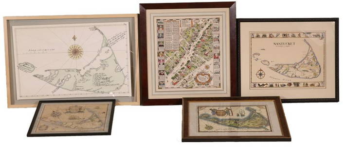
Group of Five (5) 19th Century Maps
Similar Sale History
View More Items in Maps & AtlasesRelated Maps & Atlases
More Items in Maps & Atlases
View MoreRecommended Transportation & Travel Collectibles
View More


Item Details
Description
Including England Scotland and Ireland Britain or the United Kingdom published by Cummings & Hillard No. 1 Cornhill Boston, Newfoundland Nova Scotia and New Brunswick map, French map of North America, Colored and engraved map of Canada by Blackie & Son Glasgow Edinburgh & London Drawn by J.W. Lowry and an A.J. Johnson map of Ontario of THE DOMINION OF CANADA. Condition is overall good and age appropriate, see photos.
Buyer's Premium
- 20%
Group of Five (5) 19th Century Maps
Estimate $100 - $200
2 bidders are watching this item.
Shipping & Pickup Options
Item located in Chesterland, OH, usSee Policy for Shipping
Payment

Related Searches
TOP


![Group of Five U.S. Army Battle Maps of Okinawa, Japan.: [WWII] Group of Five U.S. Army Battle Maps of Okinawa, Japan. Army Map Service, 1945. Printed reference maps prepared “For use by War and Navy Department Agencies Only”. Includes air traff](https://p1.liveauctioneers.com/928/124137/63148928_1_x.jpg?height=310&quality=70&version=1530051387)


![[Maps & Atlases] [London] Stow, John, Group of 5 maps: [Maps & Atlases] [London] Stow, John Group of 5 maps of London London, 1754-55. Approximately 18 1/2 x 15 7/8 inches. Five matted maps from Stow's "A Survey of Cities of London and Westminster and the](https://p1.liveauctioneers.com/65/168030/84729856_1_x.jpg?height=310&quality=70&version=1588715715)


![[PICTORIAL MAPS]. Five maps. Includes: GREEN, Mildred C. A ...: [PICTORIAL MAPS]. Five maps. Includes: GREEN, Mildred C. A Romance Map of New Jersey. 1935. Buffalo: Whitney-Graham Company. Inc. Colorful pictorial map with small illustrations and explanations of Ne](https://p1.liveauctioneers.com/928/305275/163151900_1_x.jpg?height=310&quality=70&version=1697054833)


![[NEW YORK CITY – PICTORIAL MAPS]. Group of 3 pictorial maps...: [NEW YORK CITY – PICTORIAL MAPS]. Group of 3 pictorial maps. Including: ANNAND, George (1890—1980). Sinclair Pictorial Map of New York/New York World’s Fair. 26 ¾ x 27 5/8”](https://p1.liveauctioneers.com/928/325952/175495562_1_x.jpg?height=310&quality=70&version=1712935174)
![[MAPS]. A group of 3 engraved maps, most with hand-coloring.: [MAPS]. A group of 3 maps, comprising: HOMANN, Johann Baptist (1663-1724). Regni Mexicani seu Novae Hispaniae, Ludovicianae, N. Angliae, Carolinae, Virginiae et Pensylvaniae. Nuremberg: Homann, [ca 17](https://p1.liveauctioneers.com/197/328642/177014805_1_x.jpg?height=310&quality=70&version=1714760103)


![[Maps] Gio. Ant. Magnini, Italia, 1620: [Maps] Gio. Ant. Magnini, Italia, 1620, Giovanni Antonio Magnini. Italia, data in luce da Fabio suo figliuolo al Serenissimo Ferdinado Gonzaga Duca di Matoua edi Monserrato etc. Bologna, for Sebastian](https://p1.liveauctioneers.com/188/326797/176317457_1_x.jpg?height=310&quality=70&version=1713847031)


