


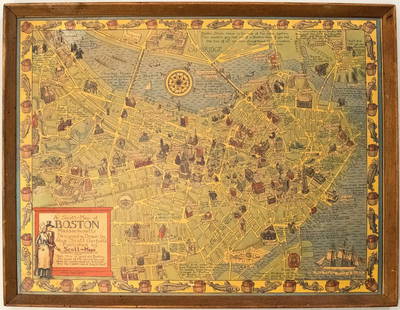
FRENCH 18TH CENTURY MAP OF BOSTON, MASSACHUSETTS
Similar Sale History
View More Items in Maps & Atlases


![4 Maps: Bradford (1838): Mass., CT, NJ, Boston.: [United States/Northeast] 4 Maps. ++ MASSACHUSETTS. ++ BOSTON. ++ CONNECTICUT. ++ NEW JERSEY. ++ Maps 10, 11, 13, and 16 from T. G. Bradford, “An Illustrated Atlas, Geographical, Statistical, And Hi](https://p1.liveauctioneers.com/179/85723/44107996_1_x.jpg?height=310&quality=70&version=1457209040)


![3 Maps incl: Map Of Boston And Adjacent Cities.: [World/ Massachusetts/Europe] 3 Maps. ++ A New Map Of The World On The Globular Projection. Phila: Thomas, Cowperthwait & Co., (1850). Hemispheres. Outer edge of overall border: 9 1/2 x 14 1/8 in. Ton](https://p1.liveauctioneers.com/179/117971/60557739_1_x.jpg?height=310&quality=70&version=1520636872)


Related Maps & Atlases


![HAND COLORED MAP OF PERU & COUNTRY OF THE AMAZONS, 1747, BY EMANUEL BOWEN, FRAMED: A New And Accurate Map Of Peru And The Country Of The Amazones. Drawn From The Most Authentick French Maps &C. And Regulated By Astronomical Observations, London]: William Innys [et al.], 1747. A deta](https://p1.liveauctioneers.com/957/328836/177180798_1_x.jpg?height=310&quality=70&version=1715021458)


![1858 Mitchell Map of Southern Europe and France [verso] Asia -- No. 24 Map of France, Spain,: Title: 1858 Mitchell Map of Southern Europe and France [verso] Asia -- No. 24 Map of France, Spain, Portugal & Italy [verso] No. 26 Map of Asia Cartographer: S Mitchell Year / Place: 1858, Philadelphi](https://p1.liveauctioneers.com/5584/328338/176911601_1_x.jpg?height=310&quality=70&version=1715113718)


![Carte des Côtes de France & d’Espagne. France Spain coast BELLIN/SCHLEY 1747 map: CAPTION PRINTED BELOW PICTURE: Carte des Côtes de France & d’Espagne [Map of the coasts of France & Spain] France & Spain on the méridien de Ferro DATE PRINTED: 1747 IMAGE SIZE: Approx](https://p1.liveauctioneers.com/5584/328641/177014374_1_x.jpg?height=310&quality=70&version=1715113718)
More Items in Maps & Atlases
View More


![[Maps] Gio. Ant. Magnini, Italia, 1620: [Maps] Gio. Ant. Magnini, Italia, 1620, Giovanni Antonio Magnini. Italia, data in luce da Fabio suo figliuolo al Serenissimo Ferdinado Gonzaga Duca di Matoua edi Monserrato etc. Bologna, for Sebastian](https://p1.liveauctioneers.com/188/326797/176317457_1_x.jpg?height=310&quality=70&version=1713847031)
![[Maps] Martin Zeiler, Itinerarium Italiae, 1640: [Maps] Martin Zeiler, Itinerarium Italiae, 1640, Martini Zeilleri. Itinerarium Italiae Nov-Antiquae: oder, Raiss-Beschreibung durch Italien, Matthaus Merian, Frankfurt, 40 plates, most double-page, in](https://p1.liveauctioneers.com/188/326797/176317459_1_x.jpg?height=310&quality=70&version=1713847031)


Recommended Transportation & Travel Collectibles
View More


Item Details
Description
FRENCH 18TH CENTURY MAP OF BOSTON, MASSACHUSETTS, on laid paper, title in top center "PLAN DE BOSTON", most likely Georges-Louis Le Rouge (French, c. 1712 to 1790), probably after John Bonner (English/American, c. 1643 to 1726), very similar to the map found in Le Rouge's "Recueil des Plans de L'Amerique Septentrionale", but lacking key or explanation, with remnants of an oval seal or cartouche stamp to upper left quadrant. Unframed. Second half 18th century. 6 1/2" x 8" OA, 5 3/4" x 6 7/8" to neat lines.
Good condition overall, expected toning, some stains and foxing, remnants of tape tabs to top corners reverse.
Provenance: From an Arlington, VA collection.
Good condition overall, expected toning, some stains and foxing, remnants of tape tabs to top corners reverse.
Provenance: From an Arlington, VA collection.
Condition
Good condition overall, expected toning, some stains and foxing, remnants of tape tabs to top corners reverse.
Buyer's Premium
- 24.5%
FRENCH 18TH CENTURY MAP OF BOSTON, MASSACHUSETTS
Estimate $50 - $100
4 bidders are watching this item.
Shipping & Pickup Options
Item located in Mt. Crawford, VA, usSee Policy for Shipping
Payment

Related Searches
TOP