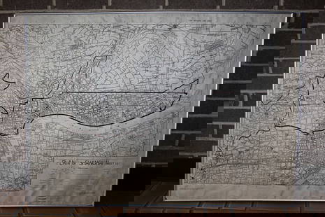
Early auto route map of San Francisco 1909
Similar Sale History
View More Items in Maps & AtlasesRelated Maps & Atlases
More Items in Maps & Atlases
View MoreRecommended Transportation & Travel Collectibles
View More


Item Details
Description
Heading: (California - San Francisco)
Author: Ross, L.
Title: Ross' Land and Auto Map of California's 25 Central Counties Embracing 100 Miles Around San Francisco
Place Published: San Francisco
Publisher:L. Ross
Date Published: 1909
Description:
Author: Ross, L.
Title: Ross' Land and Auto Map of California's 25 Central Counties Embracing 100 Miles Around San Francisco
Place Published: San Francisco
Publisher:L. Ross
Date Published: 1909
Description:
Linen-backed folding map with hand-colored lines, 134x90 cm (52½x35½").
Rare early California auto route map, with "principal auto routes showing California's Highway System." No holdings listed at OCLC and no previous auction records could be located.
Condition
Light toning and soiling with some scattered faint foxing, light foxing and staining to verso; very good.
Buyer's Premium
- 25%
Early auto route map of San Francisco 1909
Estimate $500 - $800
4 bidders are watching this item.
Shipping & Pickup Options
Item located in San Francisco, CA, usSee Policy for Shipping
Payment

Related Searches
TOP


![1892 Cram Map of Denver and San Francisco -- Denver: Reserve Reduced! Title/Content of Map: 1892 Cram Map of Denver and San Francisco -- Denver [verso] San Francisco Date: 1892, Chicago Cartographer: G Cram Size: 10.3 X 13.4 in. This is a nice early map](https://p1.liveauctioneers.com/5584/136495/69275237_1_x.jpg?height=310&quality=70&version=1550614831)


![[MAP]. TODESCHI, Pietro. [Nova et Acurata Totius Americae Tabula auct. G.I. Blaeu] America quarta: [MAP]. TODESCHI, Pietro. [Nova et Acurata Totius Americae Tabula auct. G.I. Blaeu] America quarta pars orbis quam plerunq, nuvum orbem appellitant primo detecta est anno 1492 a Christophoro Columbo...](https://p1.liveauctioneers.com/197/329395/177650542_1_x.jpg?height=310&quality=70&version=1715364962)


![[MAPS]. HOMANN, Johann Baptist, HOMANN HEIRS, and Georg Matthäus SEUTTER. [Composite Atlas].: [MAPS]. HOMANN, Johann Baptist (1663-1724), HOMANN HEIRS, and Georg Matthäus SEUTTER (1678-1757). [Composite Atlas]. [Nuremberg, Augsburg, and others: Homann Heirs and others, maps dated between](https://p1.liveauctioneers.com/197/329395/177650530_1_x.jpg?height=310&quality=70&version=1715364962)


![[MAP]. ORTELIUS, Abraham. Turcici Imperii Descriptio.1592.: [MAP]. ORTELIUS, Abraham (1527-1598). Turcici Imperii Descriptio. Antwerp, 1592. Engraved map with hand-coloring. Matted, framed, and double glazed, sight 406 x 521 mm (unexamined out of frame). Decor](https://p1.liveauctioneers.com/197/329395/177650538_1_x.jpg?height=310&quality=70&version=1715364962)


