


Burr's important Universal Atlas 1835
Similar Sale History
View More Items in Maps & Atlases


Related Maps & Atlases


![Pittsburg [Sic] Business District Rand, McNally & Co's New Business Atlas Map of Pittsburg. [Sic]: Publication Date: 1911 Title: Pittsburg [Sic] Business District Rand, McNally & Co's New Business Atlas Map of Pittsburg. [Sic] Cartographer: RAND, MCNALLY & CO. Publisher: RAND, MCNALLY & CO. Height:](https://p1.liveauctioneers.com/5584/331064/178466494_1_x.jpg?height=310&quality=70&version=1716924723)


![Atlas Pages Stark Cty, OH & Townships . c1870-1900's. [180168]: (13) Pages from "Combination Atlas Map of Stark County Ohio", Published by L. H. Everts & Co. Philadelphia, 1875. The Pages include biographies of residents of the township, illustrations of the town](https://p1.liveauctioneers.com/2699/331495/178785794_1_x.jpg?height=310&quality=70&version=1717094933)
![World Atlases 1912-1918 [181033]: (2) World Atlases. 1. "The American Library Atlas pf the World, Descriptive and Pictorial, New Census Edition" San Francisco Call 1912. Some tears and fading on front cover, pages aged but in good con](https://p1.liveauctioneers.com/2699/331495/178785799_1_x.jpg?height=310&quality=70&version=1717094933)
More Items in Maps & Atlases
View More![[MAP]. TODESCHI, Pietro. [Nova et Acurata Totius Americae Tabula auct. G.I. Blaeu] America quarta: [MAP]. TODESCHI, Pietro. [Nova et Acurata Totius Americae Tabula auct. G.I. Blaeu] America quarta pars orbis quam plerunq, nuvum orbem appellitant primo detecta est anno 1492 a Christophoro Columbo...](https://p1.liveauctioneers.com/197/329395/177650542_1_x.jpg?height=310&quality=70&version=1715364962)
![[MAPS]. HOMANN, Johann Baptist, HOMANN HEIRS, and Georg Matthäus SEUTTER. [Composite Atlas].: [MAPS]. HOMANN, Johann Baptist (1663-1724), HOMANN HEIRS, and Georg Matthäus SEUTTER (1678-1757). [Composite Atlas]. [Nuremberg, Augsburg, and others: Homann Heirs and others, maps dated between](https://p1.liveauctioneers.com/197/329395/177650530_1_x.jpg?height=310&quality=70&version=1715364962)


![[MAP]. ORTELIUS, Abraham. Americae Sive Novi Orbis, Nova Descriptio. 1573.: [MAP]. ORTELIUS, Abraham (1527-1598). Americae Sive Novi Orbis, Nova Descriptio. Antwerp, 1573. Engraved map with hand-coloring. Framed and double glazed, visible area 375 x 521 mm (unexamined out of](https://p1.liveauctioneers.com/197/329395/177650534_1_x.jpg?height=310&quality=70&version=1715364962)

![[MAP]. SPEED, John. A New Mappe of the Romane Empire. 1676.: [MAP]. SPEED, John (ca 1551-1629). A New Mappe of the Romane Empire. London: Basset & Chiswell, 1676. Engraved map with hand-coloring. Framed and double glazed, sight 419 x 559 mm. Decorative cartouch](https://p1.liveauctioneers.com/197/329395/177650541_1_x.jpg?height=310&quality=70&version=1715364962)
![Set of Twelve Satirical Anthropomorphic Maps of Europe: [SATIRICAL MAPS] A set of twelve satirical anthropomorphic maps of Europe. London: circa 1868. A set of 12 (believed complete) lithographed maps by Vincent Brooks, Day & Son, London, each offering](https://p1.liveauctioneers.com/292/330597/178279264_1_x.jpg?height=310&quality=70&version=1716409282)


![[MAP]. ORTELIUS, Abraham. Turcici Imperii Descriptio.1592.: [MAP]. ORTELIUS, Abraham (1527-1598). Turcici Imperii Descriptio. Antwerp, 1592. Engraved map with hand-coloring. Matted, framed, and double glazed, sight 406 x 521 mm (unexamined out of frame). Decor](https://p1.liveauctioneers.com/197/329395/177650538_1_x.jpg?height=310&quality=70&version=1715364962)
![[MAP]. ORTELIUS, Abraham. Romani Imperii Imago. 1592.: [MAP]. ORTELIUS, Abraham (1527-1598). Romani Imperii Imago. Antwerp, 1592. Engraved map with hand-coloring. Matted, framed, and double glazed, visible area 381 x 521 mm (unexamined out of frame). 6 de](https://p1.liveauctioneers.com/197/329395/177650537_1_x.jpg?height=310&quality=70&version=1715364962)

![[MAP]. ORTELIUS, Abraham. Aevi Veteris, Typus Geographicus. 1601.: [MAP]. ORTELIUS, Abraham (1527-1598). Aevi Veteris, Typus Geographicus. Antwerp, 1601. Engraved map with hand-coloring. Matted, framed, and double glazed, visible area 343 x 470 mm (unexamined out of](https://p1.liveauctioneers.com/197/329395/177650532_1_x.jpg?height=310&quality=70&version=1715364962)
Recommended Transportation & Travel Collectibles
View More


Item Details
Description
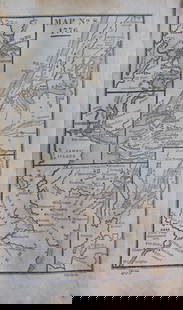
Author: Burr, David H.
Title: A New Universal Atlas; Comprising Separate Maps of all the principal Empires, Kingdoms & States Throughout the World: and forming a distinct Atlas of the United States
Place Published: New York
Publisher:Published by D.S. Stone
Date Published: [1835]
Description:
Engraved title-page + engraved contents leaf + 63 hand-colored copper-engraved maps, some with insets, all with tissue guards; plus duplicate of New York State map. (folio) 38.3x31.5 cm (15x12¼ "), original quarter leather & cloth, front cover titled in gilt.
Striking series of maps, finely detailed, and richly colored. The atlas includes 35 maps of the Americas, 24 of which pertain to the United States. "The United States of Mexico" map, dated 1832, including both California and Texas as part of Mexico, and with a large inset map "Guatemala or the United Provinces of Central America." The United States map extends west only to the Arkansas & Missouri border. Approximately a third of the maps are U.S. states or territories, including a separate map of Oregon Territory. The latter map "includes in Oregon Territory all the area west of the 'Stony Mountains,' north of the 1819 Spanish treaty line and south of 54.40', the 'Boundary of Russian Possessions settled by Convention in 1824.' South of the southern border the Los Mongos R. flows merrily from Lake Timpanogos to the sea" - Wheat. Phillips 771; Wheat, Transmississippi West, 402.
Condition
Buyer's Premium
- 25%
Burr's important Universal Atlas 1835
Shipping & Pickup Options
Item located in San Francisco, CA, usPayment
