
 Discovery- InteriorsBonhamsSponsored.Your ad here?


Discovery- Interiors
Bonhams
Sponsored.Your ad here?


 Discovery- InteriorsBonhamsSponsored.Your ad here?


Discovery- Interiors
Bonhams
Sponsored.Your ad here?

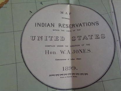
1891 Indian Reservation Map of the United States
Similar Sale History
View More Items in Maps & Atlases
Related Maps & Atlases
More Items in Maps & Atlases
View MoreRecommended Transportation & Travel Collectibles
View More


Item Details
Description
This is a RARE 1891 map of Indian reservations in the United States. With the Indian Removal Act of 1830, the U.S. Government began moving Native American populations to secluded tracts of land. From the mid to late 1800's, most were forced onto reservations. This map shows the Indian reservations as they were in 1891. Most are located in the Western United States. The map was created under the direction of T.J. Morgan, Commissioner of Indian Affairs. It shows good overall condition. The map measures 23.5" x 34".
Condition
Review Pictures and Description for Condition. Download our North American Auction Co. mobile bidding app in the Google Play and Apple App Stores today. The app shows more photographs and an excellent bidding platform.
Buyer's Premium
- 20%
1891 Indian Reservation Map of the United States
Estimate $250 - $1,000
8 bidders are watching this item.
Shipping & Pickup Options
Item located in Bozeman, MT, usSee Policy for Shipping
Payment

TOP


![[PICTORIAL MAPS – TRAVEL]. Three Pictorial Maps. 1940s/50s....: [PICTORIAL MAPS – TRAVEL]. Three Pictorial Maps. 1940s/50s. Three brochure sized foldout maps designed for travel including: Highroads to Happiness. Mexico City: Pemex Travel Club, ca. 1940s. &#](https://p1.liveauctioneers.com/928/325952/175495561_1_x.jpg?height=310&quality=70&version=1712935174)


![[Maps] Gio. Ant. Magnini, Italia, 1620: [Maps] Gio. Ant. Magnini, Italia, 1620, Giovanni Antonio Magnini. Italia, data in luce da Fabio suo figliuolo al Serenissimo Ferdinado Gonzaga Duca di Matoua edi Monserrato etc. Bologna, for Sebastian](https://p1.liveauctioneers.com/188/326797/176317457_1_x.jpg?height=310&quality=70&version=1713847031)


