Carey & Lea's .. American Atlas - Volume with 46 Originally Hand-colored Folio Maps
Similar Sale History
View More Items in Books
Related Books
More Items in Books
View MoreRecommended Books, Magazines & Papers
View More


Item Details
Description
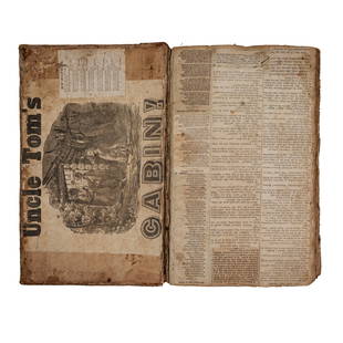
This volume is Henry Charles Carey & Isaac Lea's A Complete Historical, Chronological, and Geographical American Atlas, being a guide to the history of North and South America, and the West Indies: exhibiting an accurate account of the discovery, settlement, and progress, of their various kingdoms, states, provinces, &c. Together with the wars, celebrated battles, and remarkable events, to the year 1822. The work was published in Philadelphia 1822 by Henry Charles Carey & Isaac Lea.
The atlas features 46 folio originally hand-colored engraved maps of America mounted on guards. There is an uncolored mountain heights plate, hand-colored plate of the river lengths, and 4 letterpress tables. There is a letterpress title, advertisement, contents, and index. The work is bound in contemporary half black morocco over plain paper boards, rebacked with original spine laid down and corners renewed. It is housed in a cloth clamshell case with leather label.
This is the first edition of one of the most important early atlases printed in the United States. Fielding Lucas, the major Baltimore printer, was the principal engraver for the work. The atlas covered the areas of North America, Central America, South America and the West Indies. Each map is surrounded by text documenting the history, climate, population of that area. It is considered an indispensable American atlas and represented the beginning of the hand-colored commercial atlas business in the United States. It was particularly noted for its early maps of the states and territories of the United States. Of particular note was Stephen H. Long's map of Arkansa(s) (the American West) as it showed the trans-Mississippi West and the lands of the Louisana Purchase.
Paper Size ~ 11 1/4" by 17 5/8"
Condition
The work is in very good to excellent condition overall. There may be a few minor imperfections, offset, or faint marks to be expected with age. Please review the image carefully for condition and contact us with any questions.
Buyer's Premium
- 10%
Carey & Lea's .. American Atlas - Volume with 46 Originally Hand-colored Folio Maps
Estimate $7,000 - $10,000
11 bidders are watching this item.
Shipping & Pickup Options
Item located in Franklin, TN, usOffers In-House Shipping
Payment
Accepts seamless payments through LiveAuctioneers

TOP


![1810 Pocket Atlas Hand Colored Maps Wallis: [ATLAS] "Wallis’s New Pocket Edition of the English Counties or Travellers Companion", published by J. Wallis, complete with 44 hand colored maps including the double page Yorkshire and the Isle of](https://p1.liveauctioneers.com/5584/130397/66306028_1_x.jpg?height=310&quality=70&version=1541551002)


![MITCHELL - New General Atlas [35 American maps] 1867: MITCHELL, S. Augustus, Jr.. Mitchell's New General Atlas, containing maps of various countries of the world, plans of cities, etc., ... together with valuable statistical tables. Philadelphia: S. Augu](https://p1.liveauctioneers.com/7533/208644/106251073_1_x.jpg?height=310&quality=70&version=1624641782)


![Ramusio Atlas 1606, The Macclesfield Copy: RAMUSIO, Giovanni Battista (1485-1557). Delle navigationi et Viaggi. Venice: Giunti, 1606. 3 volumes, folio (12 1/4" x 8 1/2"), ff. [4], 34, 394; 6, 9-18, [10], 256, 90; [6], 36, 430. Woodcut device o](https://p1.liveauctioneers.com/1968/250616/130196473_1_x.jpg?height=310&quality=70&version=1654190895)


![Sexual Behavior in the Human Male [with] Sexual Behavior in the Human Female: Title: Sexual Behavior in the Human Male [with] Sexual Behavior in the Human Female Author: Alfred C. Kinsey; Wardell B. Pomeroy - Inscribed Date/Period: 1948 Publisher: W. B. Saunders Compan Edition:](https://p1.liveauctioneers.com/5584/328161/176801746_1_x.jpg?height=310&quality=70&version=1714507672)


![19 issues of rare Gay Magazine METRA 1985-1986: [Queer interest], Metra: Midwest America's Leading Free Gay Magazine, 19 issues, published 1986-1987, a few duplicates, softcover, staplebound wraps, illustrated throughout in black and white, publish](https://p1.liveauctioneers.com/184/328649/177016396_1_x.jpg?height=310&quality=70&version=1714770323)


