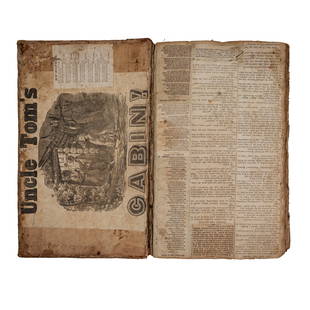
MITCHELL - New General Atlas [35 American maps] 1867
Similar Sale History
View More Items in BooksRelated Books
More Items in American Books
View MoreRecommended Books, Magazines & Papers
View More


![MITCHELL - New General Atlas [35 American maps] 1867](https://p1.liveauctioneers.com/7533/208644/106251073_1_x.jpg?quality=1&version=1624641782&width=486)
![MITCHELL - New General Atlas [35 American maps] 1867](https://p1.liveauctioneers.com/7533/208644/106251073_1_x.jpg?quality=80&version=1624641782)
Item Details
Description
MITCHELL, S. Augustus, Jr.. Mitchell's New General Atlas, containing maps of various countries of the world, plans of cities, etc., ... together with valuable statistical tables. Philadelphia: S. Augustus Mitchell, Jr., 1867. Folio. (15 3/8 x 12 1/4 inches). 54 hand-coloured lithographic maps and town plans (the first map printed with an additional table of the world time zones on verso, five double-page), numbered 1-91 (i.e. including numbering of the insets and with the plan of St. Louis unnumbered). Publisher's red half morocco and red cloth-covered boards, the upper cover decoratively blocked in gilt, the lower cover blocked in blind, rear endpaper torn.
A fine, complete copy of Mitchell's important New General Atlas.
S. Augustus Mitchell retired in 1860 leaving the business to his son S. Augustus Mitchell Jr. In the same year Mitchell Jr. published the first edition of the present work, issued to replace the New Universal Atlas. The work was evidently a success: a second edition followed in 1861, a third in 1862 and the atlas continued to be issued annually until 1887. As with its predecessor, the General Atlas concentrates on the Americas, this edition includes 35 maps of the area, including a fine double-page east-to-west-coast of the United States, the individual states are delineated on 21 maps and there are city plans of Boston, New York, Philadelphia, Baltimore, Washington, New Orleans, Cincinnati, Chicago and St.Louis. The text also is also heavily weighted in the same direction as the maps: pp.[1-]23 'List of Post Offices in the United States', [24]-25pp. 'Population of the United States', [26]-27pp. 'List of Post Offices in the Canadas', [1p.] 'Table of Population, Governments, &c.', [1p.] 'Table of Distances'; [1p.] 'Mountains of the World', [1p.] 'Rivers of the World'.
Phillips Atlases 3558; cf. Ristow p.313; Rumsey p.244.
Buyer's Premium
- 25%
MITCHELL - New General Atlas [35 American maps] 1867
Estimate $1,500 - $1,800
6 bidders are watching this item.
Shipping & Pickup Options
Item located in New York, NY, usOffers In-House Shipping
Payment

Auction Curated By

the founder of Donald Heald Rare Books, has been in the business for 49 years and worked with some of the most renowned auction houses in the world. He is a member of the American Antiquarian Society, the Grolier Club, and the ABAA
TOP


![STAUFFER - Copper & Steel USA Engravers 1907: STAUFFER, David McNeely, & Mantle FIELDING. American Engravers upon Copper and Steel. New York [vols I and II] and Philadelphia [vol.III]:: Grolier Club [vols. I and II], 1907-1917. 3 volumes (includi](https://p1.liveauctioneers.com/7533/208644/106251042_1_x.jpg?height=310&quality=70&version=1624641782)


