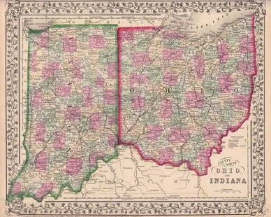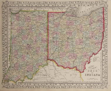
Early Map of Ohio and Indiana 1829
Similar Sale History
View More Items in Maps & AtlasesRelated Maps & Atlases
More Items in Maps & Atlases
View MoreRecommended Transportation & Travel Collectibles
View More


Item Details
Description
Early Map of Ohio and Indiana
Hand Colored Map.
Cartographer: E. Huntington
Publisher D. F. Robinson
Dated: 1829
Dimensions: 11 x 8"
Condition Report Good plus
Subject References: 108F Early Maps United States
Hand Colored Map.
Cartographer: E. Huntington
Publisher D. F. Robinson
Dated: 1829
Dimensions: 11 x 8"
Condition Report Good plus
Subject References: 108F Early Maps United States
Buyer's Premium
- 25%
Early Map of Ohio and Indiana 1829
Estimate $300 - $400
Shipping & Pickup Options
Item located in Otisville, NY, usOffers In-House Shipping
Payment
Accepts seamless payments through LiveAuctioneers

Related Searches
TOP


![(4) 1838 BRADFORD Maps: OH, IN, MI, TN: [United States/Near West] 4 Maps. ++ OHIO. ++ INDIANA. ++ MICHIGAN. [With inset of upper peninsula.] ++ TENNESSEE. ++ Maps 19, 20, 22, 29 from T. G. Bradford, “An Illustrated Atlas, Geographical, St](https://p1.liveauctioneers.com/179/85723/44107994_1_x.jpg?height=310&quality=70&version=1457208874)


![Jansson's important early map of New England: [MAP-NORTH AMERICA] JANSSON, JAN. Nova Belgica et Anglia Nova. Amsterdam: circa 1646. Latin text on verso. Neat lines 15 1/4 x 19 3/4 inches (38.7 x 50.5 cm). Marginal tears r](https://p1.liveauctioneers.com/292/326828/175962856_1_x.jpg?height=310&quality=70&version=1713473479)


![A desirable early issue of Hondius map of Virginia and Florida: [MAP-NORTH AMERICA] MERCATOR, GERARD and HONDIUS, JOCODUS. Virginiae item et Floridae Americae Provinciarum, nova descriptio. [Amsterdam: Jodocus Hondius, 1607 or later]. Hand-colored engraved map. Wi](https://p1.liveauctioneers.com/292/326828/175962855_1_x.jpg?height=310&quality=70&version=1713473479)


