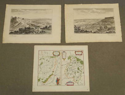
17TH C. ANTIQUE MAP SIEGE OF LA ROCHELLE, FRANCE, FRAMED
Similar Sale History
View More Items in Maps & Atlases
Related Maps & Atlases
More Items in Maps & Atlases
View MoreRecommended Transportation & Travel Collectibles
View More


Item Details
Description
"Seige et Reddition de La Rochelle, Octobre 1628", handcolored engraving on wove paper, Claes Jansz. Visscher (II), (workshop of), Germany, 1627 - 1629. In gilt molded frame, matted under UV non-glare glass, OS: 25" x 28 1/2", SS: 16 1/2" x 21".
Buyer's Premium
- 25%
17TH C. ANTIQUE MAP SIEGE OF LA ROCHELLE, FRANCE, FRAMED
Estimate $500 - $700
8 bidders are watching this item.
Shipping & Pickup Options
Item located in Thomaston, ME, usOffers In-House Shipping
Local Pickup Available
Payment
Accepts seamless payments through LiveAuctioneers

TOP


![1573 Map of the Siege of La Rochelle -- [Untitled]: Title/Content of Map: 1573 Map of the Siege of La Rochelle -- [Untitled] Siege of La Rochelle Date Printed: 1573 c. Cartographer: Anonymous Size: 9 x 11.1 in. A very interesting map of the Siege of La](https://p1.liveauctioneers.com/5584/124870/63536014_1_x.jpg?height=310&quality=70&version=1531863645)


![HAND COLORED MAP OF PERU & COUNTRY OF THE AMAZONS, 1747, BY EMANUEL BOWEN, FRAMED: A New And Accurate Map Of Peru And The Country Of The Amazones. Drawn From The Most Authentick French Maps &C. And Regulated By Astronomical Observations, London]: William Innys [et al.], 1747. A deta](https://p1.liveauctioneers.com/957/328836/177180798_1_x.jpg?height=310&quality=70&version=1715021458)


![[Maps] Gio. Ant. Magnini, Italia, 1620: [Maps] Gio. Ant. Magnini, Italia, 1620, Giovanni Antonio Magnini. Italia, data in luce da Fabio suo figliuolo al Serenissimo Ferdinado Gonzaga Duca di Matoua edi Monserrato etc. Bologna, for Sebastian](https://p1.liveauctioneers.com/188/326797/176317457_1_x.jpg?height=310&quality=70&version=1713847031)
![[Maps] Martin Zeiler, Itinerarium Italiae, 1640: [Maps] Martin Zeiler, Itinerarium Italiae, 1640, Martini Zeilleri. Itinerarium Italiae Nov-Antiquae: oder, Raiss-Beschreibung durch Italien, Matthaus Merian, Frankfurt, 40 plates, most double-page, in](https://p1.liveauctioneers.com/188/326797/176317459_1_x.jpg?height=310&quality=70&version=1713847031)


