Antique Map of New England, New York and Pennsylvania - Marco Coltellini - US
Similar Sale History
View More Items in Maps & Atlases
Related Maps & Atlases
More Items in Maps & Atlases
View MoreRecommended Transportation & Travel Collectibles
View More


Item Details
Description
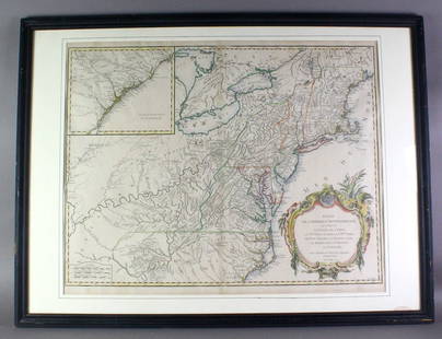
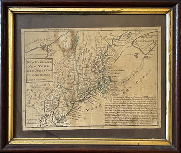
This wonderful engraving " Carta della Nuova Inghilterra Nuova Iork, e Pensilvania " (Map of New England, New York, and Pennsylvania.) originates from "ll Gazzettiere americano contenente un distinto ragguaglio di tutte le parti del Nuovo Mondo della loro situazione, clima, terreno, prodotti, stato antico e moderno, merci..." ("The American Gazetteer containing a distinct account of all parts of the New World their situation, climate, terrain, produce, ancient and modern state, commodities..."), Italian edition published in Livorno by Marco Coltellini, 1763. The work included prints of America's native mammals and birds, as well as scenes of building and manufacture, commerce (of indigo, tobacco, sugar), birds eye views of towns and city plans of the Americas and Colonies. The "Map of New England, New York, and Pennsylvania" provides a comprehensive geographical representation of these three significant regions. This cartographic work likely showcases the diverse landscapes, including coastlines, rivers, mountains, and settlements within New England, New York, and Pennsylvania. The map's accuracy and detail make it a valuable resource for navigation, exploration, and scholarly study, offering insights into the spatial arrangement and topography of these areas. It may include labels for major cities, towns, and natural features, enhancing our understanding of the cultural and geographic attributes of these regions. By presenting an integrated view of these distinct territories, the map contributes to a broader comprehension of the early colonial landscape and historical developments in this part of North America. In essence, this map stands as an informative visual record, capturing the essence of New England, New York, and Pennsylvania during the depicted period and enriching our understanding of their geographical and historical significance. The reverse side is blank. This engraving is printed on laid paper with wide margins. This is an original print, not a modern reproduction.
Buyer's Premium
- 23%
Antique Map of New England, New York and Pennsylvania - Marco Coltellini - US
Estimate €500 - €700
2 bidders are watching this item.
Shipping & Pickup Options
Item located in Bromma, Stockholm County, seOffers In-House Shipping
Payment

TOP


![[NEW YORK CITY – PICTORIAL MAPS]. Group of 3 pictorial maps...: [NEW YORK CITY – PICTORIAL MAPS]. Group of 3 pictorial maps. Including: ANNAND, George (1890—1980). Sinclair Pictorial Map of New York/New York World’s Fair. 26 ¾ x 27 5/8”](https://p1.liveauctioneers.com/928/325952/175495562_1_x.jpg?height=310&quality=70&version=1712935174)


![[Maps] Gio. Ant. Magnini, Italia, 1620: [Maps] Gio. Ant. Magnini, Italia, 1620, Giovanni Antonio Magnini. Italia, data in luce da Fabio suo figliuolo al Serenissimo Ferdinado Gonzaga Duca di Matoua edi Monserrato etc. Bologna, for Sebastian](https://p1.liveauctioneers.com/188/326797/176317457_1_x.jpg?height=310&quality=70&version=1713847031)


