


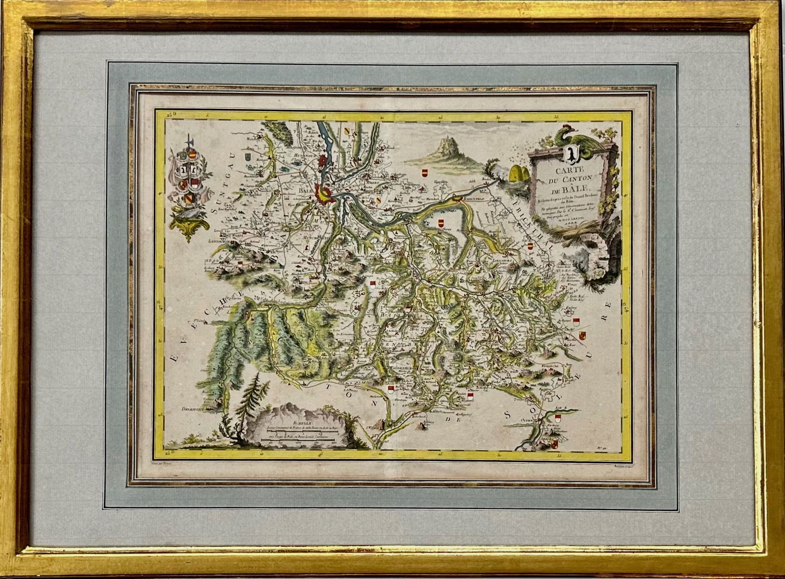
Map: Carte du Canton de Bale, Jacques Clermont, Paris, 1788
Similar Sale History
View More Items in Maps & Atlases


![Sanson World Atlas, 1659: SANSON D'ABBEVILLE, Nicholas (1600-1667). Cartes Generales de Toutes les Parties du Monde. Paris: The Author and Pierre Mariette, 1658 [but 1659]. Comparables: Arader Galleries, 2015 - $97,600; Christ](https://p1.liveauctioneers.com/1968/250616/130196469_1_x.jpg?height=310&quality=70&version=1654190895)


Related Maps & Atlases


![1684 Mallet Maps of the World Over Time -- Carte du Monde de Marc Paul [on sheet with] Carte du: Title: 1684 Mallet Maps of the World Over Time -- Carte du Monde de Marc Paul [on sheet with] Carte du Monde de Iacques Castaldo [and] Carte du Monde de Miguel Lopez Cartographer: A Mallet Year / Plac](https://p1.liveauctioneers.com/5584/331526/178834558_1_x.jpg?height=310&quality=70&version=1717530687)

![Carte de la Nouvelle Zéelande. New Zealand. Cook Strait. Thames. BONNE 1788 map: TITLE/CONTENT OF MAP: [Cook 3e Voyage] Carte de la Nouvelle Zéelande // Carte du Détroit de Cook // Baye des Isles // Baye de Tolaga // Rivière de la Tamise et de la Baye de Mercure [Co](https://p1.liveauctioneers.com/5584/332390/179262927_1_x.jpg?height=310&quality=70&version=1717528223)


More Items in Renaissance Maps & Atlases
View More
Recommended Transportation & Travel Collectibles
View More


Item Details
Description
18th century hand-colored map of the Swiss Canton containing Basel.
Detail showing topography and hundreds of small towns and villages.
Engraved by Perrier.
Identifier No, # 91 lower right.
Framed and matted under glass.
Dimensions: framed: 21 1/4 in. x 28 3/4 in., sight: 14 in. x 18 3/4 in.
Condition: good original framed estate condition, no repairs nor stains noted.
Provenance: Boston, Massachusetts Estate.
Condition
Good original pre-owned framed estate condition.
In-house shipping available.
In-house shipping available.
Buyer's Premium
- 25%
Map: Carte du Canton de Bale, Jacques Clermont, Paris, 1788
Estimate $200 - $300
4 bidders are watching this item.
Shipping & Pickup Options
Item located in Clintondale, NY, usOffers In-House Shipping
Payment
Accepts seamless payments through LiveAuctioneers

Related Searches
TOP