
 Discovery- InteriorsBonhamsSponsored.Your ad here?


Discovery- Interiors
Bonhams
Sponsored.Your ad here?


 Discovery- InteriorsBonhamsSponsored.Your ad here?


Discovery- Interiors
Bonhams
Sponsored.Your ad here?

[MAPS - COLONIAL NORTH AMERICA]. VAUGONDY, Gilles Robert de...
Similar Sale History
View More Items in Maps & AtlasesRelated Maps & Atlases
More Items in Maps & Atlases
View MoreRecommended Transportation & Travel Collectibles
View More
![[MAPS - COLONIAL NORTH AMERICA]. VAUGONDY, Gilles Robert de...](https://p1.liveauctioneers.com/928/301544/160920952_1_x.jpg?quality=1&version=1694462960&width=486)
![[MAPS - COLONIAL NORTH AMERICA]. VAUGONDY, Gilles Robert de...](https://p1.liveauctioneers.com/928/301544/160920952_1_x.jpg?quality=80&version=1694462960)
Item Details
Description
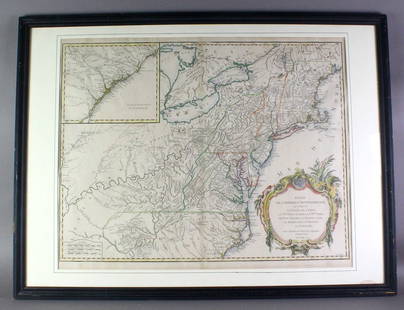
[MAPS - COLONIAL NORTH AMERICA]. VAUGONDY, Gilles Robert de (1688-1766). Partie de l'Amerique Septentrionale qui Compred le Cours de l'Ohio… Paris, 1755.
Large hand-colored engraved map (520 x 660 mm) of Colonial America produced during the second year of the French and Indian War that centers on the Appalachians and Ohio River Valley and extends from the Mississippi River to include the east coast from South Carolina to Maine. With a large inset map showing the southern coast of Carolina and Georgia. Second state with Virginia and the Carolinas extended west to the Mississippi River and the “Louisiane” toponym erased. Margins extended, two small closed tears to upper margin, small repair on verso just above cartouche.
Buyer's Premium
- 25%
[MAPS - COLONIAL NORTH AMERICA]. VAUGONDY, Gilles Robert de...
Estimate $300 - $500
16 bidders are watching this item.
Shipping & Pickup Options
Item located in Chicago, IL, usOffers In-House Shipping
Local Pickup Available
Payment
Accepts seamless payments through LiveAuctioneers

Auction Curated By

Director of Fine Books and Manuscripts
Related Searches
TOP


![[MAPS - GREAT LAKES REGION]. VAUGONDY, Gilles Robert de (16...: [MAPS - GREAT LAKES REGION]. VAUGONDY, Gilles Robert de (1688-1766). Les Lacs du Canada et Nouvelle Angleterre… Paris, 1749. Engraved map (229 x 318 mm) with hand-colored outlining, appearing to](https://p1.liveauctioneers.com/928/301544/160920958_1_x.jpg?height=310&quality=70&version=1694462960)


![[MAPS] HOMANN, JOHAN BAPTISTE. Insulae et Principatus: [MAPS] HOMANN, JOHAN BAPTISTE. Insulae et Principatus Rugiae... Nuremberg: circa 1730. 18 3/4 x 22 1/8 inches, hand-colored engraving; Together with ROBERT DE VAUGONDY, GILLES & DIDIER. La Prusse divi](https://p1.liveauctioneers.com/292/204169/103522322_1_x.jpg?height=310&quality=70&version=1621026354)
![Pair of maps of Russian Empire, 1750: Heading: Author: Robert de Vaugondy, Gilles and Didier Title: Partie Occidentale de l'Empire de Russie, ou se trouve distinguee la Russie Europeenne... [together with] Partie Orientale de L'Empire de](https://p1.liveauctioneers.com/642/151690/76551282_1_x.jpg?height=310&quality=70&version=1570486555)


![18th c. map of Africa showing known kingdoms: Heading: Author: Robert de Vaugondy, Gilles and Didier Title: L'Afrique dressée, sur les relations les plus recentes, et assujettie aux observations astronomiques Place Published: [Paris] Publisher:](https://p1.liveauctioneers.com/642/162817/82203061_1_x.jpg?height=310&quality=70&version=1582924314)


![[Maps] Martin Zeiler, Itinerarium Italiae, 1640: [Maps] Martin Zeiler, Itinerarium Italiae, 1640, Martini Zeilleri. Itinerarium Italiae Nov-Antiquae: oder, Raiss-Beschreibung durch Italien, Matthaus Merian, Frankfurt, 40 plates, most double-page, in](https://p1.liveauctioneers.com/188/326797/176317459_1_x.jpg?height=310&quality=70&version=1713847031)

![[Maps] Gio. Ant. Magnini, Italia, 1620: [Maps] Gio. Ant. Magnini, Italia, 1620, Giovanni Antonio Magnini. Italia, data in luce da Fabio suo figliuolo al Serenissimo Ferdinado Gonzaga Duca di Matoua edi Monserrato etc. Bologna, for Sebastian](https://p1.liveauctioneers.com/188/326797/176317457_1_x.jpg?height=310&quality=70&version=1713847031)


