


1865 Railroad map of Nebraska, Dakota, Idaho and Montana
Similar Sale History
View More Items in Maps & Atlases


Related Maps & Atlases


![Large Map of Montana: Large Map of Montana With map of Utah and Wyoming [separately] on versos Cartographer: George Franklin Cram Dated: Circa 1900 Type: Color Lithograph Dimensions: 14 1/2](https://p1.liveauctioneers.com/5614/330257/178045315_1_x.jpg?height=310&quality=70&version=1716032806)


![Map of Maryville, Montana Gold Mines [180908]: Folded map showing relative location, Maryville Gold Mining Company with producing mines in vicinity of Maryville, Montana, in blue ink. Parts of the map are taped along the seams. 35x28 inches unfold](https://p1.liveauctioneers.com/2699/331495/178785782_1_x.jpg?height=310&quality=70&version=1717094933)
More Items in Maps & Atlases
View More![[MAPS]. HOMANN, Johann Baptist, HOMANN HEIRS, and Georg Matthäus SEUTTER. [Composite Atlas].: [MAPS]. HOMANN, Johann Baptist (1663-1724), HOMANN HEIRS, and Georg Matthäus SEUTTER (1678-1757). [Composite Atlas]. [Nuremberg, Augsburg, and others: Homann Heirs and others, maps dated between](https://p1.liveauctioneers.com/197/329395/177650530_1_x.jpg?height=310&quality=70&version=1715364962)
![[MAP]. TODESCHI, Pietro. [Nova et Acurata Totius Americae Tabula auct. G.I. Blaeu] America quarta: [MAP]. TODESCHI, Pietro. [Nova et Acurata Totius Americae Tabula auct. G.I. Blaeu] America quarta pars orbis quam plerunq, nuvum orbem appellitant primo detecta est anno 1492 a Christophoro Columbo...](https://p1.liveauctioneers.com/197/329395/177650542_1_x.jpg?height=310&quality=70&version=1715364962)
![[MAP]. ORTELIUS, Abraham. Americae Sive Novi Orbis, Nova Descriptio. 1573.: [MAP]. ORTELIUS, Abraham (1527-1598). Americae Sive Novi Orbis, Nova Descriptio. Antwerp, 1573. Engraved map with hand-coloring. Framed and double glazed, visible area 375 x 521 mm (unexamined out of](https://p1.liveauctioneers.com/197/329395/177650534_1_x.jpg?height=310&quality=70&version=1715364962)


![Sanitary & Topographical "Viele Map" of Manhattan 1865 [182838]: Manhattan Island map surveyed by Mexican American & Civil War veteran Egbert Viele 1865. Viele was author of a color city map, a "Sanitary & Topographical Map of the City and Island of New York," firs](https://p1.liveauctioneers.com/2699/331495/178785766_1_x.jpg?height=310&quality=70&version=1717094933)
![[Maps & Atlases] Oliva, Joan: Portolan Chart of the Mediterranean: [Maps & Atlases] Oliva, Joan: Portolan Chart of the Mediterranean Oliva, Joan Portolan Chart of the Mediterranean Marseille, 1615. Illuminated manuscript portolan chart on vellum, in red, blue, green,](https://p1.liveauctioneers.com/65/332523/179335172_1_x.jpg?height=310&quality=70&version=1717709445)
![[MAP]. ORTELIUS, Abraham. Romani Imperii Imago. 1592.: [MAP]. ORTELIUS, Abraham (1527-1598). Romani Imperii Imago. Antwerp, 1592. Engraved map with hand-coloring. Matted, framed, and double glazed, visible area 381 x 521 mm (unexamined out of frame). 6 de](https://p1.liveauctioneers.com/197/329395/177650537_1_x.jpg?height=310&quality=70&version=1715364962)
![[MAP]. ORTELIUS, Abraham. Turcici Imperii Descriptio.1592.: [MAP]. ORTELIUS, Abraham (1527-1598). Turcici Imperii Descriptio. Antwerp, 1592. Engraved map with hand-coloring. Matted, framed, and double glazed, sight 406 x 521 mm (unexamined out of frame). Decor](https://p1.liveauctioneers.com/197/329395/177650538_1_x.jpg?height=310&quality=70&version=1715364962)
![[MAP]. SPEED, John. A New Mappe of the Romane Empire. 1676.: [MAP]. SPEED, John (ca 1551-1629). A New Mappe of the Romane Empire. London: Basset & Chiswell, 1676. Engraved map with hand-coloring. Framed and double glazed, sight 419 x 559 mm. Decorative cartouch](https://p1.liveauctioneers.com/197/329395/177650541_1_x.jpg?height=310&quality=70&version=1715364962)
![Set of Twelve Satirical Anthropomorphic Maps of Europe: [SATIRICAL MAPS] A set of twelve satirical anthropomorphic maps of Europe. London: circa 1868. A set of 12 (believed complete) lithographed maps by Vincent Brooks, Day & Son, London, each offering](https://p1.liveauctioneers.com/292/330597/178279264_1_x.jpg?height=310&quality=70&version=1716409282)


Recommended Transportation & Travel Collectibles
View More


Item Details
Description
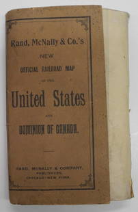
Johnson’s important map of the upper western United States. This is the first state of this map. During the Civil War the massive Washington and Nebraska territories had been chopped up into smaller territories including Idaho (1863), Montana (1864) and Dakota (1861). Though the region was mostly controlled by various American Indian nations, it was becoming more and more attractive for settlement and development. The proposed Governor Stevens route for the Northern Pacific Railroad passed through this area, and so did the more favorable Central Pacific Railroad route and even the lesser desired proposed Union Pacific Railroad route. This is the first Johnson map to incorporate Wyoming. This early configuration of the territory truncates the border with Montana at 44.5 degrees north latitude, giving Wyoming a curious western panhandle that appeared for only a short time. On this map, even though Wyoming is marked as a territory, the lettering of the territorial title is in a light outline typeface – obviously quite different from the bold titles for Montana, Dakota, and Idaho. The map is significant because it shows the northern plains and Rockies just as the post-Civil War influx of settlers was on the verge of igniting a new series of conflicts with the native American inhabitants. Interestingly, other than Nebraska, none of the territorial borders survived as they are shown here. The map lists numerous lesser-known native American tribes such as the Banack and Mountain Snake in Idaho, the Minikanye and Sansara in northeast Wyoming, the Gros Ventres in both Montana and Dakota and the Sihasapa and Itazipcho in Dakota. Gold and silver mines shown throughout Idaho and Montana. Shows railroad routes, including proposed routes. Extra clean example with just a couple of small and insignificant light marks. Extremely light edge toning. A beauty. 17 x 23.5
Reserve: $155.00
Shipping:Domestic: Flat-rate of $8.00 to anywhere within the contiguous U.S. International: Foreign shipping rates are determined by destination. International shipping may be subject to VAT. Combined shipping: Please ask about combined shipping for multiple lots before bidding. Location: This item ships from Ohio
Your purchase is protected:
Photos, descriptions, and estimates were prepared with the utmost care by a fully certified expert and appraiser. All items in this sale are guaranteed authentic.
In the rare event that the item did not conform to the lot description in the sale, Jasper52 specialists are here to help. Buyers may return the item for a full refund provided you notify Jasper52 within 5 days of receiving the item.
Reserve: $155.00
Shipping:
Your purchase is protected:
Photos, descriptions, and estimates were prepared with the utmost care by a fully certified expert and appraiser. All items in this sale are guaranteed authentic.
In the rare event that the item did not conform to the lot description in the sale, Jasper52 specialists are here to help. Buyers may return the item for a full refund provided you notify Jasper52 within 5 days of receiving the item.
Condition
Very good plus
Buyer's Premium
- 15%
1865 Railroad map of Nebraska, Dakota, Idaho and Montana
Estimate $180 - $225
6 bidders are watching this item.
Get approved to bid.
Shipping & Pickup Options
Item located in Ohio, US$8 shipping in the US
Payment
Accepts seamless payments through LiveAuctioneers
See More Items From This Jasper52 Seller

TOP