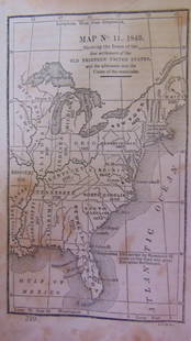
The United States Antique Map 1794 London Laurie & Whittle
Similar Sale History
View More Items in Maps & Atlases
Related Maps & Atlases
More Items in American Maps & Atlases
View MoreRecommended Transportation & Travel Collectibles
View More


Item Details
Description
The United States of America with the British Possessions in Canada, Nova Scotia, New Brunswick and Newfoundland divided with the French, also the Spanish Territories of Louisiana and Florida according to the Preliminary Articles of Peace Signed at Versailles the 20th of January 1783.
Published by Laurie & Whittle, Printed May 12th, 1794, London
Dimensions: Sight 19 ¾ x 18, Frame 23 x 21 inches.
In the preliminary Articles of Peace signed in 1783, Spain negotiated rights to Florida, with Spain keeping West Florida and gaining back East Florida in exchange for the Bahamas. This map accurately depicts both East and West Florida in yellow, to represent Spanish holdings.
Article III of the Treaty, concerning fishing rights, is reprinted next to the cartouche, which includes one of the earliest representations of an American Flag to appear on a printed map.
There is also excellent detail on the locations of forts and mines, the Indian tribal territories and villages in the Ohio and Mississippi River Valleys, including the Choctaws and the Cherokees.
Robert Laurie (ca. 1755-1836) and James Whittle (1757-1818) were London based map and atlas publishers, considered to be the successors of their employer Robert Sayer. Laurie and Whittle published numerous maps and atlases, often bringing in other important cartographers of the day, to update existing Sayer plates. The company still exist as an English publisher of nautical maps Imray, Laurie, Norie and Wilson Ltd, and considered the oldest map publisher in Europe.
Reference:
https://www.raremaps.com/gallery/detail/82717/the-united-states-of-america-with-the-british-possessions-of-laurie-whittle
Condition
Fine, no stains or damages, very light toning, Please refer to photos or request additional info. The absence or brevity of a condition statement does not imply that the lot is in perfect condition or completely free from wear and tear, imperfections or the effects of ageing. Condition reports are obtained via email or by phone. Any condition statement given as a courtesy to a client is only an opinion and not to be treated as a statement of fact. Zikorn AH shall have no responsibility for any error or omission.
Buyer's Premium
- 25%
The United States Antique Map 1794 London Laurie & Whittle
Estimate $2,000 - $2,500
8 bidders are watching this item.
Get approved to bid.
Shipping & Pickup Options
Item located in New York, NY, us$80 shipping in the US
Payment
Accepts seamless payments through LiveAuctioneers

TOP


![Fullarton: Antique Map of United States, 1859: [United States]. Edinburgh: A. Fullarton & Co, [1859]. Engraved by G. H. Swanston, with hand coloured outlines. Approximately 18-3/8 x 22-3/8 inches, two sheets joined. Margins a little age toned, els](https://p1.liveauctioneers.com/5584/107399/55057773_1_x.jpg?height=310&quality=70&version=1501794677)


![Meteorological Chart of the Earth c1845 (2) [180794]: A pair of antique maps of the Southern and Northern hemispheres, c1845. Mercator maps, published by John W. Parker, West Strand, London. Each measures about 17" x 22". Please see photo(s) for more det](https://p1.liveauctioneers.com/2699/331495/178785749_1_x.jpg?height=310&quality=70&version=1717094933)


![Early United States Maps, c1800's (2) [180906]: (2) Double Trucked Maps of the United States and North America. Circa 1800's. Map of North America by T. Ettling, railways and projected canals in legend, borders defined in orange ink. Railway Map of](https://p1.liveauctioneers.com/2699/331495/178785772_1_x.jpg?height=310&quality=70&version=1717094933)


![[MAPS]. HOMANN, Johann Baptist, HOMANN HEIRS, and Georg Matthäus SEUTTER. [Composite Atlas].: [MAPS]. HOMANN, Johann Baptist (1663-1724), HOMANN HEIRS, and Georg Matthäus SEUTTER (1678-1757). [Composite Atlas]. [Nuremberg, Augsburg, and others: Homann Heirs and others, maps dated between](https://p1.liveauctioneers.com/197/329395/177650530_1_x.jpg?height=310&quality=70&version=1715364962)


![[MAP]. TODESCHI, Pietro. [Nova et Acurata Totius Americae Tabula auct. G.I. Blaeu] America quarta: [MAP]. TODESCHI, Pietro. [Nova et Acurata Totius Americae Tabula auct. G.I. Blaeu] America quarta pars orbis quam plerunq, nuvum orbem appellitant primo detecta est anno 1492 a Christophoro Columbo...](https://p1.liveauctioneers.com/197/329395/177650542_1_x.jpg?height=310&quality=70&version=1715364962)
