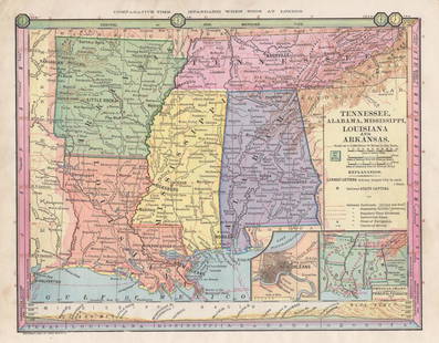
Mitchell's Map of the states of Louisiana, Mississippi, & Alabama 1834
Similar Sale History
View More Items in Maps & Atlases
Related Maps & Atlases
More Items in Maps & Atlases
View MoreRecommended Transportation & Travel Collectibles
View More


Item Details
Description
MITCHELL, Samuel Augustus (1790-1868).
Map of the states of Louisiana, Mississippi, & Alabama.
Engraved map with original hand color.
Philadelphia: S. Augustus Mitchell, 1834.
17 1/2" x 12 1/2" sheet.
PROVENANCE: Contemporary indecipherable ownership inscription on the front pastedown; with the near-contemporary ownership inscription of John Basil Lamar of Bibb County, Georgia, dated 18th March 1835 on the rear pastedown.
Fine folded engraved map with original hand color in full within an elaborate border of flowers and an attractive vignette on top edge of an eagle and shield; two tables at upper left: "Steam boat routes" and "Principle stage routes, through the states Louisiana, Alabama & Mississippi"; minor early repairs on verso. Original maroon morocco; with minor pale stains (5 1/4" x 3 1/4").
AN EXCEPTIONALLY BRIGHT AND ATTRACTIVE COPY. First published by Mitchell in his 1831 atlas "A New American Atlas, Designed Principally To Illustrate The Geography Of The United States Of North America; In Which Every Country In Each State And Territory Of The Union Is Accurately Delineated, As Far As At Present Known: The Whole Compiled From The Latest And Most Authentic Information". This map is based on a census of 1830, a number of editions having been published first within "A New American Atlas" and later as individual pocket-maps. The Mitchell Company was one of the first publishing houses to try out the new technique of engraving on steel plates, preceding the majority of the industry by nearly 20 years. During the early years of the company, Mitchell primarily published maps and travel guides. In 1860, Mitchell embarked on an ambitious "New General Atlas" before he retired and turned the business over to his son of the same name Today Mitchell maps are sought after for their fine engraving, sumptuous hand-coloring, and attention to detail. They are some of the finest maps produced during this time period. American Atlases L3584; P11026 and L3585 (Pocket edition).BCI-1-5-30
Buyer's Premium
- 25%
Mitchell's Map of the states of Louisiana, Mississippi, & Alabama 1834
Estimate $1,500 - $2,000
3 bidders are watching this item.
Shipping & Pickup Options
Item located in New York, NY, usOffers In-House Shipping
Local Pickup Available
Payment

TOP


![Map of Maryland, Virginia Texas +: Map of South Carolina, Georgia, Florida, Alabama, Mississippi, Louisiana, Tennessee and Arkansas PLUS Maryland, Virginia, West Virginia & North Carolina [1 half sheet side] & Texas [1 half sheet side]](https://p1.liveauctioneers.com/5614/289638/153375966_1_x.jpg?height=310&quality=70&version=1684353133)


![Memoir to accompany Missip.-Pacific Map: Heading: Author: Warren, Gouverneur K. Title: Memoir to Accompany the Map of the Territory of the United States from the Mississippi River to the Pacific Ocean Place Published: [Washington, D.C.] Pub](https://p1.liveauctioneers.com/642/326037/175553704_1_x.jpg?height=310&quality=70&version=1713477451)


![Hawaii & American Samoa. Pictorial state map by Ruth Taylor White 1935 old: CAPTION PRINTED BELOW PICTURE: Territory of Hawaii // [American] Samoa DATE PRINTED: 1935 IMAGE SIZE: Approx 30.5 x 23.5cm, 12 x 9.25 inches (Large) TYPE: Vintage colour pictorial map. The buyer shoul](https://p1.liveauctioneers.com/5584/326888/175994734_1_x.jpg?height=310&quality=70&version=1713903186)


