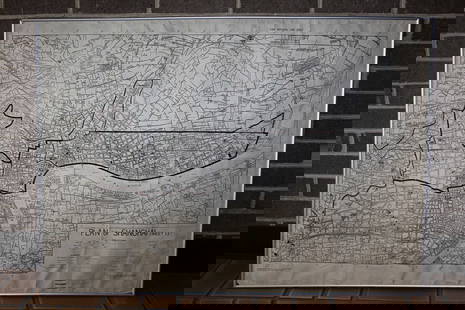
1850 Map WESTERN HEMISPHERE by Tallis
Similar Sale History
View More Items in Maps & AtlasesRelated Maps & Atlases
More Items in Maps & Atlases
View MoreRecommended Transportation & Travel Collectibles
View More


Item Details
Description
Historic Maps
Decorative 1850 Tallis "WESTERN HEMISPHERE" Map
c. 1850, Hand-colored Map of the "WESTERN HEMISPHERE," drawn by J. Rapkin, published by The London Printing and Publishing Company (John Tallis), with Illustrations by H. Warren and J. Rogers, Very Fine.
Steel-Engraved Map with slight Hand-colored in outline, 10.75" x 14," surrounded by 12 uncolored vignettes of people and animals intertwined with vines & cacti. This was one of the most popular (hence, oft-copied) maps of the 1850's because of the quaint vignettes, which include a Polar Bear, an American Bison, a spouting whale, a llama, a walrus, plus depictions of American Indians, Eskimos, and an early settler. An unobtrusive, vertical, central fold and some light foxing indicate that this was once bound into a book or magazine. Ready for framing and display.
Buyer's Premium
- 30%
1850 Map WESTERN HEMISPHERE by Tallis
Estimate $300 - $400
3 bidders are watching this item.
Shipping & Pickup Options
Item located in Rancho Santa Fe, CA, usOffers In-House Shipping
Payment

Related Searches
TOP


![1898 Rand McNally Map of Texas [verso] Indian Territory and Oklahoma -- Texas [verso] Oklahoma and: Title: 1898 Rand McNally Map of Texas [verso] Indian Territory and Oklahoma -- Texas [verso] Oklahoma and Indian Territory Cartographer: Rand McNally Year / Place: 1898, Chicago Map Dimension (in.): 9](https://p1.liveauctioneers.com/5584/329422/177662173_1_x.jpg?height=310&quality=70&version=1715717898)
![Map 24 Districts of Rainy River, Kenora and part of Kenora Patricia portion 1962 [Ontario]: Title: Map 24 Districts of Rainy River, Kenora and part of Kenora Patricia portion 1962 [Ontario] Cartographer: Lands and Surveys Branch Publisher: Ontario Dept. of Lands and Forests Dimensions: Heigh](https://p1.liveauctioneers.com/5584/329422/177662156_1_x.jpg?height=310&quality=70&version=1715717898)


![[MAP]. TODESCHI, Pietro. [Nova et Acurata Totius Americae Tabula auct. G.I. Blaeu] America quarta: [MAP]. TODESCHI, Pietro. [Nova et Acurata Totius Americae Tabula auct. G.I. Blaeu] America quarta pars orbis quam plerunq, nuvum orbem appellitant primo detecta est anno 1492 a Christophoro Columbo...](https://p1.liveauctioneers.com/197/329395/177650542_1_x.jpg?height=310&quality=70&version=1715364962)


![[MAPS]. HOMANN, Johann Baptist, HOMANN HEIRS, and Georg Matthäus SEUTTER. [Composite Atlas].: [MAPS]. HOMANN, Johann Baptist (1663-1724), HOMANN HEIRS, and Georg Matthäus SEUTTER (1678-1757). [Composite Atlas]. [Nuremberg, Augsburg, and others: Homann Heirs and others, maps dated between](https://p1.liveauctioneers.com/197/329395/177650530_1_x.jpg?height=310&quality=70&version=1715364962)


