


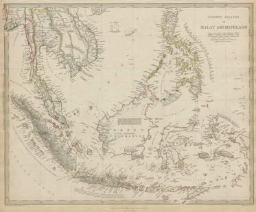
MAP OF EASTERN SHORE OF MASSACHUSETTS AND THE COSTAL ISLANDS
Similar Sale History
View More Items in Maps & Atlases


Related Maps & Atlases

![Grecian Archipelago & Mediterranean Shores. Aegean islands. HUGHES 1859 map: CAPTION PRINTED BELOW PICTURE: The Grecian Archipelago. // the shores of the Mediterranean [The Adriatic, and the Black Sea] DATE PRINTED: 1859 IMAGE SIZE: Approx 37.0 x 54.0cm, 14.75 x 21.25 inches (](https://p1.liveauctioneers.com/5584/328641/177014339_1_x.jpg?height=310&quality=70&version=1715113718)


![Eastern Mediterranean & Black Sea chart. Ports lighthouses mail. LARGE 1927 map: TITLE/CONTENT OF MAP: The Eastern Mediterranean [inset Brindisi; Valetta; Salonika; Odessa; The Sea of Azov; Corinth Canal; Bosporus; Piraeus & Athens; Smyrna; Alexandria; Suez Canal] DATE PRINTED: 19](https://p1.liveauctioneers.com/5584/328641/177014278_1_x.jpg?height=310&quality=70&version=1715113718)


More Items in Maps & Atlases
View More


![[Maps] Gio. Ant. Magnini, Italia, 1620: [Maps] Gio. Ant. Magnini, Italia, 1620, Giovanni Antonio Magnini. Italia, data in luce da Fabio suo figliuolo al Serenissimo Ferdinado Gonzaga Duca di Matoua edi Monserrato etc. Bologna, for Sebastian](https://p1.liveauctioneers.com/188/326797/176317457_1_x.jpg?height=310&quality=70&version=1713847031)
![[Maps] Martin Zeiler, Itinerarium Italiae, 1640: [Maps] Martin Zeiler, Itinerarium Italiae, 1640, Martini Zeilleri. Itinerarium Italiae Nov-Antiquae: oder, Raiss-Beschreibung durch Italien, Matthaus Merian, Frankfurt, 40 plates, most double-page, in](https://p1.liveauctioneers.com/188/326797/176317459_1_x.jpg?height=310&quality=70&version=1713847031)


Recommended Transportation & Travel Collectibles
View More


Item Details
Description
Early 20th Century, American. Showing Barnstable County, Nantucket Island and Dukes Island, (Marthas Vineyard). Hand colored, 16 by 24.5 in., overall 25 by 33.5 in.
Condition
All lots are subject to the terms and conditions of the auction and are sold AS-IS without any guarantees. There are no returns or refunds solely based on condition. All cataloged entries are strictly statements of opinion of the cataloger and/or the auction gallery and should not be interpreted as fact. Any absence of a condition report does not imply that the item is in perfect and/or good condition. Please request a condition report and any additional photos and/or information prior to bidding. AGOPB does not pack or ship any items but can assist with a list of packers and shippers, and in some instances assist with packing and shipping. It is suggested that all bidders receive a quote to pack and ship prior to bidding at the auction. Please contact info@agopb.com for a list of recommended shippers.
Buyer's Premium
- 25%
MAP OF EASTERN SHORE OF MASSACHUSETTS AND THE COSTAL ISLANDS
Estimate $200 - $400
3 bidders are watching this item.
Shipping & Pickup Options
Item located in West Palm Beach, FL, usSee Policy for Shipping
Payment
Accepts seamless payments through LiveAuctioneers

Related Searches
TOP